File:Mendenhall Towers.jpg

Size of this preview: 800 × 434 pixels. Other resolutions: 320 × 174 pixels | 640 × 347 pixels | 1,024 × 556 pixels | 1,280 × 695 pixels | 2,849 × 1,546 pixels.
Original file (2,849 × 1,546 pixels, file size: 3.85 MB, MIME type: image/jpeg)
Captions
Captions
Add a one-line explanation of what this file represents
Summary edit
| Description |
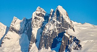
English: Mendenhall Towers in Alaska |
| Date | |
| Source | https://www.flickr.com/photos/usforestservice/38407016512/in/photolist-WiiBYF-fgcaAu-TPAMD8-25nrKUL-JjMJXY-rx5DCb-dkP7P6-ebQUs5-rx3Biy-rviRDD-21vTZVS-fhA17F-ozmxpW-rPvR6h |
| Author | Forest Service, USDA |
| Camera location | | View this and other nearby images on: OpenStreetMap |
|---|
Licensing edit
| This image was originally posted to Flickr by Forest Service Photography at https://flickr.com/photos/140082569@N07/38407016512 (archive). It was reviewed on 20 May 2019 by FlickreviewR 2 and was confirmed to be licensed under the terms of the Public Domain Mark. |
This image is a work of the Forest Service of the United States Department of Agriculture. As a work of the U.S. federal government, the image is in the public domain.
|
File history
Click on a date/time to view the file as it appeared at that time.
| Date/Time | Thumbnail | Dimensions | User | Comment | |
|---|---|---|---|---|---|
| current | 04:12, 20 May 2019 | | 2,849 × 1,546 (3.85 MB) | Ron Clausen (talk | contribs) | crop |
| 04:11, 20 May 2019 |  | 3,456 × 4,608 (3.02 MB) | Ron Clausen (talk | contribs) | User created page with UploadWizard |
You cannot overwrite this file.
File usage on Commons
The following page uses this file: