File:Mesoamérica relief map.png

Size of this preview: 800 × 551 pixels. Other resolutions: 320 × 220 pixels | 640 × 440 pixels | 1,024 × 705 pixels | 1,280 × 881 pixels | 1,501 × 1,033 pixels.
Original file (1,501 × 1,033 pixels, file size: 1.58 MB, MIME type: image/png)
Captions
Captions
Add a one-line explanation of what this file represents
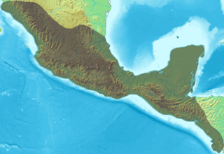
| Description | Blank relief map of Mesoamerica. |
| Date | (UTC) |
| Source | |
| Author |
|
| Other versions | Derivative works of this file: Mesoamérica relief map with continental scale.png |
| This is a retouched picture, which means that it has been digitally altered from its original version. Modifications: PNG file. The original can be viewed here: Mesoamérica.svg:
|
I, the copyright holder of this work, hereby publish it under the following license:
This file is licensed under the Creative Commons Attribution-Share Alike 3.0 Unported license.
- You are free:
- to share – to copy, distribute and transmit the work
- to remix – to adapt the work
- Under the following conditions:
- attribution – You must give appropriate credit, provide a link to the license, and indicate if changes were made. You may do so in any reasonable manner, but not in any way that suggests the licensor endorses you or your use.
- share alike – If you remix, transform, or build upon the material, you must distribute your contributions under the same or compatible license as the original.
Original upload log edit
This image is a derivative work of the following images:
- File:Mesoamérica.svg licensed with Cc-by-sa-3.0
- 2010-08-23T05:33:54Z El Comandante 1501x1033 (3380 Bytes) Bug correction test
- 2010-08-23T05:28:53Z El Comandante 1629x1065 (3383 Bytes) {{Information |Description=Blank relief map of Mesoamerica. |Source=*[[:File:Topographic30deg_N0W90.png|]] *[[:File:Topographic30deg_N0W60.png|]] |Date=2010-08-23 05:20 (UTC) |Author=*[[:File:Topographic30deg_N0W90.png|]]: De
Uploaded with derivativeFX
File history
Click on a date/time to view the file as it appeared at that time.
| Date/Time | Thumbnail | Dimensions | User | Comment | |
|---|---|---|---|---|---|
| current | 05:50, 23 August 2010 | | 1,501 × 1,033 (1.58 MB) | El Comandante (talk | contribs) | {{Information |Description=Blank relief map of Mesoamerica. |Source=*File:Mesoamérica.svg |Date=2010-08-23 05:49 (UTC) |Author=*File:Mesoamérica.svg: *Topographic30deg_N0W90.png: Demis Web Map Server *[[: |
You cannot overwrite this file.
File usage on Commons
There are no pages that use this file.