File:Metilia brunnerii MHNT male vol.jpg

Size of this preview: 800 × 491 pixels. Other resolutions: 320 × 196 pixels | 640 × 393 pixels | 1,024 × 628 pixels | 1,280 × 785 pixels | 2,560 × 1,571 pixels | 3,944 × 2,420 pixels.
Original file (3,944 × 2,420 pixels, file size: 3.7 MB, MIME type: image/jpeg)
Captions
Captions
Add a one-line explanation of what this file represents
Summary edit
|
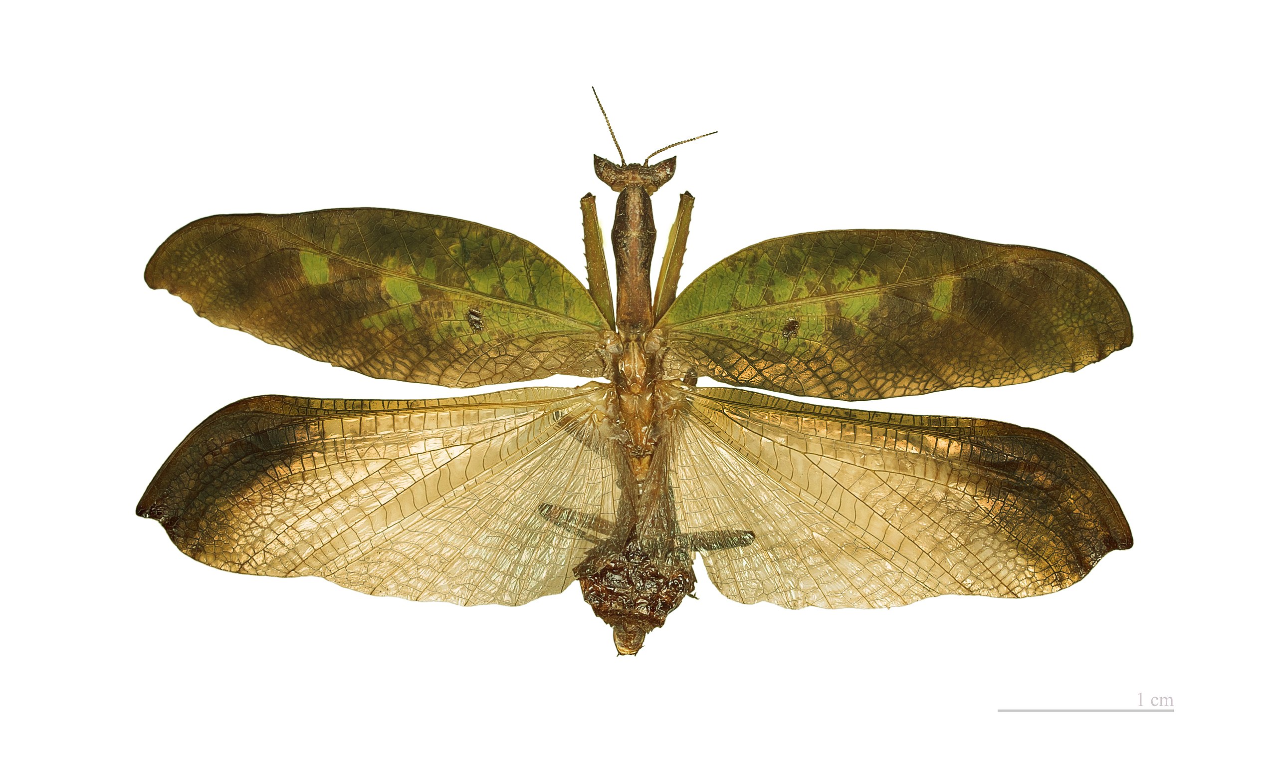
Metilia brunnerii (Saussure, 1771) | ||||||||||||||||||||||||||||||||||||||||||||||||
| ||||||||||||||||||||||||||||||||||||||||||||||||


File history
Click on a date/time to view the file as it appeared at that time.
| Date/Time | Thumbnail | Dimensions | User | Comment | |
|---|---|---|---|---|---|
| current | 06:40, 27 December 2011 | | 3,944 × 2,420 (3.7 MB) | Archaeodontosaurus (talk | contribs) | {{Information |Description ={{en|1=x}} |Source ={{own}} |Author =Archaeodontosaurus |Date = |Permission = |other_versions = }} |
You cannot overwrite this file.
File usage on Commons
The following 12 pages use this file:
- Metilia brunnerii
- User:Jean-Frédéric/WmFr/2011/12
- User talk:Archaeodontosaurus/Deuxième trimestre 2012
- User talk:Archaeodontosaurus/jusqu'à fin 2011
- Commons:Quality images/Subject/Animals/Arthropods/Grasshoppers, Crickets, Mantis, Bugs etc (Exopterygota)
- Commons:Quality images candidates/Archives December 2011
- Commons:Valued image candidates/Metilia brunnerii MHNT male vol.jpg
- Commons:Valued images by topic/Life forms/Animals/Arthropods
- Commons:Valued images by topic/Life forms/Animals/Arthropods/Mantids (Mantodea)
- Category:Acanthopidae
- Category:Metilia
- Category:Metilia brunnerii
File usage on other wikis
The following other wikis use this file:
- Usage on ast.wikipedia.org
- Usage on be.wikipedia.org
- Usage on ca.wikipedia.org
- Usage on ceb.wikipedia.org
- Usage on diq.wikipedia.org
- Usage on en.wikipedia.org
- Usage on es.wikipedia.org
- Usage on fr.wikipedia.org
- Usage on hy.wikipedia.org
- Usage on it.wikipedia.org
- Usage on no.wikipedia.org
- Usage on pt.wikipedia.org
- Usage on ru.wikipedia.org
- Usage on species.wikimedia.org
- Usage on sv.wikipedia.org
- Usage on tr.wikipedia.org
- Usage on uk.wikipedia.org
- Usage on vi.wikipedia.org
- Usage on war.wikipedia.org
- Usage on www.wikidata.org
- Usage on zh.wikipedia.org