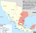
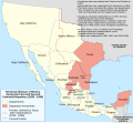
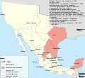
File:Mexico 1835-1846 administrative map-en.svg

Size of this PNG preview of this SVG file: 654 × 600 pixels. Other resolutions: 262 × 240 pixels | 523 × 480 pixels | 838 × 768 pixels | 1,117 × 1,024 pixels | 2,233 × 2,048 pixels | 1,241 × 1,138 pixels.
Original file (SVG file, nominally 1,241 × 1,138 pixels, file size: 426 KB)
File information
Structured data
Captions
Captions
Add a one-line explanation of what this file represents
| Datasource (reference to visualized facts) is not provided for the data that is visualized in this self-made work. |
Summary edit
| DescriptionMexico 1835-1846 administrative map-en.svg |
[edit] Deutsch: Administrative Karte Mexikos in den Jahren 1835-1846. English: Administrative map of Mexico during the two central republics (1835-1846). Español: Mapa de la organización territorial de México durante las Repúblicas Centralistas (1835-1846). Français : Carte du Mexique durant les deux républiques centrales (1935-1846). |
|||
| Date | ||||
| Source |
|
|||
| Author | Translation by me | |||
| Other versions |
[edit]
| |||
| SVG development InfoField | This diagram was created with Inkscape. This diagram uses embedded text that can be easily translated using a text editor. |
Licensing edit
This file is licensed under the Creative Commons Attribution-Share Alike 3.0 Unported license.
- You are free:
- to share – to copy, distribute and transmit the work
- to remix – to adapt the work
- Under the following conditions:
- attribution – You must give appropriate credit, provide a link to the license, and indicate if changes were made. You may do so in any reasonable manner, but not in any way that suggests the licensor endorses you or your use.
- share alike – If you remix, transform, or build upon the material, you must distribute your contributions under the same or compatible license as the original.
File history
Click on a date/time to view the file as it appeared at that time.
| Date/Time | Thumbnail | Dimensions | User | Comment | |
|---|---|---|---|---|---|
| current | 10:57, 25 October 2013 |  | 1,241 × 1,138 (426 KB) | JWB (talk | contribs) | reflow text to fit |
| 14:39, 26 September 2009 |  | 1,241 × 1,138 (426 KB) | JWB (talk | contribs) | {{Information |Description={{en|1=Territorial division of Mexico during the 1st and 2nd Centralist Republics (1835-46)}} |Source=Mexico_1835-1846_administrative_map-es.svg with text translated to English |Author=Translation by me |Date=2009-09-26 |Permiss |
You cannot overwrite this file.
File usage on Commons
The following 11 pages use this file:
- File:División política de México (1836-1846).svg
- File:File-Mexico 1835-1846 administrative map-en-2.svg
- File:File-Mexico 1835-1846 administrative map-ru-2.svg
- File:Mexico 1835-1846 administrative map-de.svg
- File:Mexico 1835-1846 administrative map-en-2.svg
- File:Mexico 1835-1846 administrative map-en.svg
- File:Mexico 1835-1846 administrative map-es.svg
- File:Mexico 1835-1846 administrative map-fr.svg
- File:Mexico 1835-1846 administrative map-it.svg
- File:México División Política-República Central.png
- Template:Other versions/Mexico 1835-1846 administrative map
File usage on other wikis
The following other wikis use this file:
- Usage on af.wikipedia.org
- Usage on en.wikipedia.org
- Usage on ro.wikipedia.org
- Usage on tr.wikipedia.org
- Usage on uk.wikipedia.org
Metadata
This file contains additional information such as Exif metadata which may have been added by the digital camera, scanner, or software program used to create or digitize it. If the file has been modified from its original state, some details such as the timestamp may not fully reflect those of the original file. The timestamp is only as accurate as the clock in the camera, and it may be completely wrong.
| Width | 1241.2 |
|---|---|
| Height | 1138.4 |


