File:Middlesex County CC-NJ.jpg
Size of this preview: 800 × 469 pixels. Other resolutions: 320 × 188 pixels | 640 × 375 pixels | 1,024 × 600 pixels | 1,576 × 924 pixels.
Original file (1,576 × 924 pixels, file size: 849 KB, MIME type: image/jpeg)
Captions
Captions
Add a one-line explanation of what this file represents
Summary edit
| Description |
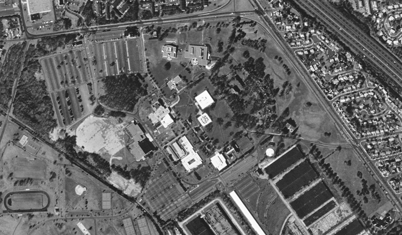
English: Aerial image of w:Middlesex County College. Rotated image: |
|||
| Date | ||||
| Source | USGS The National Map, via MSR Maps (formerly TerraServer-USA) | |||
| Author | United States Geological Survey (USGS) | |||
| Permission (Reusing this file) |
"The images are in the public domain, and are freely available for you to download, use and re-distribute"[1]
|
This file was reviewed on 14 May 2009 by the administrator or trusted user Rambo's Revenge (en.wiki), who confirmed the Public Domain status on that date.
|
File history
Click on a date/time to view the file as it appeared at that time.
| Date/Time | Thumbnail | Dimensions | User | Comment | |
|---|---|---|---|---|---|
| current | 06:00, 7 April 2009 | | 1,576 × 924 (849 KB) | Rotatebot (talk | contribs) | Bot: Rotate 90° |
| 01:33, 7 April 2009 |  | 924 × 1,576 (773 KB) | MBisanz (talk | contribs) | {{Information |Description={{en|1=Aerial view of w:Middlesex County College.}} |Source=[http://terraserver-usa.com/usgsentry.aspx?T=1&S=10&Z=18&X=2768&Y=22420&W=10 USGS] |Author=USGS |Date=4/16/1995 |Permission= |other_versions= }} <!--{{ImageUpload| |
You cannot overwrite this file.
File usage on Commons
There are no pages that use this file.
File usage on other wikis
The following other wikis use this file:
- Usage on en.wikipedia.org