File:Mieminger Kette map2.png
Size of this preview: 800 × 442 pixels. Other resolutions: 320 × 177 pixels | 640 × 354 pixels | 1,024 × 566 pixels | 1,280 × 707 pixels | 2,560 × 1,415 pixels | 3,731 × 2,062 pixels.
Original file (3,731 × 2,062 pixels, file size: 1.34 MB, MIME type: image/png)
Captions
Captions
Add a one-line explanation of what this file represents
| Description |
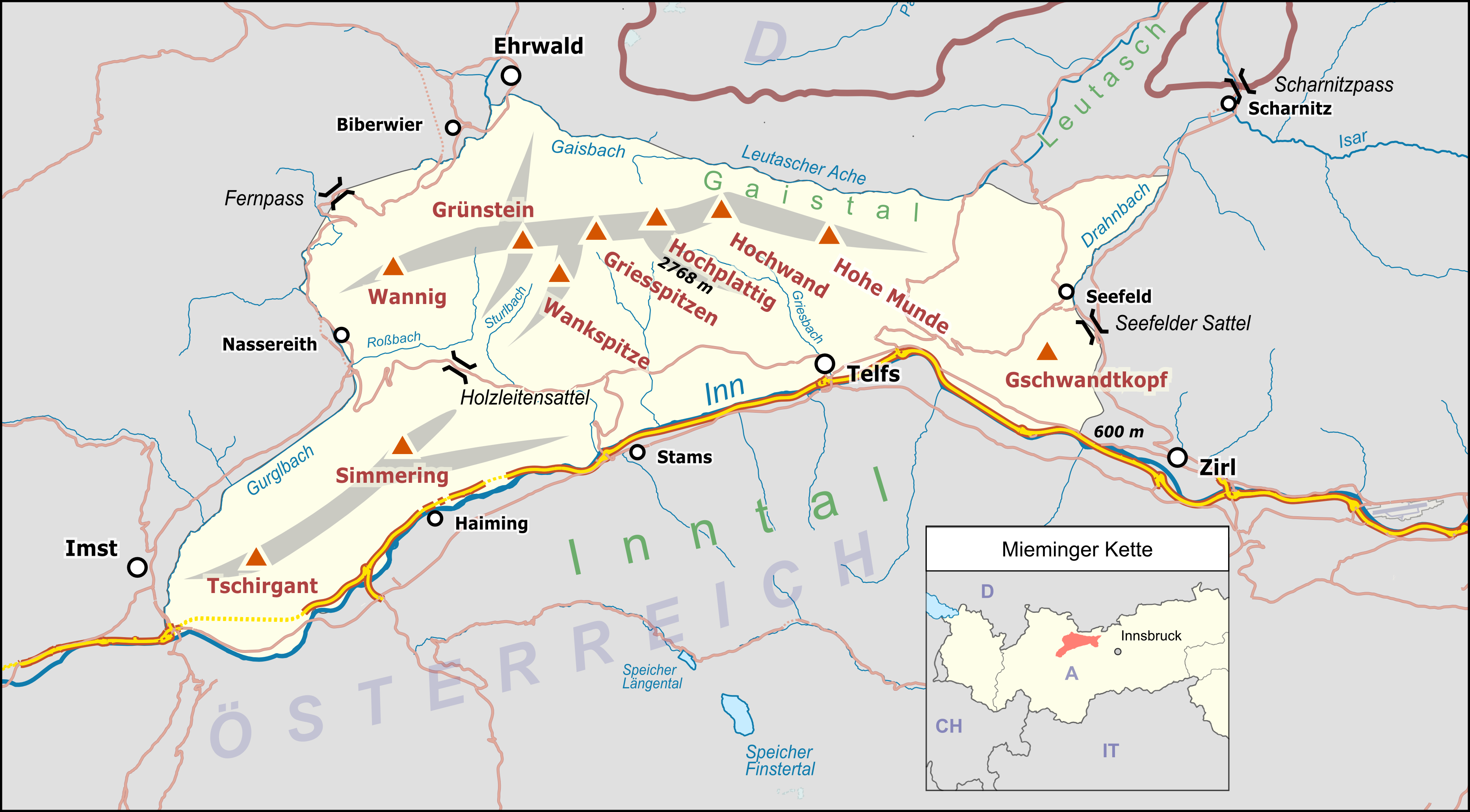
Deutsch: Übersichtskarte der Mieminger Kette. |
|||||||||
| Date | ||||||||||
| Source |
Own work Map was created using:
|
|||||||||
| Creator |
|
|||||||||
| Permission (Reusing this file) |
Map data (c) OpenStreetMap (and) contributors, CC-BY-SA | |||||||||
| Geotemporal data | ||||||||||
| Bounding box |
|
|||||||||
| Georeferencing | ||||||||||
| Other versions |
 svg-Version svg-Version |
|||||||||
This file is licensed under the Creative Commons Attribution-Share Alike 2.0 Generic license.
- You are free:
- to share – to copy, distribute and transmit the work
- to remix – to adapt the work
- Under the following conditions:
- attribution – You must give appropriate credit, provide a link to the license, and indicate if changes were made. You may do so in any reasonable manner, but not in any way that suggests the licensor endorses you or your use.
- share alike – If you remix, transform, or build upon the material, you must distribute your contributions under the same or compatible license as the original.
File history
Click on a date/time to view the file as it appeared at that time.
| Date/Time | Thumbnail | Dimensions | User | Comment | |
|---|---|---|---|---|---|
| current | 05:26, 11 December 2016 | | 3,731 × 2,062 (1.34 MB) | Pechristener (talk | contribs) | {{Map |Description={{de|1=Übersichtskarte der {{w|Mieminger Gebirge|Mieminger Kette|de}}. }} |Source ={{own}} Map was created using: *[http://www.openstreetmap.org/ Open Street Map] *{{w|Austria location map.svg}} for location map |Author... |
You cannot overwrite this file.
File usage on Commons
The following 3 pages use this file:
File usage on other wikis
The following other wikis use this file:
- Usage on arz.wikipedia.org
- Usage on cs.wikipedia.org
- Usage on de.wikipedia.org
- Usage on www.wikidata.org