File:Miharu in Fukushima Prefecture.png

Size of this preview: 800 × 563 pixels. Other resolutions: 320 × 225 pixels | 640 × 450 pixels | 1,024 × 720 pixels | 1,281 × 901 pixels.
Original file (1,281 × 901 pixels, file size: 52 KB, MIME type: image/png)
Captions
Captions
Add a one-line explanation of what this file represents
Summary edit
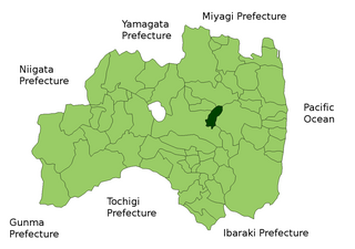
| Description | Location Map of Miharu in Fukushima Prefecture, Japan |
| Date | |
| Source | Image:FukushimaMapCurrent.png and rework |
| Author | user:alberth2 |
Licensing edit

|
Shigenobu AOKI, the copyright holder of this work, allows anyone to use it for any purpose including unrestricted redistribution, commercial use, and modification.
|
File history
Click on a date/time to view the file as it appeared at that time.
| Date/Time | Thumbnail | Dimensions | User | Comment | |
|---|---|---|---|---|---|
| current | 05:52, 30 August 2007 | | 1,281 × 901 (52 KB) | Alberth2 (talk | contribs) | == Summary == {{Information |Description=Location Map of Miharu in Fukushima Prefecture, Japan |Source=Image:FukushimaMapCurrent.png and rework |Date=Aug. 30th, 2007 |Author=user:alberth2 |Permission= |other_versions= }} == Licensing == {{Map of |
You cannot overwrite this file.
File usage on Commons
There are no pages that use this file.
File usage on other wikis
The following other wikis use this file: