File:Minn610.svg

Size of this PNG preview of this SVG file: 526 × 599 pixels. Other resolutions: 211 × 240 pixels | 421 × 480 pixels | 674 × 768 pixels | 898 × 1,024 pixels | 1,797 × 2,048 pixels | 702 × 800 pixels.
Original file (SVG file, nominally 702 × 800 pixels, file size: 1.7 MB)
Captions
Captions
Add a one-line explanation of what this file represents
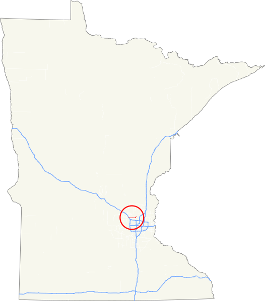
| Description | Map of Minnesota State Highway 610. Created in QuantamGIS and finished in Inkscape |
| Date | |
| Source | Own work |
| Author | Fredddie |
| I, the copyright holder of this work, release this work into the public domain. This applies worldwide. In some countries this may not be legally possible; if so: I grant anyone the right to use this work for any purpose, without any conditions, unless such conditions are required by law. |
File history
Click on a date/time to view the file as it appeared at that time.
| Date/Time | Thumbnail | Dimensions | User | Comment | |
|---|---|---|---|---|---|
| current | 06:39, 20 May 2010 | | 702 × 800 (1.7 MB) | Fredddie (talk | contribs) | circled route |
| 04:56, 20 May 2010 |  | 702 × 800 (1.7 MB) | Fredddie (talk | contribs) | {{Information |Description=Map of Minnesota State Highway 610. Created in QuantamGIS and finished in Inkscape |Source={{own}} |Date=2010-05-20 |Author= Fredddie |Permission= |other_versions= }} Category:Road maps of Minnesota {{pd-s |
You cannot overwrite this file.
File usage on Commons
There are no pages that use this file.