File:Monaro Highway location map.svg

Original file (SVG file, nominally 1,656 × 1,056 pixels, file size: 716 KB)
Captions
Captions
Summary edit
| Description |
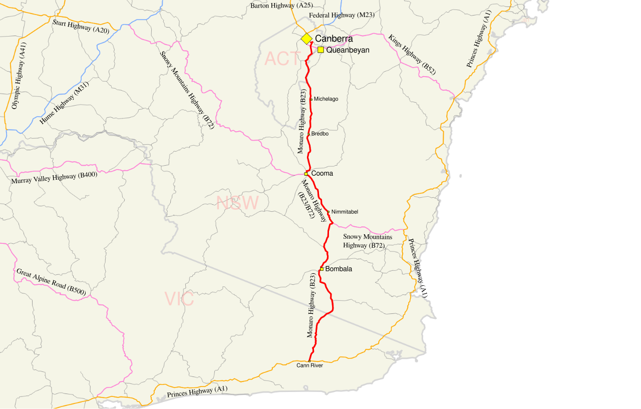
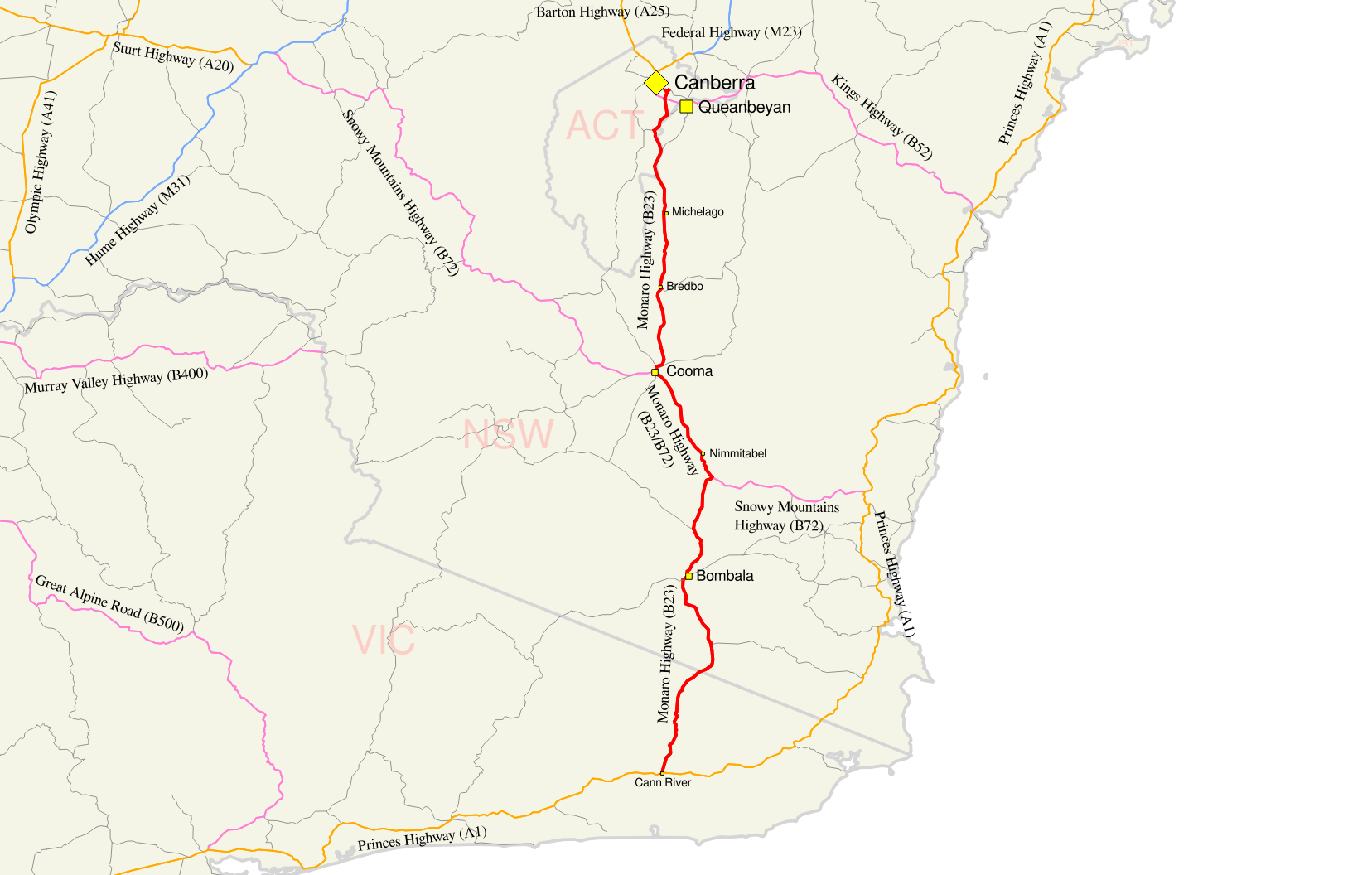
English: Map of the Monaro Highway |
| Date | |
| Source | Own work, Created in Quantum GIS and Inkscape - Sources: Geoscience Australia Data, then overlaid with state/territory abbreviations, and town and highway/route names. |
| Author |
Original author of GIS data: © Commonwealth of Australia (Geoscience Australia) 2013. |
| Permission (Reusing this file) |
Original author of GIS data: "Save for the content on this website supplied by third parties, the Geoscience Australia logo, the Commonwealth Coat of Arms, and any material protected by a trade mark, Geoscience Australia has applied the Creative Commons Attribution 3.0 Australia licence. Geoscience Australia asserts the right to be recognised as author of the original material in the following manner: |
Licensing edit
GIS data edit
Geoscience Australia asserts the right to be recognised as author of the original material as displayed above - Please ensure any derivatives also recognise as author of the original material
- You are free:
- to share – to copy, distribute and transmit the work
- to remix – to adapt the work
- Under the following conditions:
- attribution – You must give appropriate credit, provide a link to the license, and indicate if changes were made. You may do so in any reasonable manner, but not in any way that suggests the licensor endorses you or your use.

File history
Click on a date/time to view the file as it appeared at that time.
| Date/Time | Thumbnail | Dimensions | User | Comment | |
|---|---|---|---|---|---|
| current | 04:08, 26 October 2013 | | 1,656 × 1,056 (716 KB) | Nbound (talk | contribs) | {{Information |description={{en|1=Map of the Silver City Highway}} |date=2013-10-26 |source= Own work, Created in Quantum GIS and Inkscape - Sources: Geoscience Australia Data, then overlaid with state/territory abbrevi... |
You cannot overwrite this file.
File usage on Commons
There are no pages that use this file.
File usage on other wikis
The following other wikis use this file:
- Usage on en.wikipedia.org