File:Monthly wind averages seen by RapidScat for November 2014 (PIA20365-1).jpg

Original file (1,600 × 875 pixels, file size: 1.13 MB, MIME type: image/jpeg)
Captions
Captions
Summary edit
.jpg&action=edit§ion=1)
| Description |
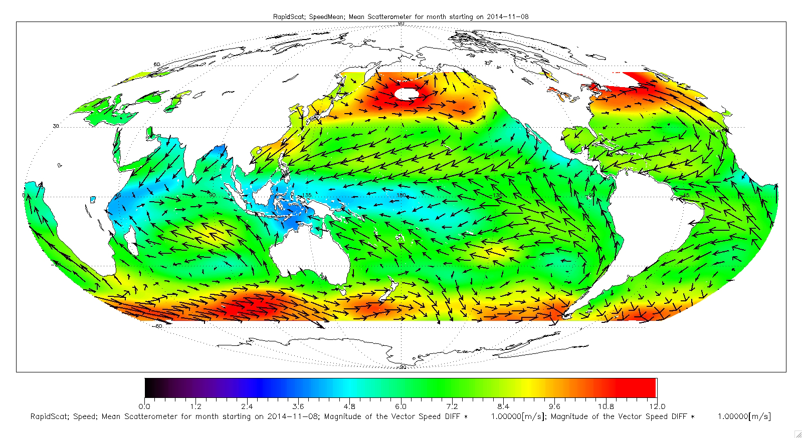
English: While El Niño events have a significant impact on the entire Earth System, they are most easily visible in measurements of sea surface temperature (SST), sea surface height (SSH) and ocean winds near the surface. In fact, the precursor and the main driver of El Niño events is manifested in the weakening of the normally westward blowing trade winds, or even their complete reversal to blow from west to east, in the Western and Central tropical Pacific.
These images show ocean winds near the surface as observed by NASA's ISS-RapidScat on the International Space Station. ISS-RapidScat was launched on Sept. 21, 2014, and began providing high-quality data a couple of weeks later. The RapidScat instrument is a speedy and cost-effective replacement for NASA's QuikScat satellite, which monitored ocean winds for 10 years, providing essential measurements used in weather predictions and climate monitoring. QuikScat's measurements were so essential that when the satellite stopped collecting wind data in late 2009, NASA was challenged to quickly and cost-effectively conceive of a replacement. To interactively explore the data, visit http://mwsci.jpl.nasa.gov/rapidscat/. This figure shows monthly average winds for November 2014. The colors represent the wind speed (or speed differences), while the vectors illustrate the direction of the anomalous mean wind components. The El Niño signal is very clearly evident in the eastward blowing anomalous winds observed in the tropical western and central Pacific. The El Niño signal is also seen in the anomalous stronger convergence into the tropical eastern Pacific, as evidenced by the stronger winds moving toward the equator observed in this region. |
| Date | |
| Source | https://photojournal.jpl.nasa.gov/catalog/PIA20365 (image link) |
| Author | NASA/JPL-Caltech |
This image or video was catalogued by Jet Propulsion Laboratory of the United States National Aeronautics and Space Administration (NASA) under Photo ID: PIA20365. This tag does not indicate the copyright status of the attached work. A normal copyright tag is still required. See Commons:Licensing. Other languages:
|
Licensing edit
.jpg&action=edit§ion=2)
| This file is in the public domain in the United States because it was solely created by NASA. NASA copyright policy states that "NASA material is not protected by copyright unless noted". (See Template:PD-USGov, NASA copyright policy page or JPL Image Use Policy.) | ||
 |
Warnings:
|
File history
Click on a date/time to view the file as it appeared at that time.
| Date/Time | Thumbnail | Dimensions | User | Comment | |
|---|---|---|---|---|---|
| current | 02:35, 16 January 2018 | | 1,600 × 875 (1.13 MB) | Huntster (talk | contribs) | {{Information |Description={{en|1=While El Niño events have a significant impact on the entire Earth System, they are most easily visible in measurements of sea surface temperature (SST), sea surface height (SSH) and ocean winds near the surface. In f... |
You cannot overwrite this file.
File usage on Commons
The following page uses this file:
.jpg&oldid=745305777)