File:Montreal WV districts map 2024.svg

Size of this PNG preview of this SVG file: 796 × 600 pixels. Other resolutions: 319 × 240 pixels | 637 × 480 pixels | 1,019 × 768 pixels | 1,280 × 965 pixels | 2,560 × 1,929 pixels | 1,591 × 1,199 pixels.
Original file (SVG file, nominally 1,591 × 1,199 pixels, file size: 680 KB)
Captions
Captions
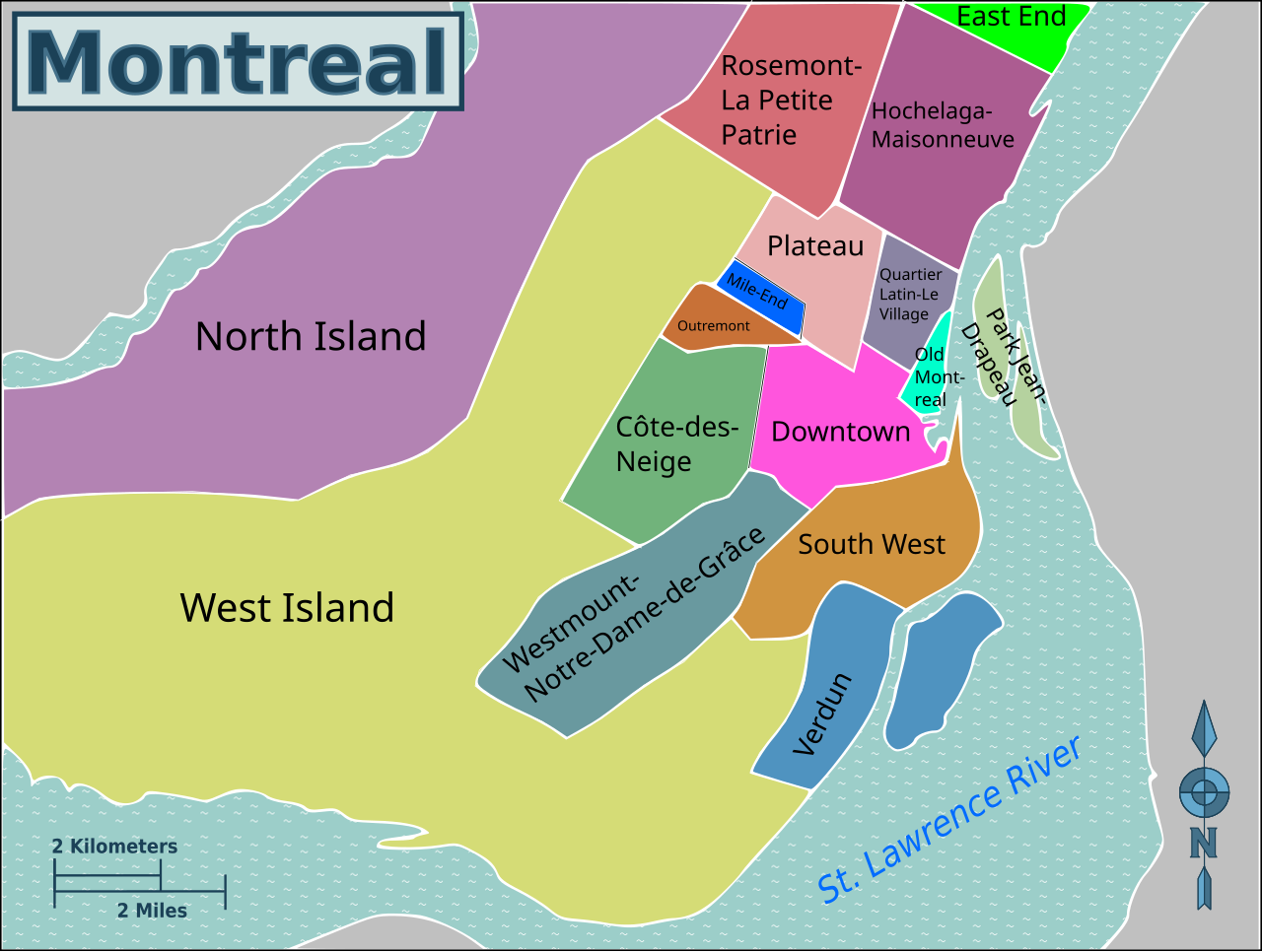
Map of the distrct breakdown used by English Wikivoyage
Summary edit
| Description |
English: Wikivoyage-style map of Montreal, showing travel districts used by Wikivoyage |
| Date | |
| Source | Own work, updated from File:Wikivoyage Montreal district map.svg |
| Author | Shaundd (update Jan 2024), Ypsilon from Finland (original) |
Licensing edit
I, the copyright holder of this work, hereby publish it under the following license:
| This file is made available under the Creative Commons CC0 1.0 Universal Public Domain Dedication. | |
| The person who associated a work with this deed has dedicated the work to the public domain by waiving all of their rights to the work worldwide under copyright law, including all related and neighboring rights, to the extent allowed by law. You can copy, modify, distribute and perform the work, even for commercial purposes, all without asking permission.
|
File history
Click on a date/time to view the file as it appeared at that time.
| Date/Time | Thumbnail | Dimensions | User | Comment | |
|---|---|---|---|---|---|
| current | 21:39, 10 February 2024 | | 1,591 × 1,199 (680 KB) | Shaundd (talk | contribs) | Uploaded own work with UploadWizard |
You cannot overwrite this file.
File usage on Commons
The following 2 pages use this file:
File usage on other wikis
The following other wikis use this file:
- Usage on en.wikivoyage.org