File:Morgan's Raid historical marker in Lexington.jpg
Size of this preview: 800 × 600 pixels. Other resolutions: 320 × 240 pixels | 640 × 480 pixels | 1,024 × 768 pixels | 1,280 × 960 pixels | 2,560 × 1,920 pixels | 2,816 × 2,112 pixels.
Original file (2,816 × 2,112 pixels, file size: 3.86 MB, MIME type: image/jpeg)
Captions
Captions
Add a one-line explanation of what this file represents
| Camera location | | View this and other nearby images on: OpenStreetMap |
|---|
| Description |
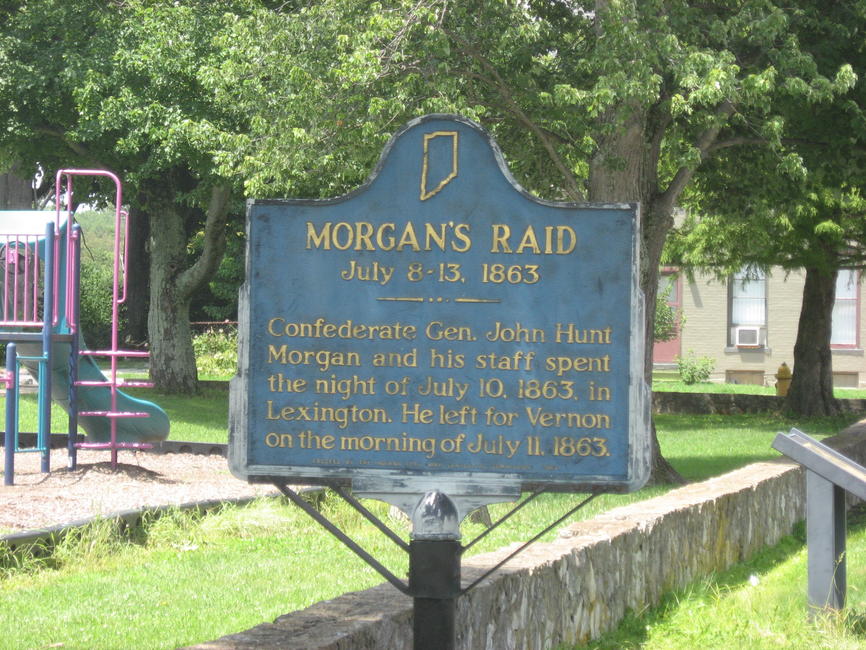
English: A historical marker on the former courthouse square in Lexington, Indiana, United States. It was placed in 1963 along Cherry Street, which is presently State Road 203. |
|||||
| Date | Taken on 28 July 2012 | |||||
| Source | Own work | |||||
| Author | Nyttend | |||||
| Permission (Reusing this file) |
Plaque and photo respectively:
|

File history
Click on a date/time to view the file as it appeared at that time.
| Date/Time | Thumbnail | Dimensions | User | Comment | |
|---|---|---|---|---|---|
| current | 23:35, 6 August 2012 | | 2,816 × 2,112 (3.86 MB) | Nyttend (talk | contribs) | {{Location|38|39|9.4|N|85|37|32|W}} {{Information |Description={{en|A historical marker on the former courthouse square in {{w|Lexington, Indiana|Lexington}}, {{w|Indiana}}, {{w|United States}}. It was placed in 1963 along Cherry Street, which is pres... |
You cannot overwrite this file.
File usage on Commons
There are no pages that use this file.
File usage on other wikis
The following other wikis use this file:
- Usage on en.wikipedia.org