File:MormonWarMap english.svg

Size of this PNG preview of this SVG file: 500 × 520 pixels. Other resolutions: 231 × 240 pixels | 462 × 480 pixels | 738 × 768 pixels | 985 × 1,024 pixels | 1,969 × 2,048 pixels.
Original file (SVG file, nominally 500 × 520 pixels, file size: 928 KB)
Captions
Captions
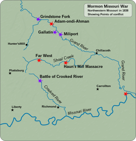
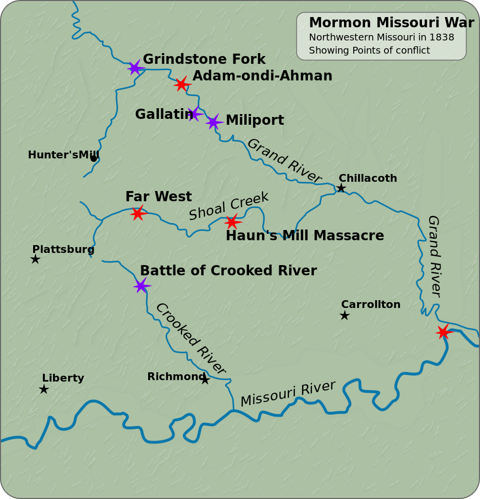
Northwestern Missouri, showing points of conflict in the Mormon Missouri War.
Summary edit
| Description |
English: Northwestern Missouri, showing points of conflict in the Mormon Missouri War. Español: Mapa de Misuri Noroccidental, mostrando los puntos de conflicto en la Guerra Mormona de Misuri.
|
||||||||||||||||||||||||||||||||
| Date | |||||||||||||||||||||||||||||||||
| Source |
Own work |
||||||||||||||||||||||||||||||||
| Author | Goran tek-en | ||||||||||||||||||||||||||||||||
| Permission (Reusing this file) |
This file is licensed under the Creative Commons Attribution-Share Alike 4.0 International license. Attribution: Goran tek-en
|
||||||||||||||||||||||||||||||||
| Other versions |
|
||||||||||||||||||||||||||||||||
| SVG development | This vector image was created with Inkscape. |
||||||||||||||||||||||||||||||||

File history
Click on a date/time to view the file as it appeared at that time.
| Date/Time | Thumbnail | Dimensions | User | Comment | |
|---|---|---|---|---|---|
| current | 18:36, 18 November 2021 | | 500 × 520 (928 KB) | Goran tek-en (talk | contribs) | ppi to 96, optimized |
| 19:34, 18 February 2014 |  | 500 × 520 (1.77 MB) | Goran tek-en (talk | contribs) | User created page with UploadWizard |
You cannot overwrite this file.
File usage on Commons
The following 4 pages use this file:
File usage on other wikis
The following other wikis use this file:
- Usage on fi.wikipedia.org
- Usage on www.wikidata.org