File:Moschovia Nova Tabula.jpg

Size of this preview: 800 × 585 pixels. Other resolutions: 320 × 234 pixels | 640 × 468 pixels | 1,024 × 749 pixels | 1,280 × 936 pixels | 1,760 × 1,287 pixels.
Original file (1,760 × 1,287 pixels, file size: 473 KB, MIME type: image/jpeg)
Captions
Captions
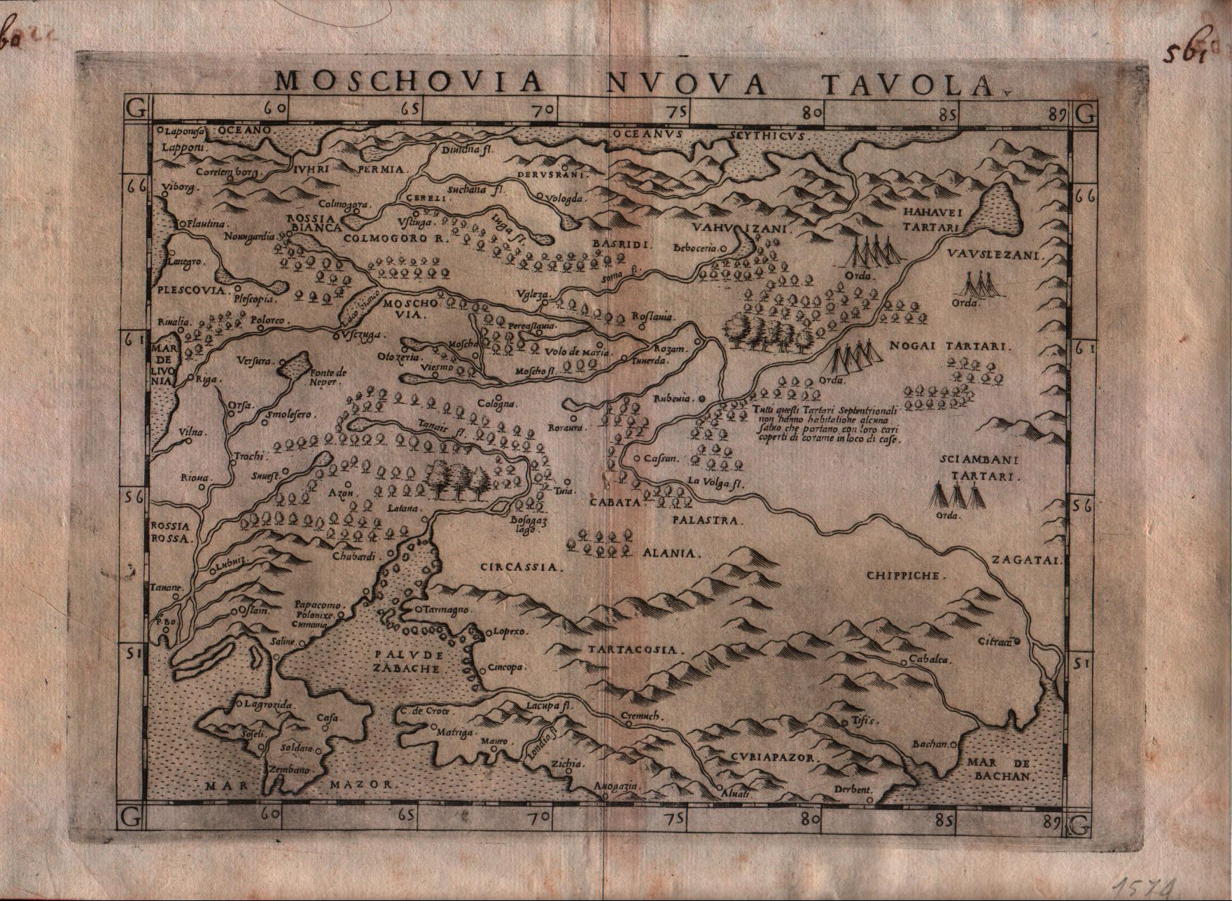
Gastaldi's modern map of Russia, including Poland, Lithuania, Estonia and Ukraine.
Summary edit
| Description |
English: Gastaldi's map is among the earliest modern maps of the region. Based upon the 1546 map of Sigmund Herberstein, it extends further to the north than the Herberstein map.
•Barry Lawrence Ruderman• |
|||||||||||||||||||
| Date | ||||||||||||||||||||
| Source | http://www.thetreasuremaps.com/maps/0118.jpg | |||||||||||||||||||
| Author |
|
|||||||||||||||||||
Licensing edit
|
This work is in the public domain in its country of origin and other countries and areas where the copyright term is the author's life plus 70 years or fewer. This work is in the public domain in the United States because it was published (or registered with the U.S. Copyright Office) before January 1, 1929. | |
| This file has been identified as being free of known restrictions under copyright law, including all related and neighboring rights. | |
File history
Click on a date/time to view the file as it appeared at that time.
| Date/Time | Thumbnail | Dimensions | User | Comment | |
|---|---|---|---|---|---|
| current | 19:08, 5 October 2019 | | 1,760 × 1,287 (473 KB) | Poli.Pav (talk | contribs) | User created page with UploadWizard |
You cannot overwrite this file.
File usage on Commons
The following page uses this file:
File usage on other wikis
The following other wikis use this file:
- Usage on uk.wikipedia.org