File:Mount St. Helens 1979.jpg
Size of this preview: 800 × 546 pixels. Other resolutions: 320 × 219 pixels | 640 × 437 pixels | 1,024 × 699 pixels | 1,280 × 874 pixels | 2,911 × 1,988 pixels.
Original file (2,911 × 1,988 pixels, file size: 4.87 MB, MIME type: image/jpeg)
Captions
Captions
Add a one-line explanation of what this file represents
Summary edit
| Description |
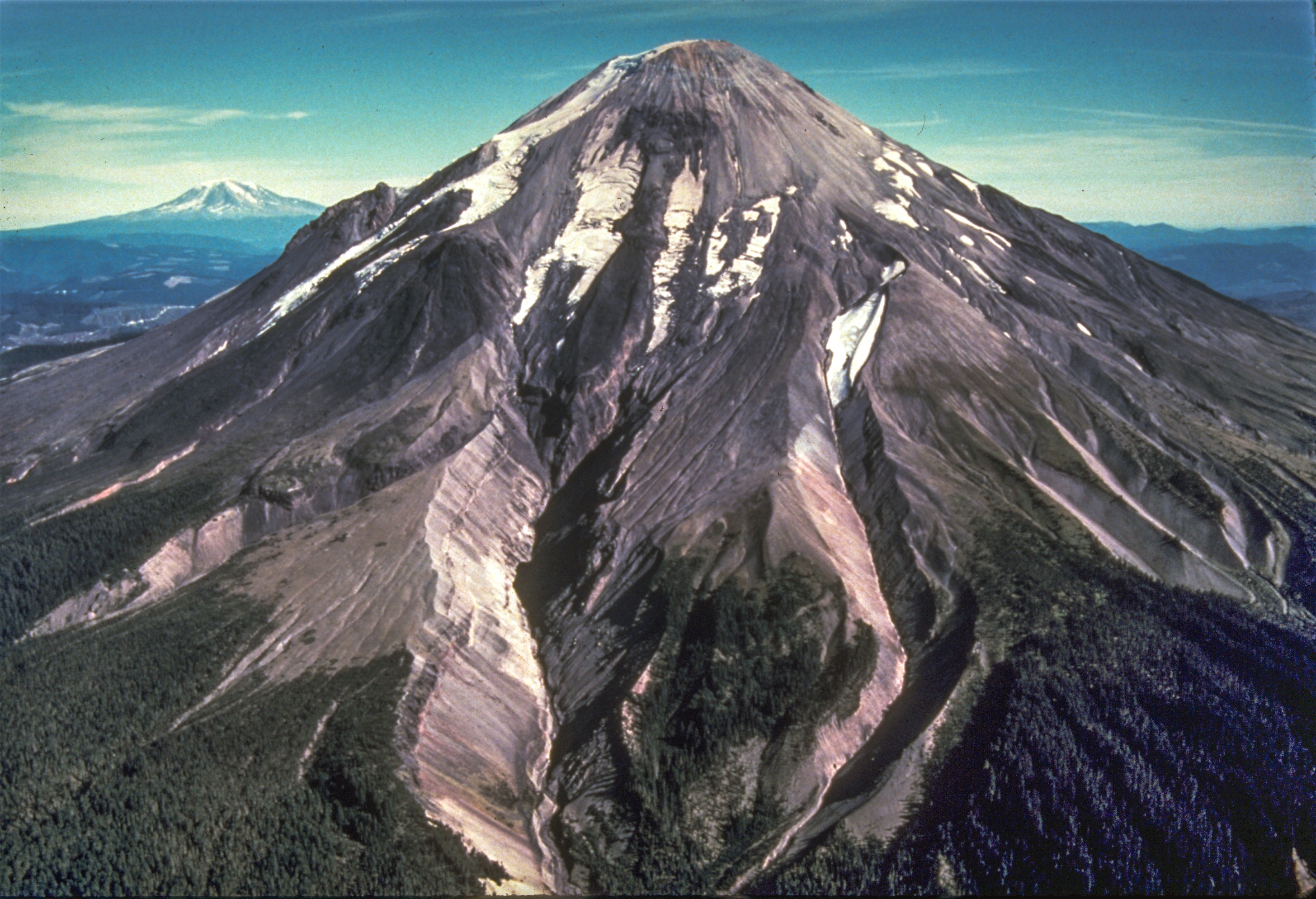
English: Before the eruption of May 18, 1980, Mount St. Helens' elevation was 2,950 m (9,677 ft), the smallest of five major volcanic peaks in Washington State. View from the west, Mount Adams in distance. S. Fork Toutle River is valley in center of photo. |
| Date | |
| Source | http://volcanoes.usgs.gov/volcanoes/st_helens/st_helens_gallery_29.html image 9 |
| Author | USGS |
| Permission (Reusing this file) |
PD-USGov-USGS |
Licensing edit
This image is in the public domain in the United States because it only contains materials that originally came from the United States Geological Survey, an agency of the United States Department of the Interior. For more information, see the official USGS copyright policy.
|
File history
Click on a date/time to view the file as it appeared at that time.
| Date/Time | Thumbnail | Dimensions | User | Comment | |
|---|---|---|---|---|---|
| current | 12:19, 13 November 2013 | | 2,911 × 1,988 (4.87 MB) | Hike395 (talk | contribs) | {{Information |Description ={{en|1=Before the eruption of May 18, 1980, Mount St. Helens' elevation was 2,950 m (9,677 ft), the smallest of five major volcanic peaks in Washington State. View from the west, Mount Adams in distance. S. Fork Toutle Ri... |
You cannot overwrite this file.
File usage on Commons
The following page uses this file: