File:Mount St. Helens map - Flickr - brewbooks.jpg

Size of this preview: 718 × 599 pixels. Other resolutions: 288 × 240 pixels | 575 × 480 pixels | 920 × 768 pixels | 1,227 × 1,024 pixels | 2,453 × 2,048 pixels | 2,845 × 2,375 pixels.
Original file (2,845 × 2,375 pixels, file size: 2.76 MB, MIME type: image/jpeg)
Captions
Captions
Add a one-line explanation of what this file represents
Summary edit
| Description |
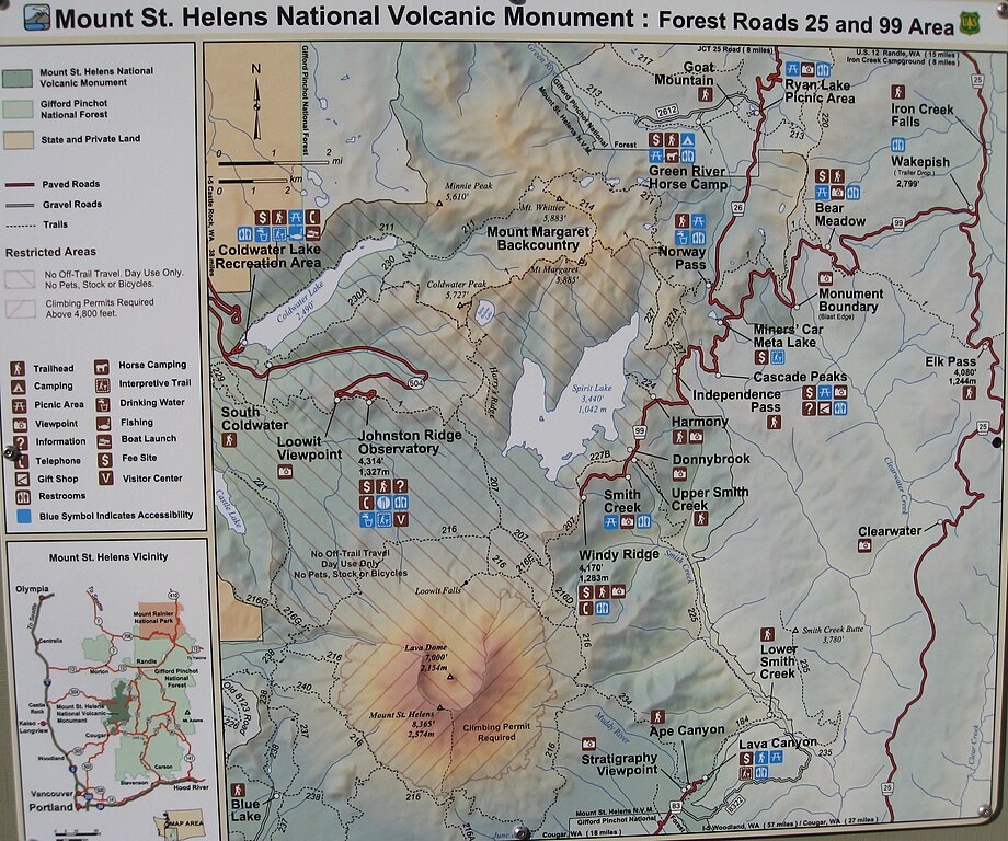
Heading up to Mount St Helens northeast side. We'll camp tonight and hike into the crater in the morning. sth 003 |
| Date | |
| Source | Mount St Helens map |
| Author | brewbooks from near Seattle, USA |
| Camera location | | View this and other nearby images on: OpenStreetMap |
|---|
Licensing edit
| This image or media file contains material based on a work of a National Park Service employee, created as part of that person's official duties. As a work of the U.S. federal government, such work is in the public domain in the United States. See the NPS website and NPS copyright policy for more information. |
| This image was originally posted to Flickr by brewbooks at https://flickr.com/photos/93452909@N00/6161016651. It was reviewed on 5 November 2016 by FlickreviewR and was confirmed to be licensed under the terms of the cc-by-sa-2.0. |
File history
Click on a date/time to view the file as it appeared at that time.
| Date/Time | Thumbnail | Dimensions | User | Comment | |
|---|---|---|---|---|---|
| current | 14:33, 5 November 2016 | | 2,845 × 2,375 (2.76 MB) | Josve05a (talk | contribs) | == {{int:filedesc}} == {{Information |Description=Heading up to Mount St Helens northeast side. We'll camp tonight and hike into the crater in the morning. sth 003 |Source=[https://www.flickr.com/photos/brewbooks/6161016651/ Mount St Helens map] |Date... |
You cannot overwrite this file.
File usage on Commons
The following page uses this file:
- File:Mount St Helens map - Flickr - brewbooks.jpg (file redirect)
File usage on other wikis
The following other wikis use this file:
- Usage on en.wikipedia.org