File:Mt-Rae-Alberta-Canada-aerial2.jpg
Size of this preview: 450 × 600 pixels. Other resolutions: 180 × 240 pixels | 360 × 480 pixels | 576 × 768 pixels | 768 × 1,024 pixels | 1,704 × 2,272 pixels.
Original file (1,704 × 2,272 pixels, file size: 2.73 MB, MIME type: image/jpeg)
Captions
Captions
Add a one-line explanation of what this file represents
Summary edit
| Description |
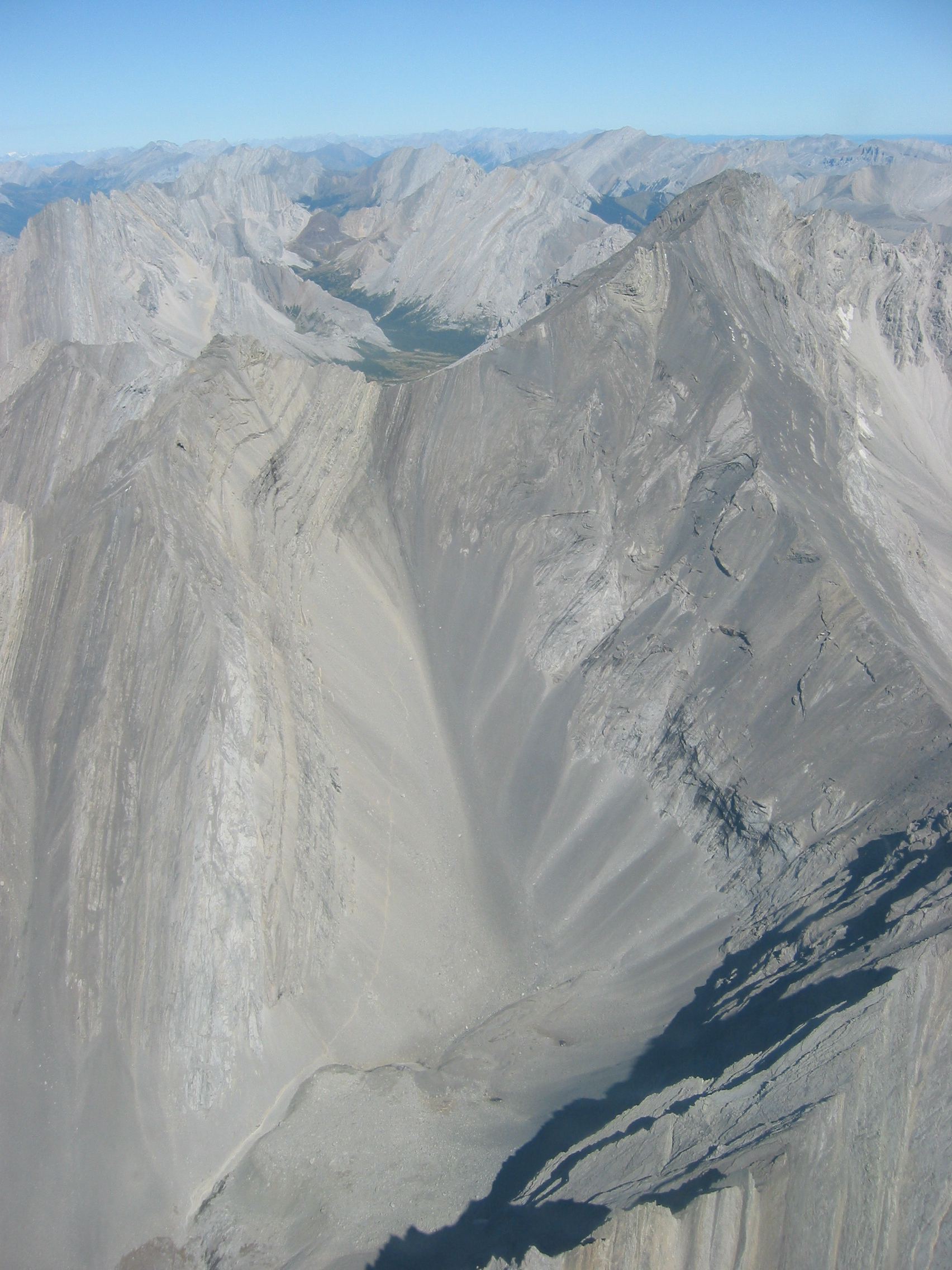
English: This photo was taken by flying between Mt. Arethusa and Mt. Rae (looking north-ish). The scramble starts at the Highwood pass parking lot on Hwy 40 (2,227 metres/7,310 feet) and proceeds to the back of the Ptarmigan cirque. The back of the Ptarmigan cirque is in the bottom left corner of the photo. The scramble proceeds from there up the center of the frame to the col. The last section before the col is made up of steeper slabs and ugly scree. The trail can be seen in the high resolution photo. |
| Date | |
| Source | Transferred from en.wikipedia to Commons by RedWolf using CommonsHelper. |
| Author | Kevin Lenz |
Licensing edit
This file is licensed under the Creative Commons Attribution-Share Alike 2.5 Generic license.
- You are free:
- to share – to copy, distribute and transmit the work
- to remix – to adapt the work
- Under the following conditions:
- attribution – You must give appropriate credit, provide a link to the license, and indicate if changes were made. You may do so in any reasonable manner, but not in any way that suggests the licensor endorses you or your use.
- share alike – If you remix, transform, or build upon the material, you must distribute your contributions under the same or compatible license as the original.
Original upload log edit
The original description page was here. All following user names refer to en.wikipedia.
- 2006-09-24 22:05 Kevin lenz 1704×2272× (2858536 bytes) Author: Kevin Lenz Date: 2006-09-02 11:52am
File history
Click on a date/time to view the file as it appeared at that time.
| Date/Time | Thumbnail | Dimensions | User | Comment | |
|---|---|---|---|---|---|
| current | 23:02, 12 December 2009 | | 1,704 × 2,272 (2.73 MB) | RedWolf (talk | contribs) | {{Information |Description={{en|This photo was taken by flying between Mt. Arethusa and Mt. Rae (looking north-ish). The scramble starts at the Highwood pass parking lot on Hwy 40 (2,227 metres/7,310 feet) and proceeds to the back of the Ptarmigan cirque. |
You cannot overwrite this file.
File usage on Commons
There are no pages that use this file.
File usage on other wikis
The following other wikis use this file:
- Usage on en.wikipedia.org