File:Mt. Sinyella AZ.jpg

Size of this preview: 800 × 533 pixels. Other resolutions: 320 × 213 pixels | 640 × 427 pixels | 1,024 × 682 pixels | 1,280 × 853 pixels | 2,560 × 1,706 pixels | 4,191 × 2,793 pixels.
Original file (4,191 × 2,793 pixels, file size: 1.62 MB, MIME type: image/jpeg)
Captions
Captions
Add a one-line explanation of what this file represents
Summary edit
| Description |
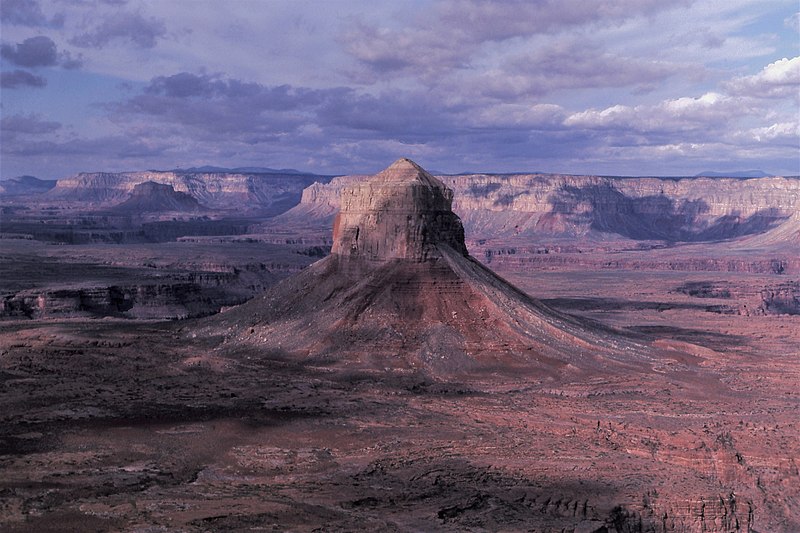
English: Aerial view west toward east side of Mount Sinyella. Surrounded by flat-lying Esplanade Sandstone. Bottom red slope, Hermit Formation; lower cliff, Coconino Sandstone; upper cliff and slope, Toroweap Formation; capped by small gray ledges of Kaibab Formation. |
| Date | |
| Source | https://www.sciencebase.gov/catalog/item/5c75a605e4b0fe48cb4a5310 |
| Author | George Billingsley, U.S. Geological Survey |
| Camera location | | View this and other nearby images on: OpenStreetMap |
|---|
Licensing edit
This image is in the public domain in the United States because it only contains materials that originally came from the United States Geological Survey, an agency of the United States Department of the Interior. For more information, see the official USGS copyright policy.
|
File history
Click on a date/time to view the file as it appeared at that time.
| Date/Time | Thumbnail | Dimensions | User | Comment | |
|---|---|---|---|---|---|
| current | 10:57, 1 February 2021 | | 4,191 × 2,793 (1.62 MB) | Ron Clausen (talk | contribs) | Uploaded a work by George Billingsley, U.S. Geological Survey from https://www.sciencebase.gov/catalog/item/5c75a605e4b0fe48cb4a5310 with UploadWizard |
You cannot overwrite this file.
File usage on Commons
There are no pages that use this file.
File usage on other wikis
The following other wikis use this file:
- Usage on en.wikipedia.org