File:Mt Baldy from Carriage Trail, Redlands 5-12-13a (9017023129).jpg
Original file (1,750 × 1,316 pixels, file size: 564 KB, MIME type: image/jpeg)
Captions
Captions
Summary edit
.jpg&action=edit§ion=1)
| Description |
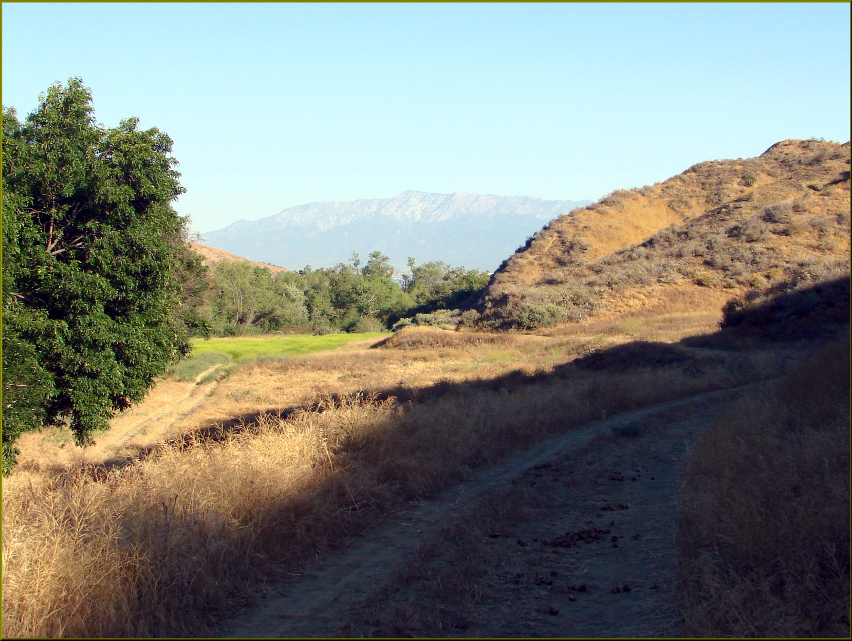
English: (1 in a multiple picture set) One of our newer trails set up by the Redlands Conservancy is Carriage Trail. There is an interesting story to this trail. Some of the earliest founders of Redlands, the Smiley Brothers, made this trail (you can see it on the left side of the pictures) so that they could take their guest from their mansion in Smiley Heights (west side of town) down along San Timoteo Canyon Creek, and then up to the great view at what is now called Panorama Point on the east side of town. When I took this picture, I stood and imagined that I could see them in their horse drawn carriage, dressed to the nines, moving leisurely along the trail next to the babbling stream. |
| Date | |
| Source | https://www.flickr.com/photos/23155134@N06/9017023129/ |
| Author | inkknife_2000 (7.5 million views +) |
| Permission (Reusing this file) |
At the time of upload, the image license was automatically confirmed using the Flickr API. For more information see Flickr API detail. |
| Flickr sets |
|
| Flickr pools |
|
| Flickr tags |
|
| Camera location | | View this and other nearby images on: OpenStreetMap |
|---|
.jpg¶ms=034.023462_N_-117.193694_E_globe:Earth_type:camera__&language=en)
Licensing edit
.jpg&action=edit§ion=2)
- You are free:
- to share – to copy, distribute and transmit the work
- to remix – to adapt the work
- Under the following conditions:
- attribution – You must give appropriate credit, provide a link to the license, and indicate if changes were made. You may do so in any reasonable manner, but not in any way that suggests the licensor endorses you or your use.
- share alike – If you remix, transform, or build upon the material, you must distribute your contributions under the same or compatible license as the original.
| This image was originally posted to Flickr by inkknife_2000 (7.5 million views +) at https://flickr.com/photos/23155134@N06/9017023129. It was reviewed on 30 March 2017 by FlickreviewR and was confirmed to be licensed under the terms of the cc-by-sa-2.0. |
File history
Click on a date/time to view the file as it appeared at that time.
| Date/Time | Thumbnail | Dimensions | User | Comment | |
|---|---|---|---|---|---|
| current | 17:50, 30 March 2017 | | 1,750 × 1,316 (564 KB) | Fæ (talk | contribs) | Don Graham, Set 72157632867571900, ID 9017023129, Original title Mt Baldy from Carriage Trail, Redlands 5-12-13a |
You cannot overwrite this file.
File usage on Commons
There are no pages that use this file.
.jpg&oldid=644229354)