File:Murerplan - Wiedikon.jpg
Size of this preview: 800 × 524 pixels. Other resolutions: 320 × 210 pixels | 640 × 419 pixels | 1,024 × 670 pixels | 1,280 × 838 pixels.
Original file (1,280 × 838 pixels, file size: 412 KB, MIME type: image/jpeg)
Captions
Captions
Add a one-line explanation of what this file represents
Summary edit
| Description |
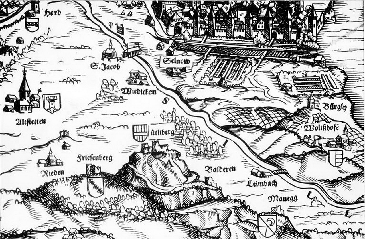
Deutsch: Das Gebiet westlich und südlich der Stadt Zürich, im Zentrum das heutige Quartier Wiedikon auf der Karte von de:Jos Murer aus dem Jahr 1566. Zu erkennen sind unter anderem der Uetliberg mit den Burgen Friesenberg und Uetliburg, Baldern und Manegg sowie die Stadtquartiere bzw. Stadtteile Hard mit dem Hardturm (links oben), Altstetten, St. Jakob (Aussersihl) mit der im Alten Zürichkrieg schicksalshaften Brücke, Selnau, Wollishofen und Leimbach. |
| Date | |
| Source | Website Ortsmuseum Wiedikon |
| Author | de:Jos Murer, upload by Roland zh on 7. Mai 2009 |
Licensing edit
|
This work is in the public domain in its country of origin and other countries and areas where the copyright term is the author's life plus 100 years or fewer. | |
| This file has been identified as being free of known restrictions under copyright law, including all related and neighboring rights. | |
File history
Click on a date/time to view the file as it appeared at that time.
| Date/Time | Thumbnail | Dimensions | User | Comment | |
|---|---|---|---|---|---|
| current | 01:02, 7 May 2009 | | 1,280 × 838 (412 KB) | Roland zh (talk | contribs) | == Summary == {{Information |Description={{de|Das Gebiet westlich und südlich der Stadt Zürich, im Zentrum das heutige Quartier Wiedikon auf der Karte von de:Jos Murer aus dem Jahr 1566. Zu erkennen sind |
You cannot overwrite this file.
File usage on Commons
There are no pages that use this file.
File usage on other wikis
The following other wikis use this file:
- Usage on de.wikipedia.org
- Usage on en.wikipedia.org