File:Musa Bay, Iran.jpg
Original file (3,508 × 2,540 pixels, file size: 2.02 MB, MIME type: image/jpeg)
Captions
Captions
Summary
edit
| Description |
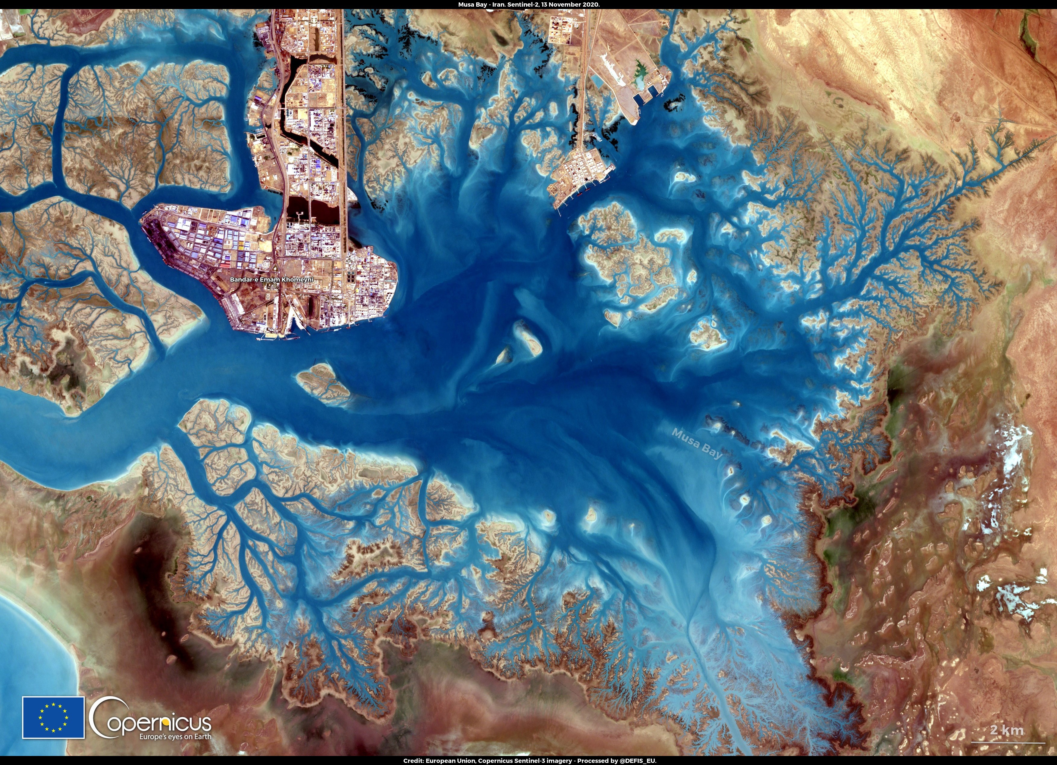
English: This image, acquired by one of the Copernicus Sentinel-2 satellites on 13 November, shows the Musa Bay in Iran. Musa bay is a shallow estuary with a long history as a shipping hub: in the classical age, Greek navigators used the area for trade with the peoples of Mesopotamia and today it hosts Bandar-e Emam Khomeyni (BEK), one of the most important port areas of Iran. The waters of the bay are pristine, with the exception of the BEK area where many crude oil refining facilities produce a wide variety of petroleum-based products and production waste causes pollution of the waters. The Copernicus Sentinel-2 is a high-resolution mission composed two identical satellites designed to provide optical imaging with a revisit frequency of 5 days. These satellites benefit Copernicus services and applications such as water quality monitoring or emergency management. |
| Date | Taken on 13 November 2020 |
| Source | Musa Bay, Iran |
| Author | European Union , Copernicus Sentinel-2 imagery |
Licensing
edit

|
This image contains data from a satellite in the Copernicus Programme, such as Sentinel-1, Sentinel-2 or Sentinel-3. Attribution is required when using this image.
Attribution: Contains modified Copernicus Sentinel data 2020
The use of Copernicus Sentinel Data is regulated under EU law (Commission Delegated Regulation (EU) No 1159/2013 and Regulation (EU) No 377/2014). Relevant excerpts:
Free access shall be given to GMES dedicated data [...] made available through GMES dissemination platforms [...].
Access to GMES dedicated data [...] shall be given for the purpose of the following use in so far as it is lawful:
GMES dedicated data [...] may be used worldwide without limitations in time.
GMES dedicated data and GMES service information are provided to users without any express or implied warranty, including as regards quality and suitability for any purpose. |
File history
Click on a date/time to view the file as it appeared at that time.
| Date/Time | Thumbnail | Dimensions | User | Comment | |
|---|---|---|---|---|---|
| current | 08:09, 24 August 2023 | | 3,508 × 2,540 (2.02 MB) | OptimusPrimeBot (talk | contribs) | #Spacemedia - Upload of https://www.copernicus.eu/system/files/2020-11/image_day/musabay_logo_credit_row2.jpg via Commons:Spacemedia |
You cannot overwrite this file.
File usage on Commons
There are no pages that use this file.