File:My Public Lands Roadtrip- Animas Forks along the Alpine Loop in Colorado (19591389579).jpg

Original file (2,048 × 1,365 pixels, file size: 985 KB, MIME type: image/jpeg)
Captions
Captions
Summary edit
.jpg&action=edit§ion=1)
| Description |
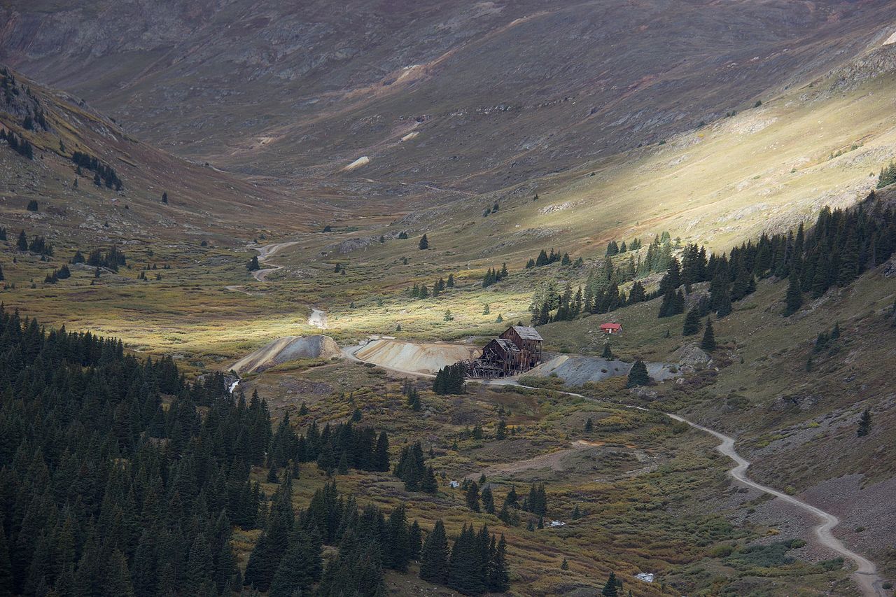
The Alpine Loop is one of America’s Back-Country Byways, providing an off-the-beaten-path trip for adventurers in cars, motorcycles, 4x4 vehicles and even mountain bikes. Tucked away in the San Juan Mountains, the byway winds through the towns of Lake City, Ouray and Silverton, Colorado, for 65 miles. U.S. settlers moved into the area in the late 1800s to search for silver, gold, lead and zinc. They constructed a network of roads and railways so they could transport ore and supplies through the mountain ridges. Most of the mines are closed today, but the roads still remain, offering a rare and intimate view of historic southwestern Colorado. Remnants of the area’s past dot the byway – visitors may see once-booming ghost towns, old mine shafts and railroad fixtures. Pictured here, Animas Forks was once a thriving mining town of 30 cabins and a hotel, general store, saloon and post office. When gold mining profits declined, investment in the town declined as well. And the town was a ghost by the 1920s. The BLM Colorado and local partners maintain this ghost town as a stop for travelers along the Alpine Loop. |
| Date | |
| Source | My Public Lands Roadtrip: Animas Forks along the Alpine Loop in Colorado |
| Author | Bureau of Land Management |
Licensing edit
.jpg&action=edit§ion=2)
- You are free:
- to share – to copy, distribute and transmit the work
- to remix – to adapt the work
- Under the following conditions:
- attribution – You must give appropriate credit, provide a link to the license, and indicate if changes were made. You may do so in any reasonable manner, but not in any way that suggests the licensor endorses you or your use.
| This image was originally posted to Flickr by mypubliclands at https://flickr.com/photos/91981596@N06/19591389579. It was reviewed on 5 August 2015 by FlickreviewR and was confirmed to be licensed under the terms of the cc-by-2.0. |
| This image is a work of a Bureau of Land Management* employee, taken or made as part of that person's official duties. As a work of the U.S. federal government, the image is in the public domain in the United States. *or predecessor organization |
File history
Click on a date/time to view the file as it appeared at that time.
| Date/Time | Thumbnail | Dimensions | User | Comment | |
|---|---|---|---|---|---|
| current | 18:19, 4 August 2015 | | 2,048 × 1,365 (985 KB) | Wilfredor (talk | contribs) | Transferred from Flickr via Flickr2Commons |
You cannot overwrite this file.
File usage on Commons
There are no pages that use this file.
.jpg&oldid=492670642)