File:Núria from Coll Finestrelles.jpg
Size of this preview: 800 × 600 pixels. Other resolutions: 320 × 240 pixels | 640 × 480 pixels | 1,024 × 768 pixels | 1,280 × 960 pixels | 2,560 × 1,920 pixels | 4,608 × 3,456 pixels.
Original file (4,608 × 3,456 pixels, file size: 8.85 MB, MIME type: image/jpeg)
Captions
Captions
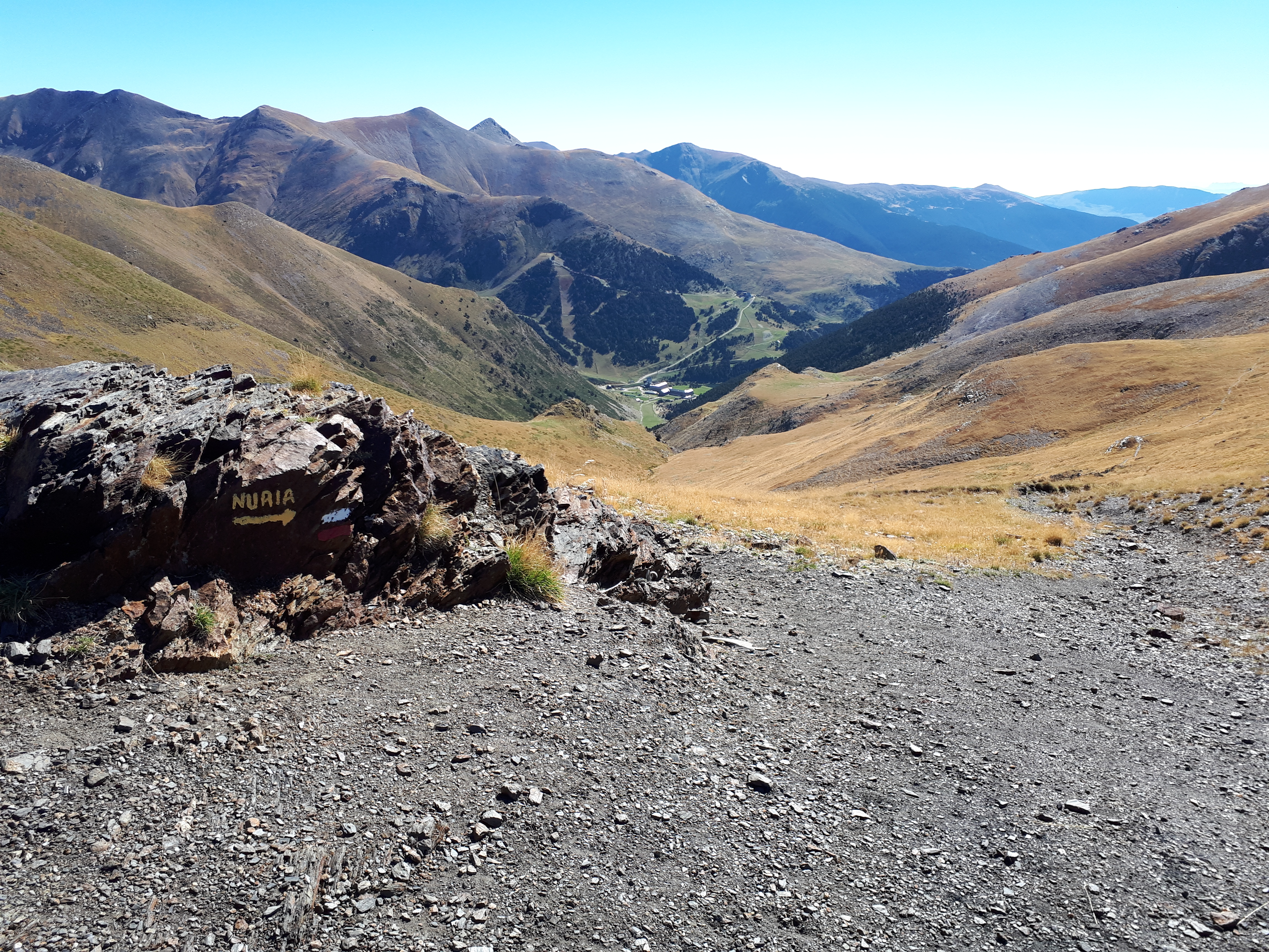
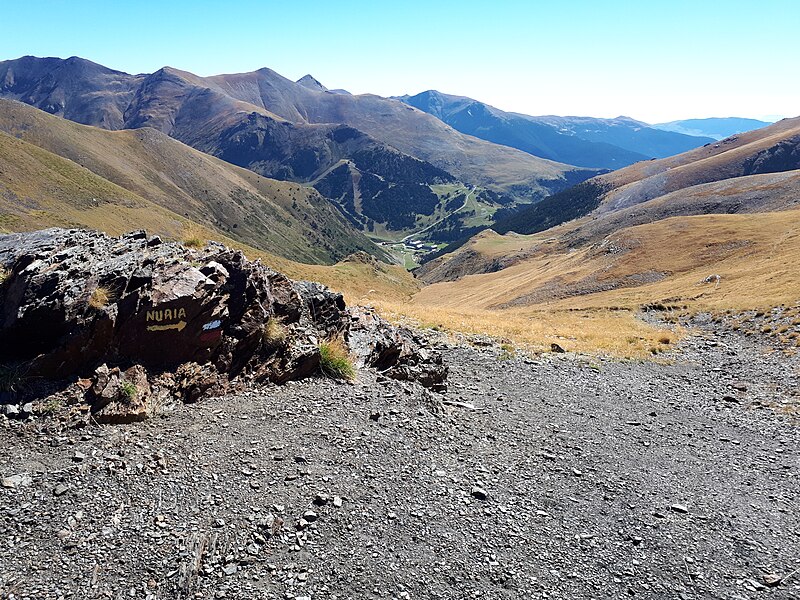
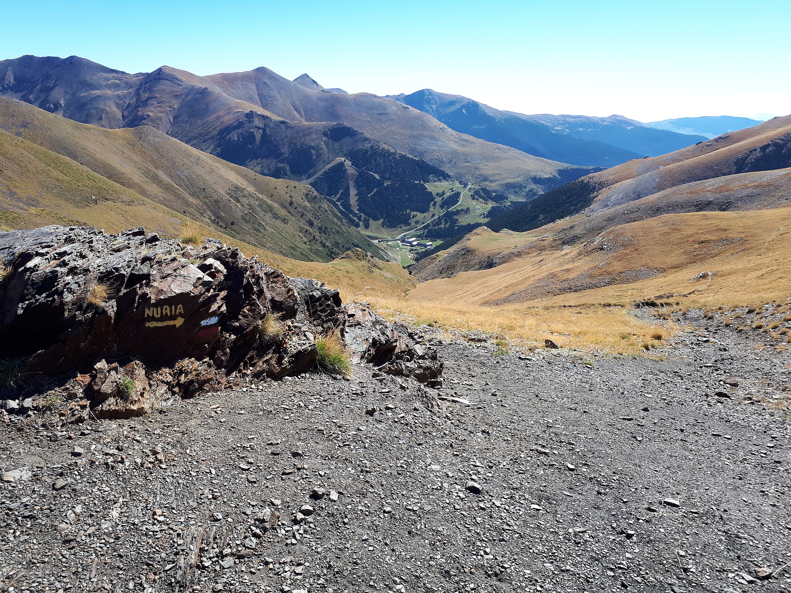
View to the south to Núria, Catalonia, Spain (eastern Pyrenees), from the Coll de Finestrelles, on the frontier with France.
Summary edit
| Description |
English: The red-and-white waymark indicates that the col is on the GRT73, a Grande Randonnée Transfrontalière. This is a path which passes from one country to another - in this case, one which crosses the spine of the Pyrenees mountain chain, and which links long-distance paths on either side - the GR 36 at Err in France and the GR 11 at Vall de Núria in Spain (Catalonia).
See also: |
| Date | |
| Source | Own work |
| Author | Alan Mattingly |
| Camera location | | View this and other nearby images on: OpenStreetMap |
|---|
Licensing edit
I, the copyright holder of this work, hereby publish it under the following license:
| This file is made available under the Creative Commons CC0 1.0 Universal Public Domain Dedication. | |
| The person who associated a work with this deed has dedicated the work to the public domain by waiving all of their rights to the work worldwide under copyright law, including all related and neighboring rights, to the extent allowed by law. You can copy, modify, distribute and perform the work, even for commercial purposes, all without asking permission.
|
File history
Click on a date/time to view the file as it appeared at that time.
| Date/Time | Thumbnail | Dimensions | User | Comment | |
|---|---|---|---|---|---|
| current | 20:14, 20 February 2024 | | 4,608 × 3,456 (8.85 MB) | Alan Mattingly (talk | contribs) | Uploaded own work with UploadWizard |
You cannot overwrite this file.
File usage on Commons
There are no pages that use this file.
File usage on other wikis
The following other wikis use this file:
- Usage on en.wikipedia.org
- Usage on fr.wikipedia.org