File:NOAA Ship Thomas Jefferson (4505637567).jpg

Original file (1,290 × 1,032 pixels, file size: 228 KB, MIME type: image/jpeg)
Captions
Captions
Summary edit
.jpg&action=edit§ion=1)
| Description |
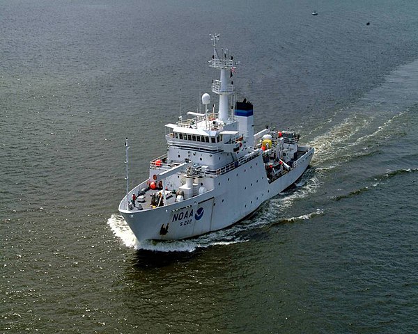
NOAA Ship Thomas Jefferson, one of the most technologically advanced hydrographic survey vessels in the world, departed its Norfolk, Virginia, homeport on April 6, 2010, to conduct a five-month long effort to map the seafloor and look for hazards to navigation off the Gulf coast. To learn more about how NOS maps the sea floor, visit: Office of Coast Survey Norfolk, Va.-based NOAA Ship Thomas Jefferson to Map Ocean Floor in Gulf of Mexico What Is Hydrography? (Diving Deeper audio podcast) Sea Floor Mapping (National Ocean Service Education) (Original source: National Ocean Service Image Gallery) |
| Date | |
| Source |
|
| Author | NOAA's National Ocean Service |
Licensing edit
.jpg&action=edit§ion=2)
- You are free:
- to share – to copy, distribute and transmit the work
- to remix – to adapt the work
- Under the following conditions:
- attribution – You must give appropriate credit, provide a link to the license, and indicate if changes were made. You may do so in any reasonable manner, but not in any way that suggests the licensor endorses you or your use.
| This image, originally posted to Flickr, was reviewed on 21 June 2013 by the administrator or reviewer File Upload Bot (Magnus Manske), who confirmed that it was available on Flickr under the stated license on that date. |
File history
Click on a date/time to view the file as it appeared at that time.
| Date/Time | Thumbnail | Dimensions | User | Comment | |
|---|---|---|---|---|---|
| current | 15:02, 21 June 2013 | | 1,290 × 1,032 (228 KB) | File Upload Bot (Magnus Manske) (talk | contribs) | Transferred from Flickr by User:High Contrast |
You cannot overwrite this file.
File usage on Commons
The following page uses this file:
File usage on other wikis
The following other wikis use this file:
- Usage on cs.wikipedia.org
- Usage on fr.wikipedia.org
.jpg&oldid=759531261)