File:NPS cape-cod-beech-forest-trail-map.gif

Size of this preview: 318 × 599 pixels. Other resolutions: 127 × 240 pixels | 512 × 964 pixels.
Original file (512 × 964 pixels, file size: 74 KB, MIME type: image/gif, 0.1 s)
Captions
Captions
Add a one-line explanation of what this file represents
Summary
edit
| Description |
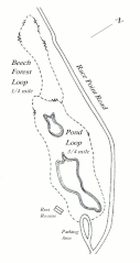
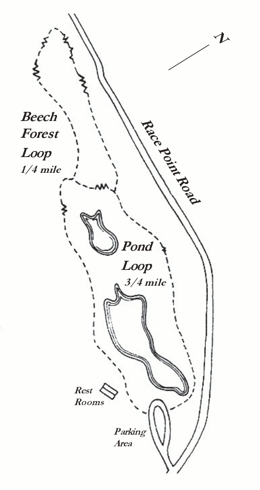
English: This Beech Forest trail map shows this series of loop trails near the end of the Cape near the Province Lands Visitor Center. You might as well do both loops – it’s only a mile or so walk. |
| Date | |
| Source | U.S. National Park Service (http://npmaps.com/wp-content/uploads/cape-cod-beech-forest-trail-map.gif) |
| Author | U.S. National Park Service, restoration/cleanup by Matt Holly |
Licensing
edit
| This image or media file contains material based on a work of a National Park Service employee, created as part of that person's official duties. As a work of the U.S. federal government, such work is in the public domain in the United States. See the NPS website and NPS copyright policy for more information. |
File history
Click on a date/time to view the file as it appeared at that time.
| Date/Time | Thumbnail | Dimensions | User | Comment | |
|---|---|---|---|---|---|
| current | 19:53, 16 May 2017 | | 512 × 964 (74 KB) | RKBot (talk | contribs) | =={{int:filedesc}}== {{Information |description= {{en|1=This Beech Forest trail map shows this series of loop trails near the end of the Cape near the Province Lands Visitor Center. You might as well do both loops – it’s only a mile or so walk.}} |... |
You cannot overwrite this file.
File usage on Commons
The following page uses this file: