File:NPS crater-lake-elevation-map.jpg

Size of this preview: 406 × 599 pixels. Other resolutions: 163 × 240 pixels | 325 × 480 pixels | 955 × 1,408 pixels.
Original file (955 × 1,408 pixels, file size: 280 KB, MIME type: image/jpeg)
Captions
Captions
Add a one-line explanation of what this file represents
Summary edit
| Description |
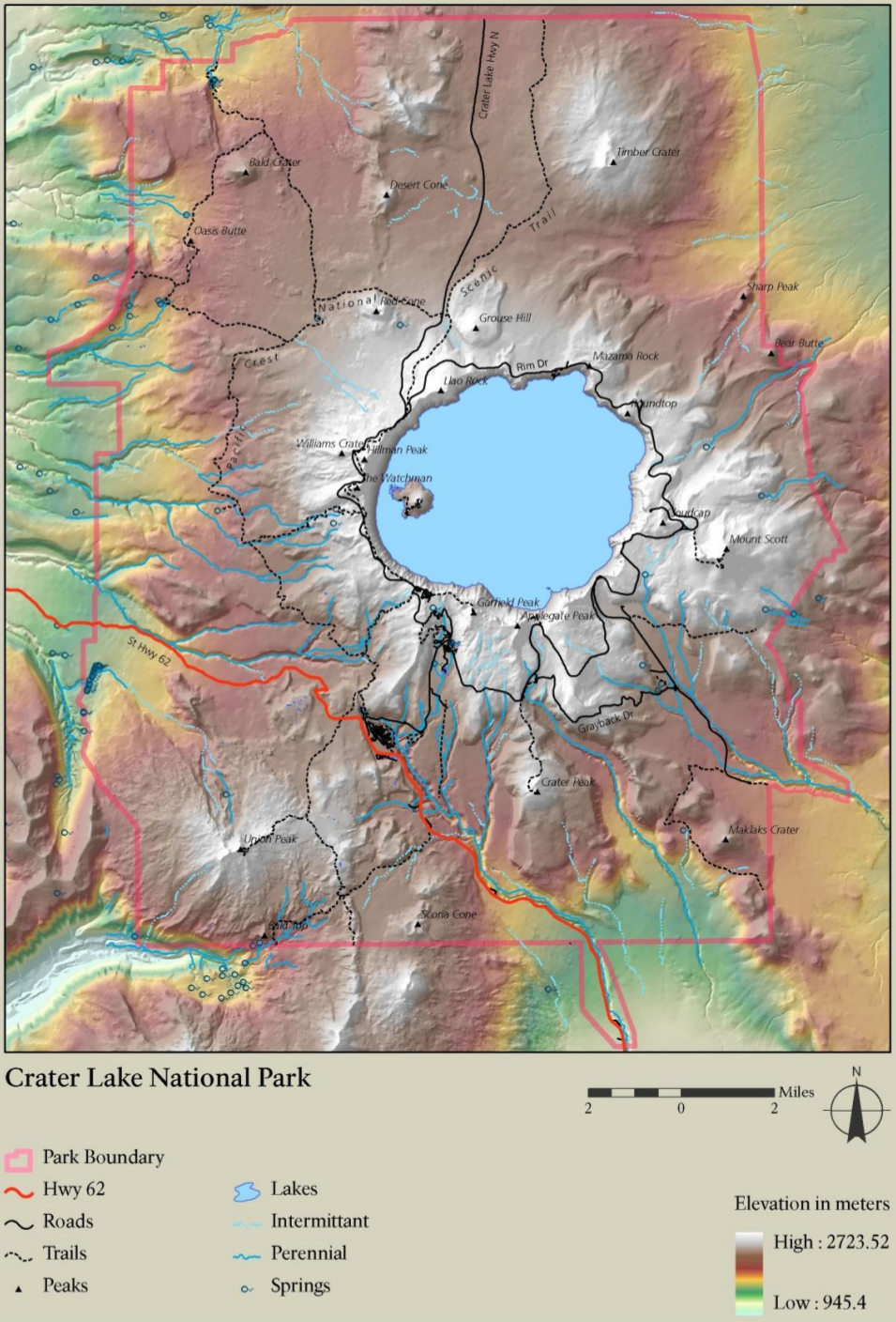
English: Crater Lake elevation map, which really hammers home how Crater Lake is filling the interior of a volcanic caldera. See how the mountain slopes up to the crater rim and lake? |
| Date | |
| Source | U.S. National Park Service (http://npmaps.com/wp-content/uploads/crater-lake-elevation-map.jpg) |
| Author | U.S. National Park Service, restoration/cleanup by Matt Holly |
Licensing edit
| This image or media file contains material based on a work of a National Park Service employee, created as part of that person's official duties. As a work of the U.S. federal government, such work is in the public domain in the United States. See the NPS website and NPS copyright policy for more information. |
File history
Click on a date/time to view the file as it appeared at that time.
| Date/Time | Thumbnail | Dimensions | User | Comment | |
|---|---|---|---|---|---|
| current | 20:11, 16 May 2017 | | 955 × 1,408 (280 KB) | RKBot (talk | contribs) | =={{int:filedesc}}== {{Information |description= {{en|1=Crater Lake elevation map, which really hammers home how Crater Lake is filling the interior of a volcanic caldera. See how the mountain slopes up to the crater rim and lake?}} |date= 2017-01-22 |... |
You cannot overwrite this file.
File usage on Commons
The following page uses this file: