File:NPS denali-savage-campground-map.gif

Size of this preview: 560 × 599 pixels. Other resolutions: 224 × 240 pixels | 449 × 480 pixels | 961 × 1,028 pixels.
Original file (961 × 1,028 pixels, file size: 191 KB, MIME type: image/gif, 0.1 s)
Captions
Captions
Add a one-line explanation of what this file represents
Summary edit
| Description |
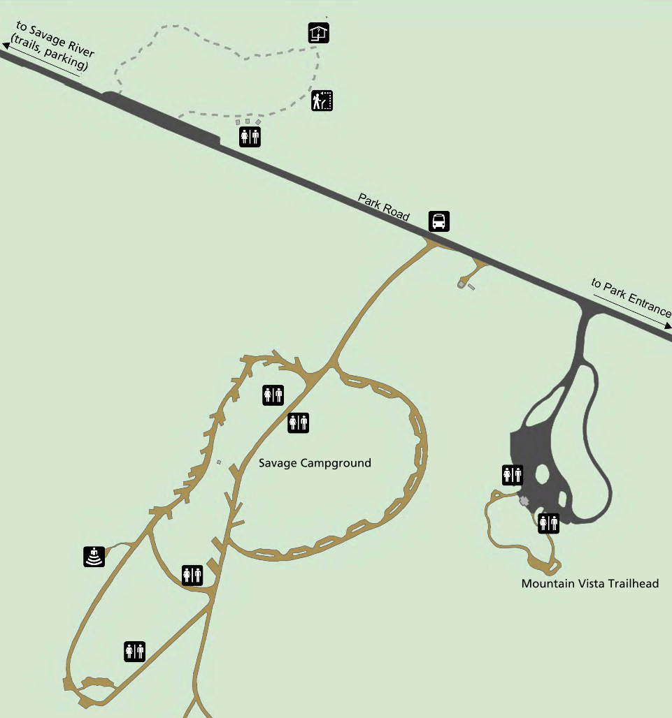
English: Savage River Campground map. This campground is located 13 miles west along the Park Road and has 33 campsites. This map also shows nearby trails and viewpoints. |
| Date | |
| Source | U.S. National Park Service (http://npmaps.com/wp-content/uploads/denali-savage-campground-map.gif) |
| Author | U.S. National Park Service, restoration/cleanup by Matt Holly |
Licensing edit
| This image or media file contains material based on a work of a National Park Service employee, created as part of that person's official duties. As a work of the U.S. federal government, such work is in the public domain in the United States. See the NPS website and NPS copyright policy for more information. |
File history
Click on a date/time to view the file as it appeared at that time.
| Date/Time | Thumbnail | Dimensions | User | Comment | |
|---|---|---|---|---|---|
| current | 21:04, 16 May 2017 | | 961 × 1,028 (191 KB) | RKBot (talk | contribs) | =={{int:filedesc}}== {{Information |description= {{en|1=Savage River Campground map. This campground is located 13 miles west along the Park Road and has 33 campsites. This map also shows nearby trails and viewpoints.}} |date= 2014-01-11 |source= U.S.... |
You cannot overwrite this file.
File usage on Commons
The following 3 pages use this file:
File usage on other wikis
The following other wikis use this file:
- Usage on www.wikidata.org