File:NPS glacier-goat-haunt-north-fork-trail-map.jpg

Size of this preview: 540 × 599 pixels. Other resolutions: 216 × 240 pixels | 432 × 480 pixels | 692 × 768 pixels | 922 × 1,024 pixels | 1,534 × 1,703 pixels.
Original file (1,534 × 1,703 pixels, file size: 384 KB, MIME type: image/jpeg)
Captions
Captions
Add a one-line explanation of what this file represents
Summary edit
| Description |
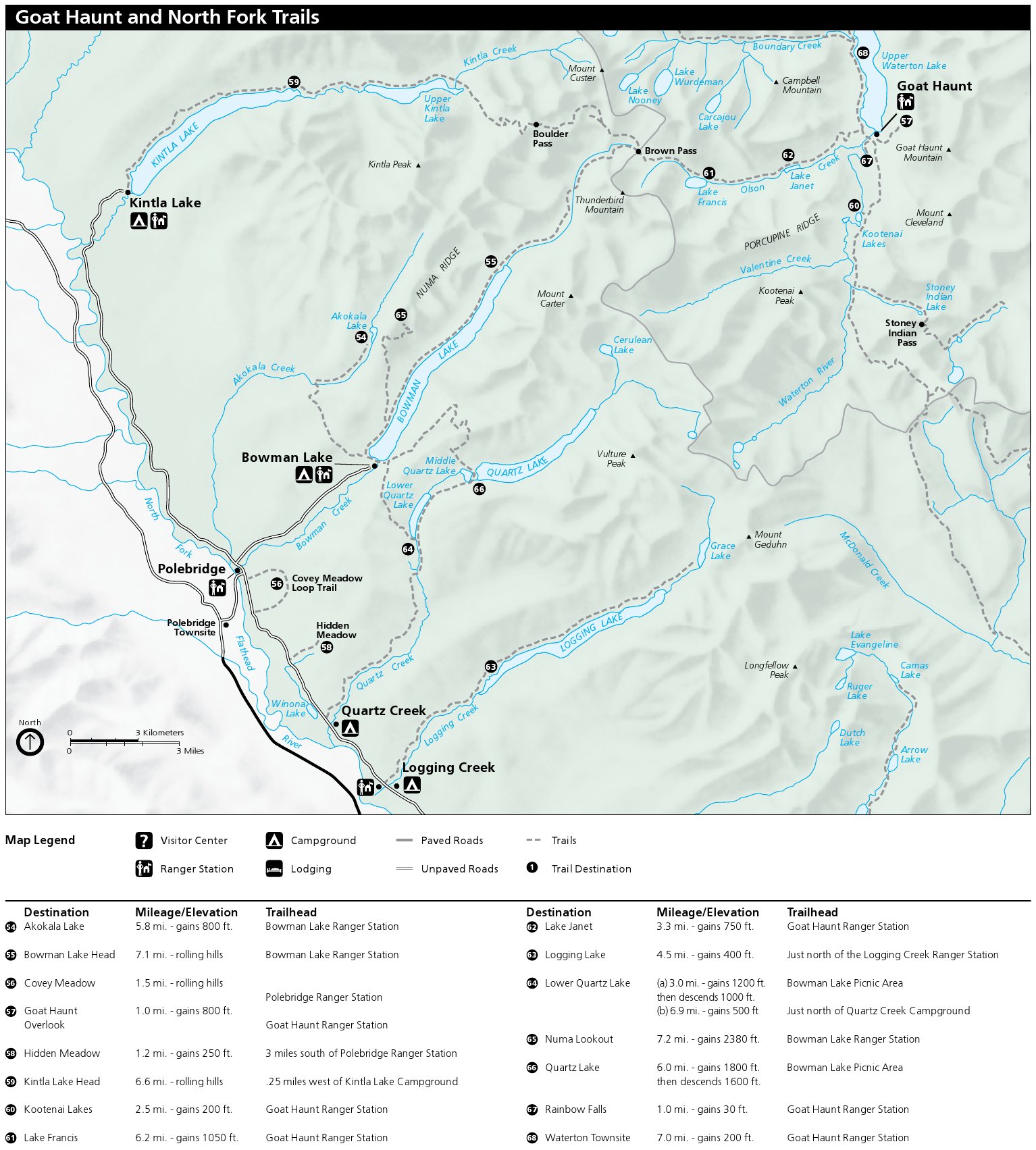
English: This North Fork trail map shows the remote, quiet northwest corner the park. It includes trails around Goat Haunt on the southern end of Upper Waterton Lake and trailheads at Kintla and Bowman lakes. |
| Date | |
| Source | U.S. National Park Service (http://npmaps.com/wp-content/uploads/glacier-goat-haunt-north-fork-trail-map.jpg) |
| Author | U.S. National Park Service, restoration/cleanup by Matt Holly |
Licensing edit
| This image or media file contains material based on a work of a National Park Service employee, created as part of that person's official duties. As a work of the U.S. federal government, such work is in the public domain in the United States. See the NPS website and NPS copyright policy for more information. |
File history
Click on a date/time to view the file as it appeared at that time.
| Date/Time | Thumbnail | Dimensions | User | Comment | |
|---|---|---|---|---|---|
| current | 21:41, 16 May 2017 | | 1,534 × 1,703 (384 KB) | RKBot (talk | contribs) | =={{int:filedesc}}== {{Information |description= {{en|1=This North Fork trail map shows the remote, quiet northwest corner the park. It includes trails around Goat Haunt on the southern end of Upper Waterton Lake and trailheads at Kintla and Bowman lak... |
You cannot overwrite this file.
File usage on Commons
There are no pages that use this file.