File:NPS mount-rainier-paradise-winter-trails-map.gif

Size of this preview: 364 × 599 pixels. Other resolutions: 146 × 240 pixels | 291 × 480 pixels | 466 × 768 pixels | 622 × 1,024 pixels | 1,487 × 2,449 pixels.
Original file (1,487 × 2,449 pixels, file size: 575 KB, MIME type: image/gif, 0.1 s)
Captions
Captions
Add a one-line explanation of what this file represents
Summary edit
| Description |
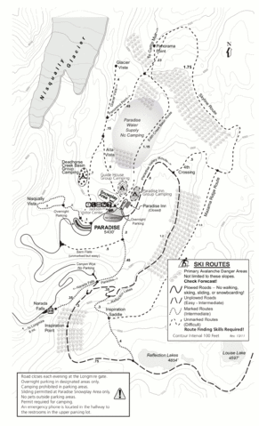
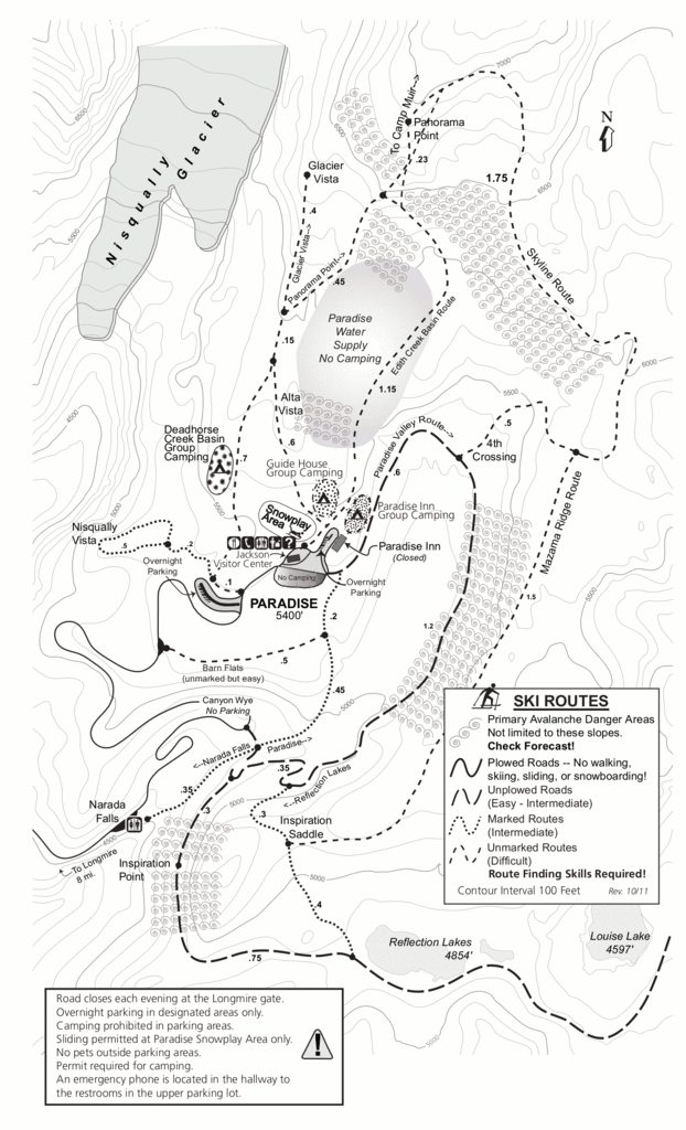
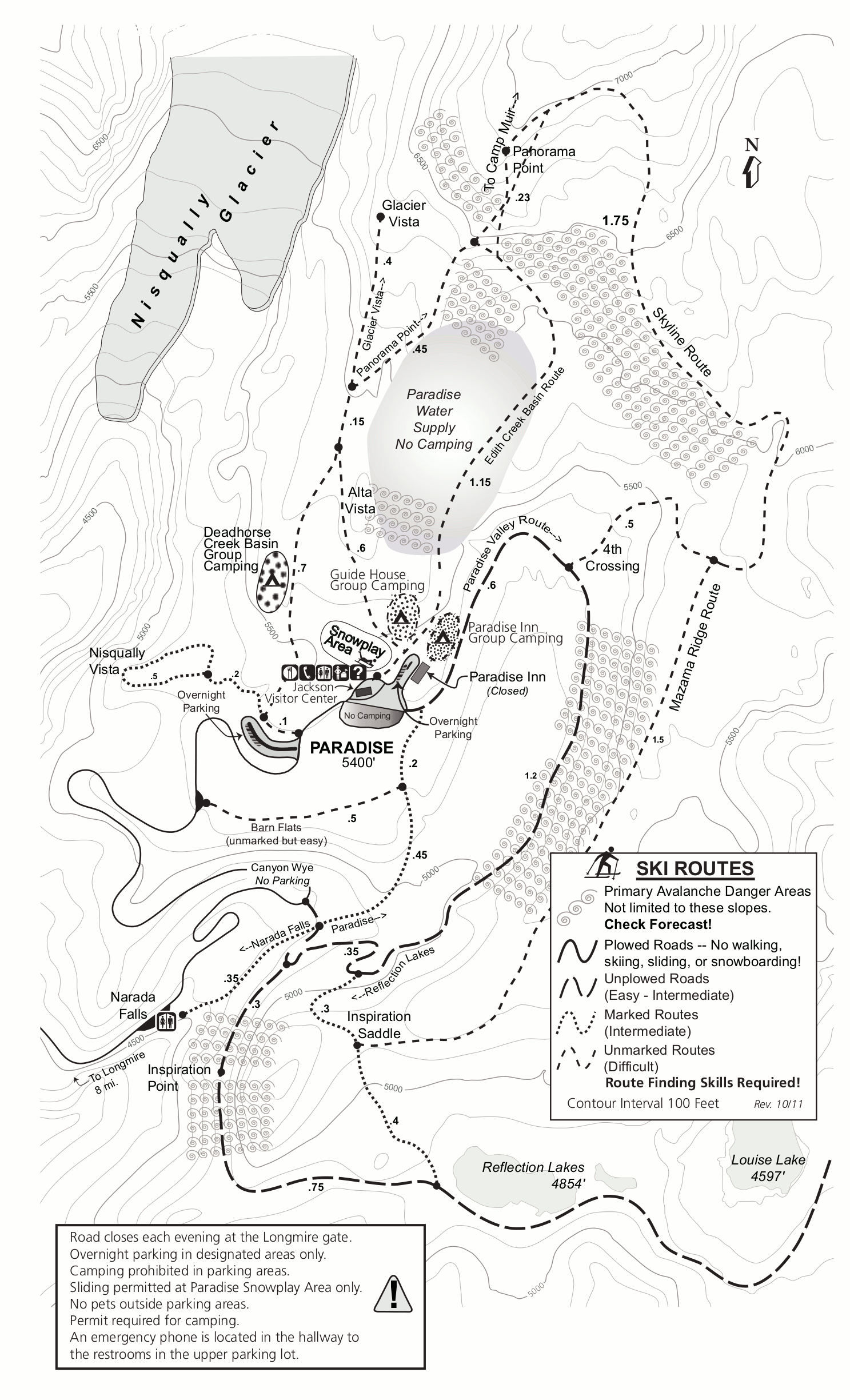
English: Paradise winter trail map, showing the snowplay area, popular ski and snowshoe routes, avalanche danger zones, and snow camping areas near the Jackson Visitor Center. |
| Date | |
| Source | U.S. National Park Service (http://npmaps.com/wp-content/uploads/mount-rainier-paradise-winter-trails-map.gif) |
| Author | U.S. National Park Service, restoration/cleanup by Matt Holly |
Licensing edit
| This image or media file contains material based on a work of a National Park Service employee, created as part of that person's official duties. As a work of the U.S. federal government, such work is in the public domain in the United States. See the NPS website and NPS copyright policy for more information. |
File history
Click on a date/time to view the file as it appeared at that time.
| Date/Time | Thumbnail | Dimensions | User | Comment | |
|---|---|---|---|---|---|
| current | 01:07, 17 May 2017 | | 1,487 × 2,449 (575 KB) | RKBot (talk | contribs) | =={{int:filedesc}}== {{Information |description= {{en|1=Paradise winter trail map, showing the snowplay area, popular ski and snowshoe routes, avalanche danger zones, and snow camping areas near the Jackson Visitor Center.}} |date= 2013-11-05 |source=... |
You cannot overwrite this file.
File usage on Commons
The following page uses this file: