File:NSW & QLD bushfire on Dec 9, 2019.jpg
Size of this preview: 576 × 600 pixels. Other resolutions: 230 × 240 pixels | 461 × 480 pixels | 720 × 750 pixels.
Original file (720 × 750 pixels, file size: 431 KB, MIME type: image/jpeg)
Captions
Captions
Add a one-line explanation of what this file represents
Summary edit
| Description |
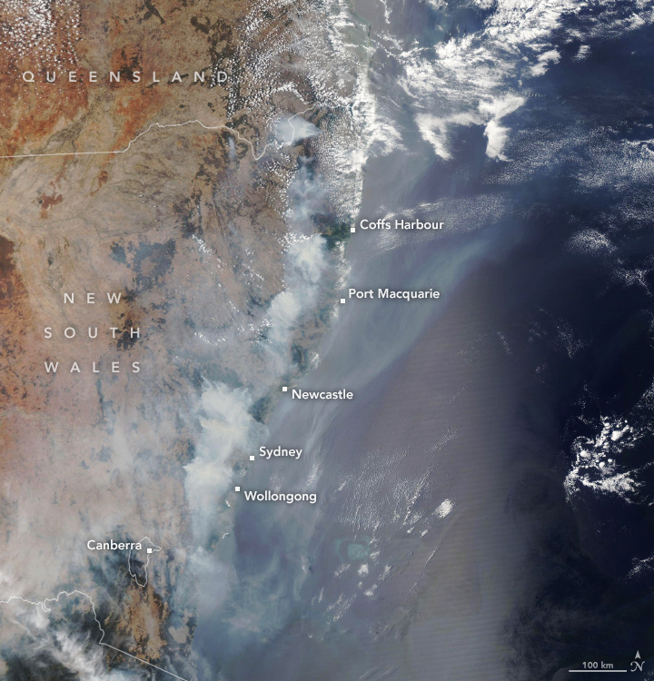
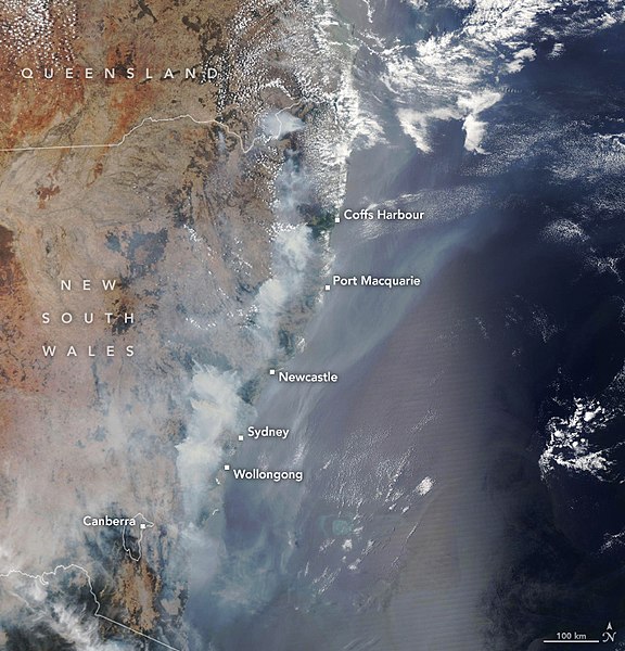
English: The fires have been particularly damaging to eucalypt forests and woodlands, which thrive in areas of relatively dry and nutrient-poor soil. These forests are prone to big outbreaks of fire because many of the trees species have oil-rich foliage that is extremely flammable. The map above, based on data from Australia’s Department of Agriculture, shows the range of eucalypt forests. Red dots show the locations of fires as detected by the Visible Infrared Imaging Radiometer Suite (VIIRS) on the Suomi NPP satellite between November 1 and December 5, 2019. The natural-color image was acquired by the Moderate Resolution Imaging Spectroradiometer (MODIS) on NASA’s Aqua satellite on December 9, 2019. |
| Date | |
| Source | https://earthobservatory.nasa.gov/images/145998/fires-take-a-toll-on-australian-forests |
| Author | NASA Earth Observatory |
Licensing edit
| This file is in the public domain in the United States because it was solely created by NASA. NASA copyright policy states that "NASA material is not protected by copyright unless noted". (See Template:PD-USGov, NASA copyright policy page or JPL Image Use Policy.) | ||
 |
Warnings:
|
File history
Click on a date/time to view the file as it appeared at that time.
| Date/Time | Thumbnail | Dimensions | User | Comment | |
|---|---|---|---|---|---|
| current | 07:50, 8 January 2020 | | 720 × 750 (431 KB) | A1Cafel (talk | contribs) | User created page with UploadWizard |
You cannot overwrite this file.
File usage on Commons
The following page uses this file: