File:NTD - FAA airport diagram.gif
Size of this preview: 390 × 599 pixels. Other resolutions: 156 × 240 pixels | 313 × 480 pixels | 806 × 1,237 pixels.
Original file (806 × 1,237 pixels, file size: 30 KB, MIME type: image/gif)
Captions
Captions
Add a one-line explanation of what this file represents
Summary edit
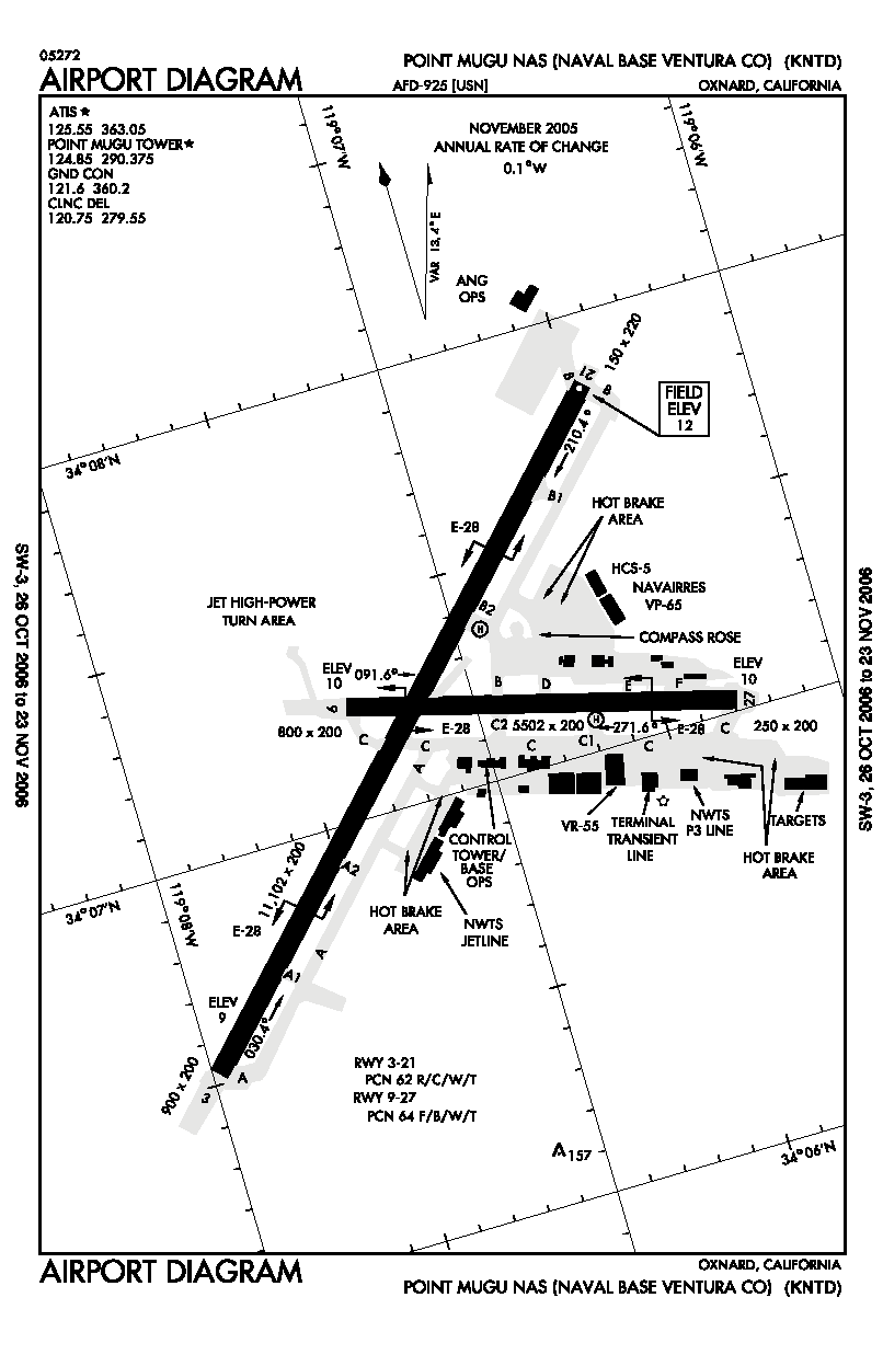
| Description | FAA airport diagram for NTD (NAS Point Mugu) in California, United States. |
| Date | Unknown date. Effective: 26 October 2006 - 23 November 2006 |
| Source | http://www.naco.faa.gov/index.asp?xml=naco/online/d_tpp |
| Author | United States Federal Aviation Administration |
| Permission (Reusing this file) |
Public Domain |
Licensing edit
This image or file is a work of a Federal Aviation Administration employee, taken or made as part of that person's official duties. As a work of the U.S. federal government, the image is in the public domain in the United States.
|
 |
File history
Click on a date/time to view the file as it appeared at that time.
| Date/Time | Thumbnail | Dimensions | User | Comment | |
|---|---|---|---|---|---|
| current | 05:49, 18 October 2006 | | 806 × 1,237 (30 KB) | Thadius856 (talk | contribs) | FAA airport diagram for NTD (NAS Point Mugu) in California, United States. {{PD-USGov-FAA}} Category:Airports in the United States |
You cannot overwrite this file.
File usage on Commons
The following page uses this file:
File usage on other wikis
The following other wikis use this file:
- Usage on de.wikipedia.org
- Usage on fa.wikipedia.org
- Usage on tg.wikipedia.org
- Usage on ur.wikipedia.org
- Usage on www.wikidata.org