File:NYC Macombs Dam Bridge.jpg

Size of this preview: 800 × 600 pixels. Other resolutions: 320 × 240 pixels | 640 × 480 pixels | 1,024 × 768 pixels | 1,280 × 960 pixels | 2,560 × 1,920 pixels | 3,168 × 2,376 pixels.
Original file (3,168 × 2,376 pixels, file size: 2.52 MB, MIME type: image/jpeg)
Captions
Captions
Add a one-line explanation of what this file represents
Summary edit
| Camera location | | View this and other nearby images on: OpenStreetMap |
|---|
| Description |
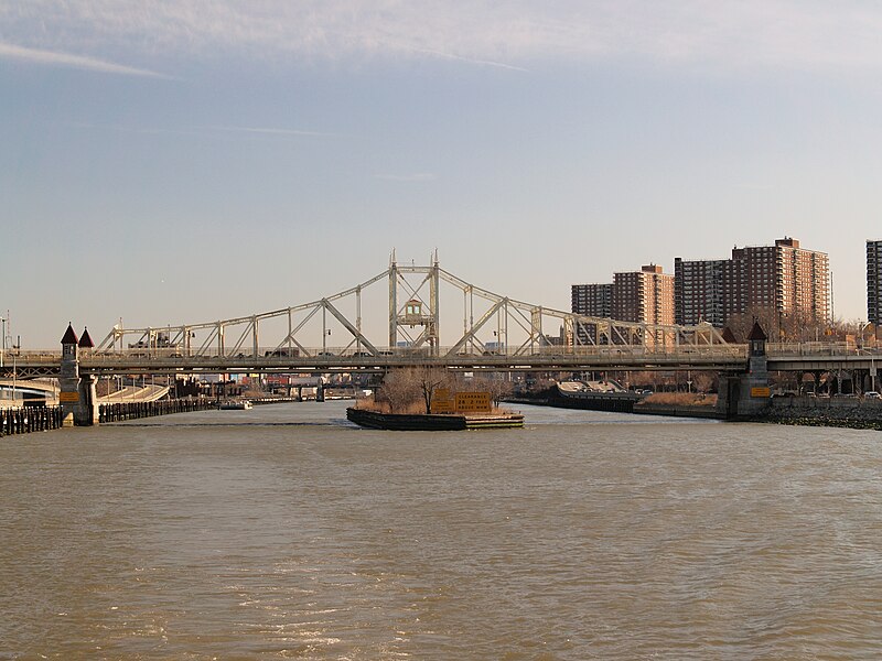
Deutsch: Die Macombs Dam Bridge, die die New Yorker Stadtteile Manhattan und Bronx über den Harlem River verbindet, gesehen von Norden English: Macombs Dam Bridge, connecting Manhattan and Bronx in New York City, seen from N. |
| Date | |
| Source | Own work |
| Author | Arnoldius |
Licensing edit
I, the copyright holder of this work, hereby publish it under the following license:
This file is licensed under the Creative Commons Attribution-Share Alike 3.0 Unported license.
- You are free:
- to share – to copy, distribute and transmit the work
- to remix – to adapt the work
- Under the following conditions:
- attribution – You must give appropriate credit, provide a link to the license, and indicate if changes were made. You may do so in any reasonable manner, but not in any way that suggests the licensor endorses you or your use.
- share alike – If you remix, transform, or build upon the material, you must distribute your contributions under the same or compatible license as the original.
File history
Click on a date/time to view the file as it appeared at that time.
| Date/Time | Thumbnail | Dimensions | User | Comment | |
|---|---|---|---|---|---|
| current | 20:06, 11 February 2013 | | 3,168 × 2,376 (2.52 MB) | Arnoldius (talk | contribs) | == {{int:filedesc}} == {{Location dec|40.830396|-73.93389|heading:S}} {{Information |Description={{de|Die Macombs Dam Bridge, die die New Yorker Stadtteile Manhattan und Bronx über den Harlem River verbindet, gesehen von Norden}} {{en|Macombs Dam Brid... |
You cannot overwrite this file.
File usage on Commons
The following page uses this file:
File usage on other wikis
The following other wikis use this file:
- Usage on de.wikipedia.org