File:National Geographic Map of Indian Subcontinent.jpg
Size of this preview: 727 × 600 pixels. Other resolutions: 291 × 240 pixels | 582 × 480 pixels | 931 × 768 pixels | 1,241 × 1,024 pixels | 2,060 × 1,700 pixels.
Original file (2,060 × 1,700 pixels, file size: 1.1 MB, MIME type: image/jpeg)
Captions
Captions
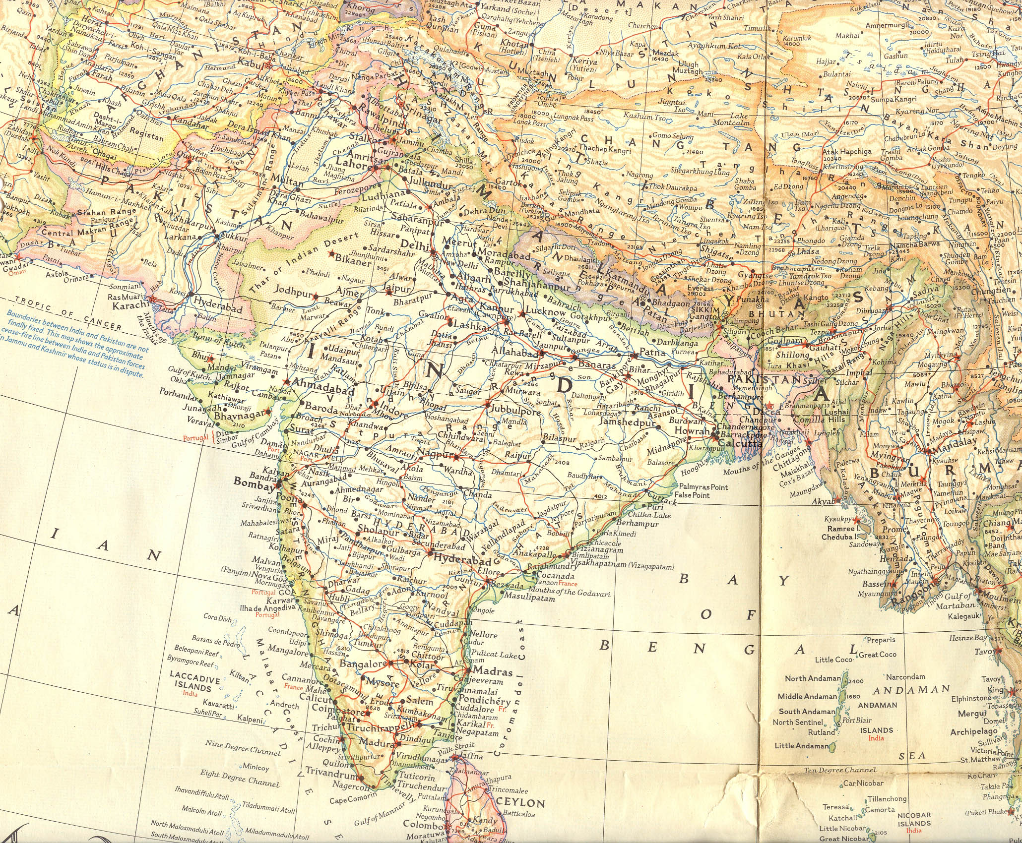
National Geographic Map of Indian Subcontinent

|
This map image could be re-created using vector graphics as an SVG file. This has several advantages; see Commons:Media for cleanup for more information. If an SVG form of this image is available, please upload it and afterwards replace this template with
{{vector version available|new image name}}.
It is recommended to name the SVG file “National Geographic Map of Indian Subcontinent.svg”—then the template Vector version available (or Vva) does not need the new image name parameter. |

Summary edit
| Description |
English: In March 1951, the editors of this National Geographic map are still warning their readers about possible boundary changes, especially in Kashmir. |
| Date | |
| Source | Bought on eBay |
| Author | Editors of this National Geographic map |
Licensing edit

|
Permission is granted to copy, distribute and/or modify this document under the terms of the GNU Free Documentation License, Version 1.2 or any later version published by the Free Software Foundation; with no Invariant Sections, no Front-Cover Texts, and no Back-Cover Texts. A copy of the license is included in the section entitled GNU Free Documentation License. |
If this file is eligible for relicensing, it may also be used under the Creative Commons Attribution-ShareAlike 3.0 license. The relicensing status of this image has not yet been reviewed. You can help.
|
File history
Click on a date/time to view the file as it appeared at that time.
| Date/Time | Thumbnail | Dimensions | User | Comment | |
|---|---|---|---|---|---|
| current | 16:42, 24 October 2020 | | 2,060 × 1,700 (1.1 MB) | Rnrctg (talk | contribs) | Uploaded a work by Editors of this National Geographic map from Bought on eBay with UploadWizard |
You cannot overwrite this file.
File usage on Commons
There are no pages that use this file.