File:Nesat 2017-07-29 0530Z.jpg

Size of this preview: 450 × 600 pixels. Other resolutions: 180 × 240 pixels | 360 × 480 pixels | 576 × 768 pixels | 768 × 1,024 pixels | 2,100 × 2,800 pixels.
Original file (2,100 × 2,800 pixels, file size: 1.8 MB, MIME type: image/jpeg)
Captions
Captions
Add a one-line explanation of what this file represents
Summary
edit
| Description |
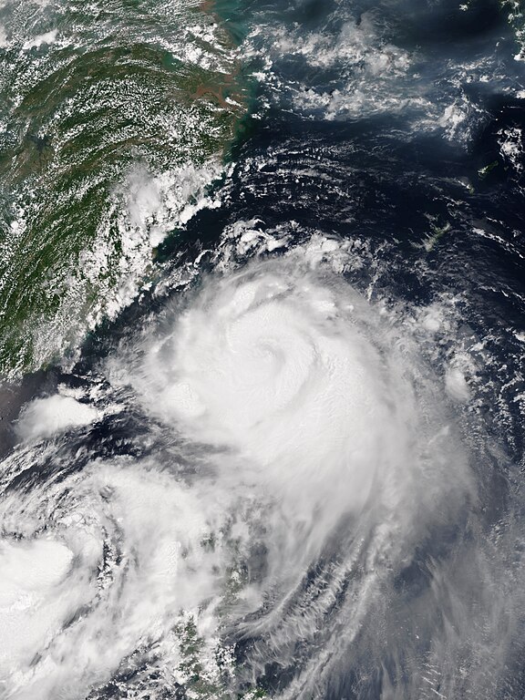
English: Typhoon Nesat approaching Taiwan at peak intensity on July 29, 2017. |
| Date | |
| Source | NOAA View Global Data Explorer |
| Author | VIIRS image captured by NASA’s Suomi NPP satellite |
| Camera location | | View this and other nearby images on: OpenStreetMap |
|---|
Licensing
edit
| This file is in the public domain in the United States because it was solely created by NASA. NASA copyright policy states that "NASA material is not protected by copyright unless noted". (See Template:PD-USGov, NASA copyright policy page or JPL Image Use Policy.) | ||
 |
Warnings:
|
File history
Click on a date/time to view the file as it appeared at that time.
| Date/Time | Thumbnail | Dimensions | User | Comment | |
|---|---|---|---|---|---|
| current | 10:16, 15 September 2023 | | 2,100 × 2,800 (1.8 MB) | Nino Marakot (talk | contribs) | Reverted to version as of 07:31, 31 July 2017 (UTC) |
| 01:00, 9 February 2018 |  | 4,808 × 6,272 (4.57 MB) | A1Cafel (talk | contribs) | 375m | |
| 07:45, 31 July 2017 |  | 2,100 × 2,800 (1.39 MB) | ChocolateTrain (talk | contribs) | Very minor improvements (colour enhancement and clarity), but aspect ratio and zoom identical | |
| 07:31, 31 July 2017 |  | 2,100 × 2,800 (1.8 MB) | Meow (talk | contribs) | User created page with UploadWizard |
You cannot overwrite this file.
File usage on Commons
The following 2 pages use this file:
File usage on other wikis
The following other wikis use this file:
- Usage on en.wikipedia.org
- Usage on ja.wikipedia.org
- Usage on ru.wikipedia.org
- Usage on th.wikipedia.org
- Usage on tl.wikipedia.org
- Usage on vi.wikipedia.org
- Usage on zh.wikipedia.org