File:Nevado del Ruiz - radar image from space.jpg
Size of this preview: 800 × 600 pixels. Other resolutions: 320 × 240 pixels | 640 × 480 pixels | 1,024 × 768 pixels | 1,280 × 960 pixels | 1,886 × 1,414 pixels.
Original file (1,886 × 1,414 pixels, file size: 1.25 MB, MIME type: image/jpeg)
Captions
Captions
Add a one-line explanation of what this file represents
Summary
edit
| Description |
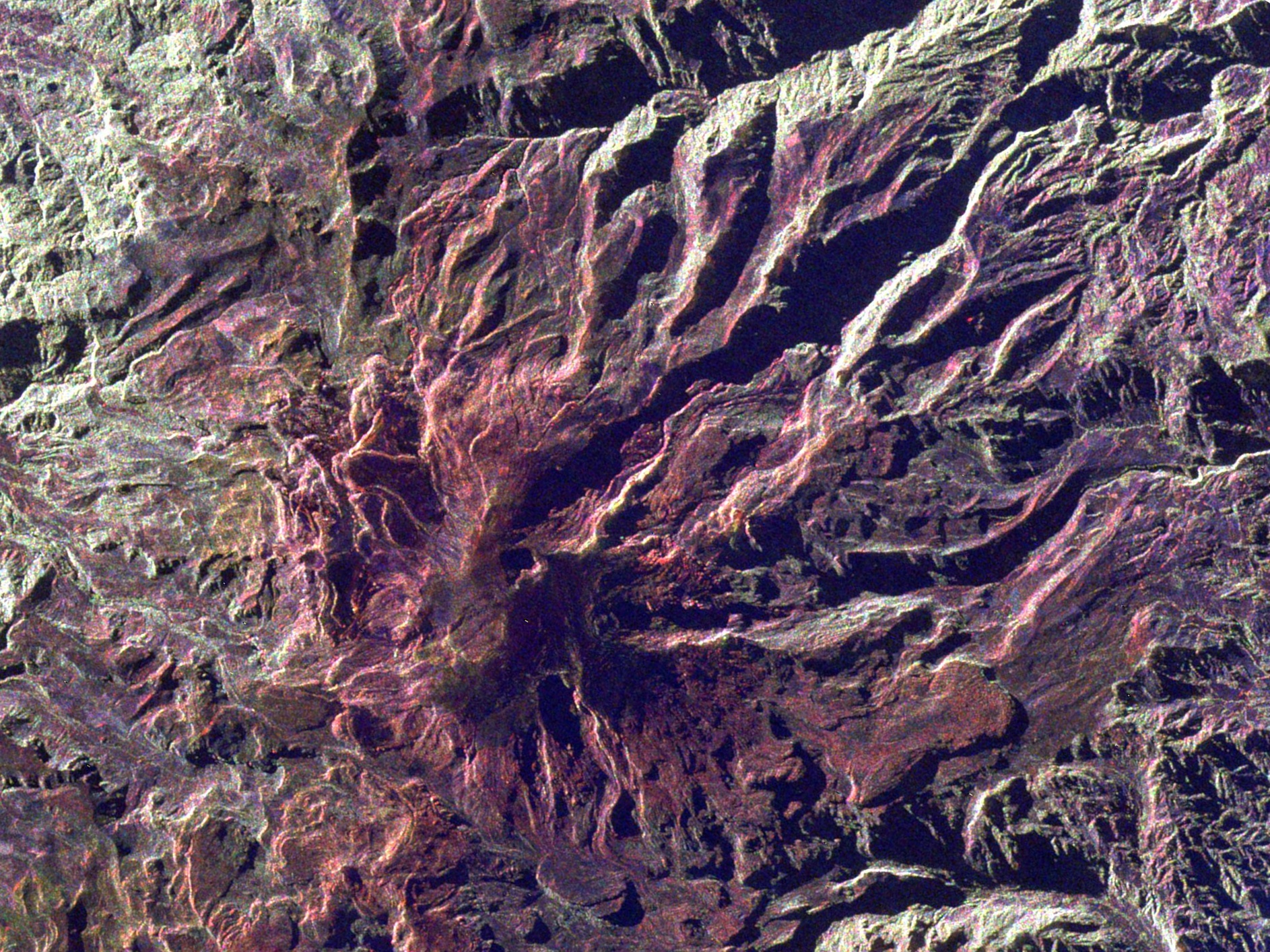
English: Radar image of Colombia's Nevado del Ruiz volcano from space. Arenas crater, which is 1 kilometre wide and 240 metre deep, is visible near the peak. An eruption from this crater in 1985 triggered lahars that killed 25,000 people.
See File:Ruiz volcano.jpg for full description. North is towards the top. |
| Date | |
| Source | http://photojournal.jpl.nasa.gov/catalog/PIA01827 ID PIA01827 |
| Author | NASA. |
| Other versions | This is a cropped and rotated version of File:Ruiz volcano.jpg - rotated so that north is at the top, and cropped to focus on Nevado del Ruiz. |
Licensing
edit
| This file is in the public domain in the United States because it was solely created by NASA. NASA copyright policy states that "NASA material is not protected by copyright unless noted". (See Template:PD-USGov, NASA copyright policy page or JPL Image Use Policy.) | ||
 |
Warnings:
|
File history
Click on a date/time to view the file as it appeared at that time.
| Date/Time | Thumbnail | Dimensions | User | Comment | |
|---|---|---|---|---|---|
| current | 02:54, 26 March 2009 | | 1,886 × 1,414 (1.25 MB) | Avenue (talk | contribs) | {{Information |Description={{en|1=Radar image of Nevado del Ruiz from space. See File:Ruiz volcano.jpg for full description. This file is rotated so north is at the top, and cropped to focus on Nevado del Ruiz.}} |Source=http:// |
You cannot overwrite this file.
File usage on Commons
There are no pages that use this file.
File usage on other wikis
The following other wikis use this file:
- Usage on ast.wikipedia.org
- Usage on ca.wikipedia.org
- Usage on es.wikipedia.org
- Usage on eu.wikipedia.org
- Usage on fr.wikipedia.org
- Usage on ga.wikipedia.org
- Usage on he.wikipedia.org
- Usage on it.wikipedia.org
- Usage on ka.wikipedia.org
- Usage on mk.wikipedia.org
- Usage on ru.wikipedia.org
- Usage on uk.wikipedia.org