File:Nfld regions map.png
Size of this preview: 419 × 599 pixels. Other resolutions: 168 × 240 pixels | 336 × 480 pixels | 537 × 768 pixels | 716 × 1,024 pixels | 1,800 × 2,574 pixels.
Original file (1,800 × 2,574 pixels, file size: 1.65 MB, MIME type: image/png)
Captions
Captions
Add a one-line explanation of what this file represents
Summary edit
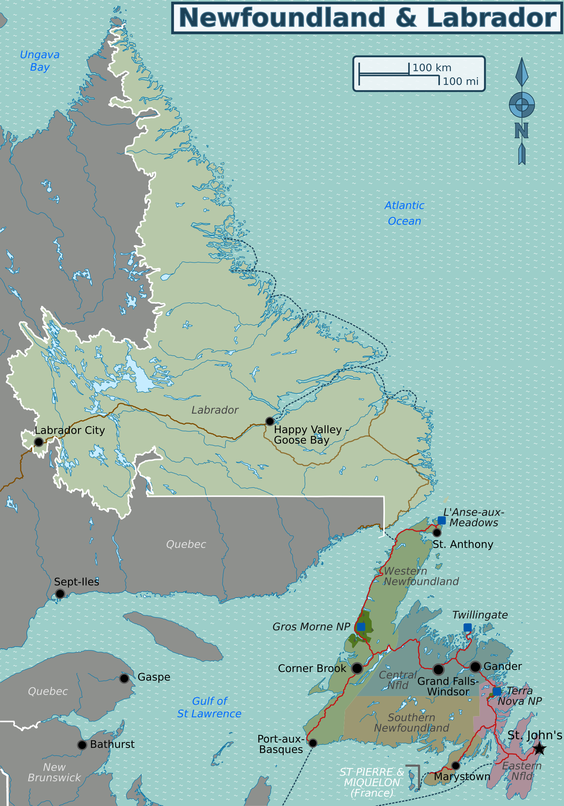
| Description | Map of Newfoundland and Labrador for use on Wikivoyage, English version |
| Date | (original), updated on 5 July 2015 |
| Source | Own work based on the location map by NordNordWest, and OpenStreetMap |
| Author | Shaundd |
| Other versions |
.png)
Licensing edit
This file is licensed under the Creative Commons Attribution-Share Alike 3.0 Unported license.
- You are free:
- to share – to copy, distribute and transmit the work
- to remix – to adapt the work
- Under the following conditions:
- attribution – You must give appropriate credit, provide a link to the license, and indicate if changes were made. You may do so in any reasonable manner, but not in any way that suggests the licensor endorses you or your use.
- share alike – If you remix, transform, or build upon the material, you must distribute your contributions under the same or compatible license as the original.
Original upload log edit
| This file was imported from Wikivoyage WTS. |
The original description page was here. All following user names refer to wts.wikivoyage-old.
- 2012-05-12 06:25 (WT-shared) Shaund archive copy at the Wayback Machine 1512×2162 (1070046 bytes) {{Imagecredit|credit=[[User:Shaund|Shaund]] and [http://commons.wikimedia.org/wiki/User:NordNordWest NordNordWest]|captureDate=11 May 12|loc (Import from wikitravel.org/shared)
File history
Click on a date/time to view the file as it appeared at that time.
| Date/Time | Thumbnail | Dimensions | User | Comment | |
|---|---|---|---|---|---|
| current | 04:55, 5 July 2015 | | 1,800 × 2,574 (1.65 MB) | Shaundd (talk | contribs) | update roads and ferry routes in Labrador, make scale more visible |
| 01:36, 18 November 2012 |  | 1,512 × 2,162 (1.02 MB) | MGA73bot2 (talk | contribs) | {{BotMoveToCommons|wts.oldwikivoyage|year={{subst:CURRENTYEAR}}|month={{subst:CURRENTMONTHNAME}}|day={{subst:CURRENTDAY}}}} == {{int:filedesc}} == {{Information |description=Map of Newfoundland and Labrador. Wikivoyage regions and major cities in Newfo... |
You cannot overwrite this file.
File usage on Commons
There are no pages that use this file.
File usage on other wikis
The following other wikis use this file:
- Usage on en.wikivoyage.org
- Usage on es.wikivoyage.org
- Usage on nl.wikivoyage.org