File:Niagara Square, Buffalo, NY - 52686136718.jpg
Size of this preview: 449 × 599 pixels. Other resolutions: 180 × 240 pixels | 360 × 480 pixels | 576 × 768 pixels | 768 × 1,024 pixels | 1,536 × 2,048 pixels | 2,924 × 3,899 pixels.
Original file (2,924 × 3,899 pixels, file size: 4.34 MB, MIME type: image/jpeg)
Captions
Captions
Add a one-line explanation of what this file represents
Summary edit
| Description |
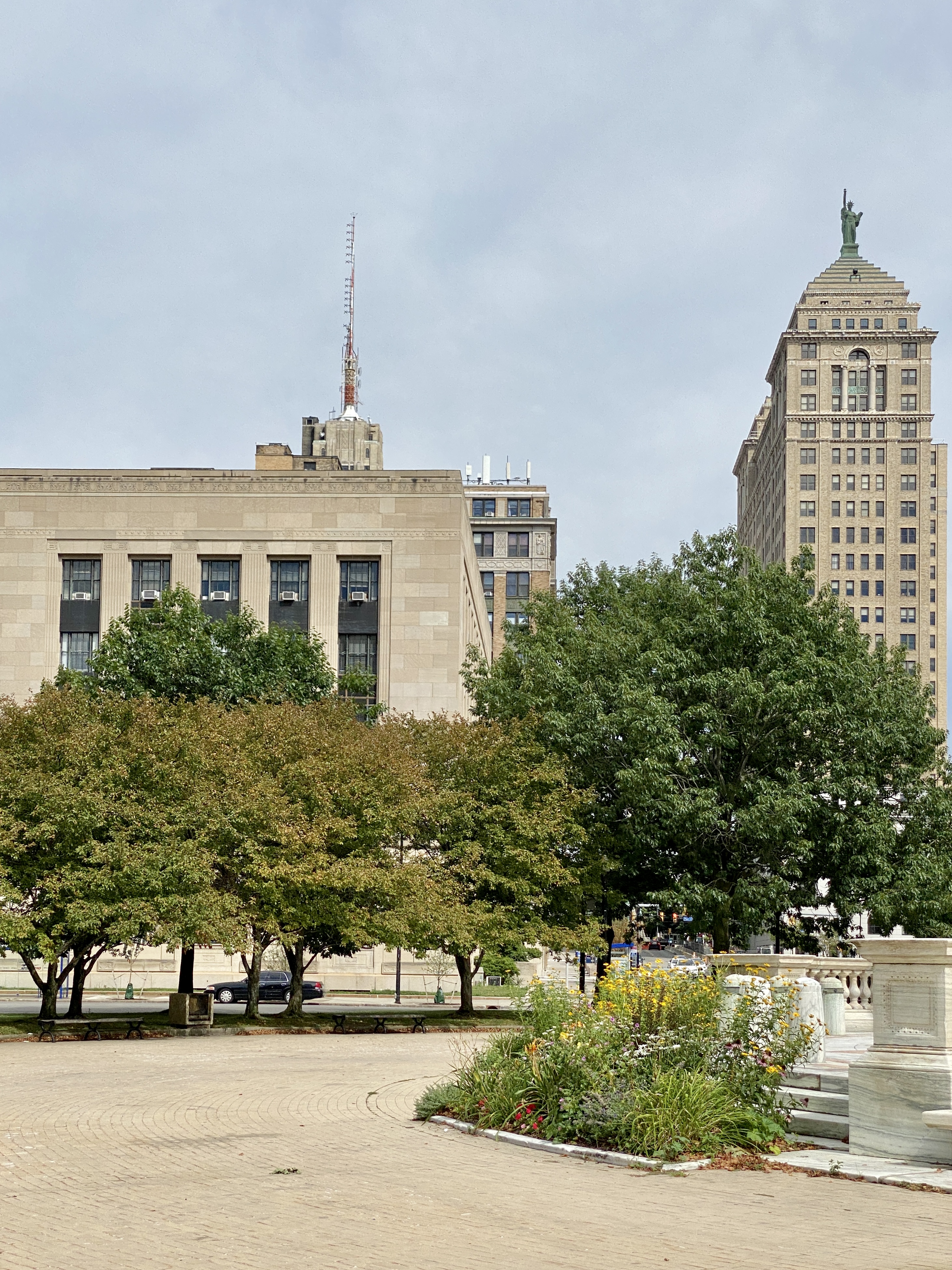
English: Created in 1805 by Joseph Ellicott, this public square sat at the central hub of the original radial street grid of the City of Buffalo, located at the junction of Niagara Street, Delaware Avenue, Genesee Street, and Court Street. Initially a fashionable residential area, the square became increasingly built up and commercialized in the early 20th Century, today being home to Buffalo City Hall, three federal buildings, the Athletic Club of Buffalo, former Statler Hotel, and the Buffalo City Court Building. The square is home to the William McKinley Monument, dedicated in memory of the president after his assassination at the Pan-American Exposition in Buffalo in 1901, which was designed by Carèrre and Hastings, and completed in 1907. The square originally was heavily connected to streets that continued well outside the downtown area, but urban renewal and redevelopment between the late 1920s and late 1970s has severed the connections along Court Street on the west side of the square with the construction of City Hall in 1929-1931, Genesee Street at the square and to the southwest of the square with the construction of the City Courts Building in 1974 and the construction of the Niagara Thruway five blocks from the square, severing its connection to the shore of Lake Erie, the interruption of Niagara Street two blocks from the square with the construction of the Main Place Tower and Mall and the Edward A. Rath County Office Building in the late 1960s, and the interruption of Genesee Street with the construction of the Buffalo-Niagara Convention Center in 1978 one block northeast of the square, and the construction of the atrium of the Hyatt Regency Hotel two blocks northeast of the square in 1981. As a result of these changes to the street grid and depopulation of the city in general during the latter part of the 20th Century, the square no longer is quite as busy as it once was, though it still serves as a major symbolic, political, and cultural center for Buffalo and the surrounding metropolitan region. |
| Date | |
| Source | https://www.flickr.com/photos/59081381@N03/52686136718/ |
| Author | w_lemay |
| Camera location | | View this and other nearby images on: OpenStreetMap |
|---|
Licensing edit
This file is licensed under the Creative Commons Attribution-Share Alike 2.0 Generic license.
- You are free:
- to share – to copy, distribute and transmit the work
- to remix – to adapt the work
- Under the following conditions:
- attribution – You must give appropriate credit, provide a link to the license, and indicate if changes were made. You may do so in any reasonable manner, but not in any way that suggests the licensor endorses you or your use.
- share alike – If you remix, transform, or build upon the material, you must distribute your contributions under the same or compatible license as the original.
| This image was originally posted to Flickr by w_lemay at https://flickr.com/photos/59081381@N03/52686136718. It was reviewed on 5 May 2023 by FlickreviewR 2 and was confirmed to be licensed under the terms of the cc-by-sa-2.0. |
File history
Click on a date/time to view the file as it appeared at that time.
| Date/Time | Thumbnail | Dimensions | User | Comment | |
|---|---|---|---|---|---|
| current | 16:06, 5 May 2023 | | 2,924 × 3,899 (4.34 MB) | Ɱ (talk | contribs) | Uploaded a work by w_lemay from https://www.flickr.com/photos/59081381@N03/52686136718/ with UploadWizard |
You cannot overwrite this file.
File usage on Commons
There are no pages that use this file.