File:Niegowa (gmina) location map.png

Original file (2,488 × 1,575 pixels, file size: 557 KB, MIME type: image/png)
Captions
Captions
Summary edit
_location_map.png&action=edit§ion=1)
| Description |
English: Location map |
| Date | |
| Source | Own work |
| Author | Smat |
| Description |
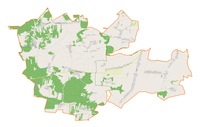
Polski: Mapa gminy Niegowa, Polska
English: Map of Niegowa (gmina), Poland |
|||||||||
| Date | ||||||||||
| Source | You may find a page on the OpenStreetMap wiki page for Niegowa (gmina) | |||||||||
| Creator |
OpenStreetMap contributors OpenStreetMap contributors |
|||||||||
| Permission (Reusing this file) |
OpenStreetMap data is available under the Open Database License (details). Map tiles are licensed under the Creative Commons Attribution-ShareAlike 2.0 license (CC-BY-SA 2.0).
This file is licensed under the Creative Commons Attribution-Share Alike 2.0 Generic license.
|
|||||||||
| Geotemporal data | ||||||||||
| Bounding box |
|
|||||||||
| Georeferencing | If inappropriate please set warp_status = skip to hide. | |||||||||
Licensing edit
_location_map.png&action=edit§ion=2)
| This work contains information from OpenStreetMap, which is made available under the Open Database License (ODbL).
The ODbL does not require any particular license for maps produced from ODbL data. Prior to 1 August 2020, map tiles produced by the OpenStreetMap Foundation were licensed under the CC-BY-SA-2.0 license. Maps produced by other people may be subject to other licences. |
File history
Click on a date/time to view the file as it appeared at that time.
| Date/Time | Thumbnail | Dimensions | User | Comment | |
|---|---|---|---|---|---|
| current | 12:44, 25 October 2018 | | 2,488 × 1,575 (557 KB) | Smat (talk | contribs) | User created page with UploadWizard |
You cannot overwrite this file.
File usage on Commons
There are no pages that use this file.
File usage on other wikis
The following other wikis use this file:
- Usage on pl.wikipedia.org
- Mirów (województwo śląskie)
- Zamek w Bobolicach
- Gorzków Nowy
- Gorzków Stary
- Łutowiec
- Mzurów
- Niegowa
- Niegówka
- Ogorzelnik
- Postaszowice
- Tomiszowice
- Trzebniów
- Antolka (województwo śląskie)
- Bliżyce (województwo śląskie)
- Bobolice (województwo śląskie)
- Dąbrowno (województwo śląskie)
- Ludwinów (powiat myszkowski)
- Moczydło (województwo śląskie)
- Sokolniki (województwo śląskie)
- Brzeziny (powiat myszkowski)
- Zagórze (powiat myszkowski)
- Jaskinia Wierna
- Zamek w Mirowie
- Parafia św. Mikołaja w Niegowej
- Parafia św. Jana Berchmansa w Gorzkowie-Trzebniowie
- Stajnia (jaskinia)
- Moduł:Mapa/dane/Niegowa (gmina)
- Parafia Najświętszego Serca Jezusa w Sokolnikach
- Kościół św. Mikołaja w Niegowej
- Tunelik w Kozubcu
- Schronisko Górne w Kozubcu
- Komin w Studnisku Mirowskim
- Schronisko Dolne w Górze Drugie
- Schronisko Wielkie w Górze
- Schronisko Małe w Górze Pierwsze
- Schronisko Małe w Górze Drugie
- Jaskinia Narożna
- Schronisko przy Jaskini Narożnej
- Ostrężnik (Trzebniów)
- Jaskinia Wiercica
- Usage on pl.wikibooks.org
_location_map.png&oldid=706463985)