File:NixesMate.JPG
Size of this preview: 800 × 600 pixels. Other resolutions: 320 × 240 pixels | 640 × 480 pixels | 1,024 × 768 pixels | 1,280 × 960 pixels | 2,592 × 1,944 pixels.
Original file (2,592 × 1,944 pixels, file size: 1.88 MB, MIME type: image/jpeg)
Captions
Captions
Add a one-line explanation of what this file represents
|
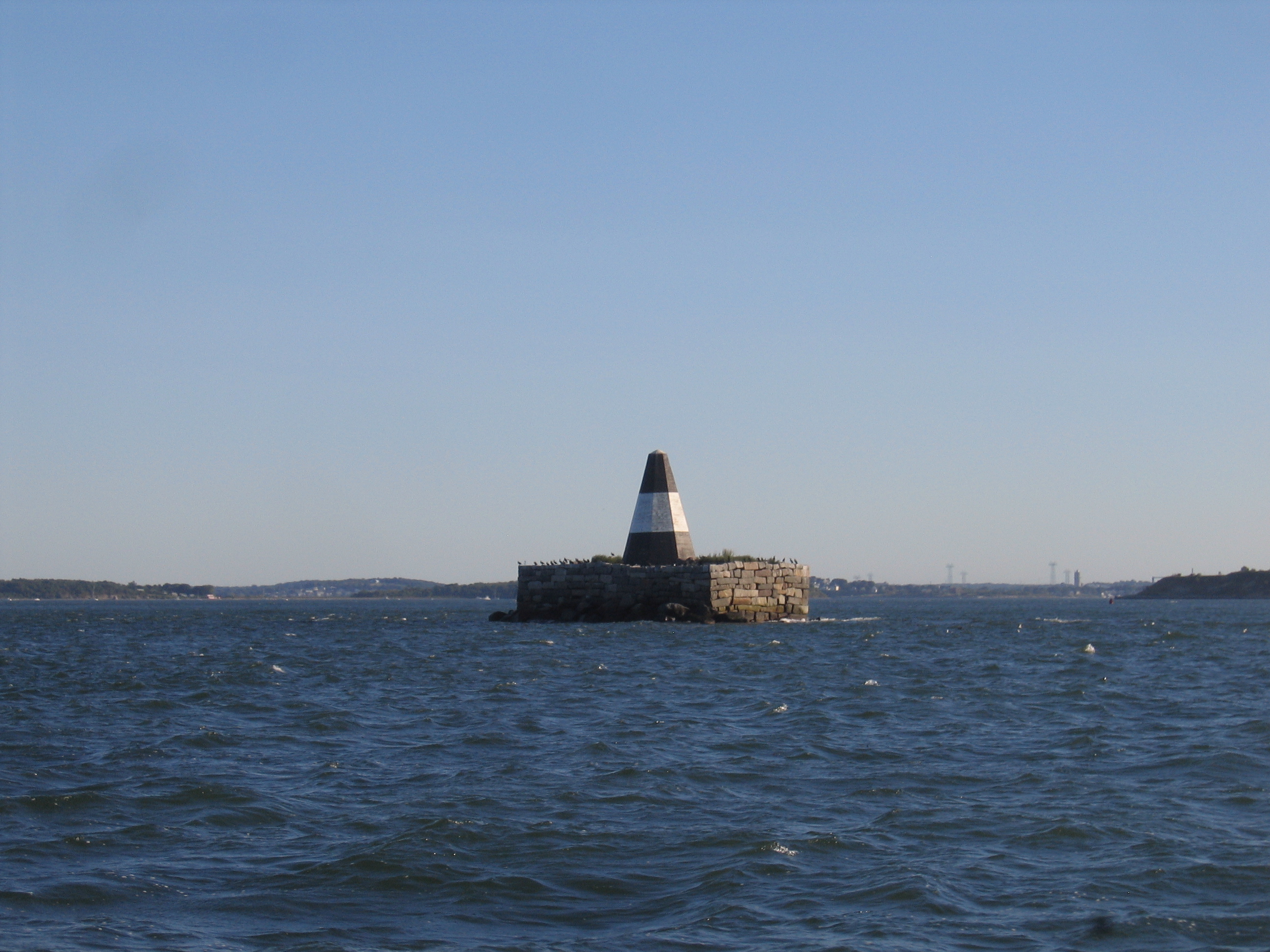
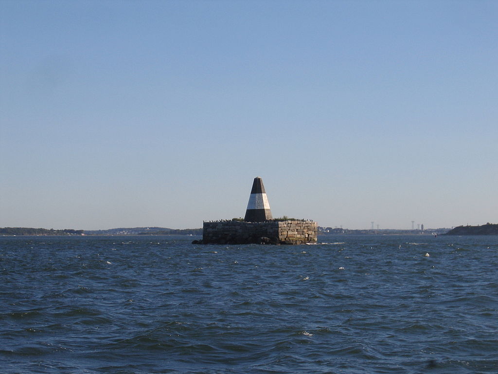
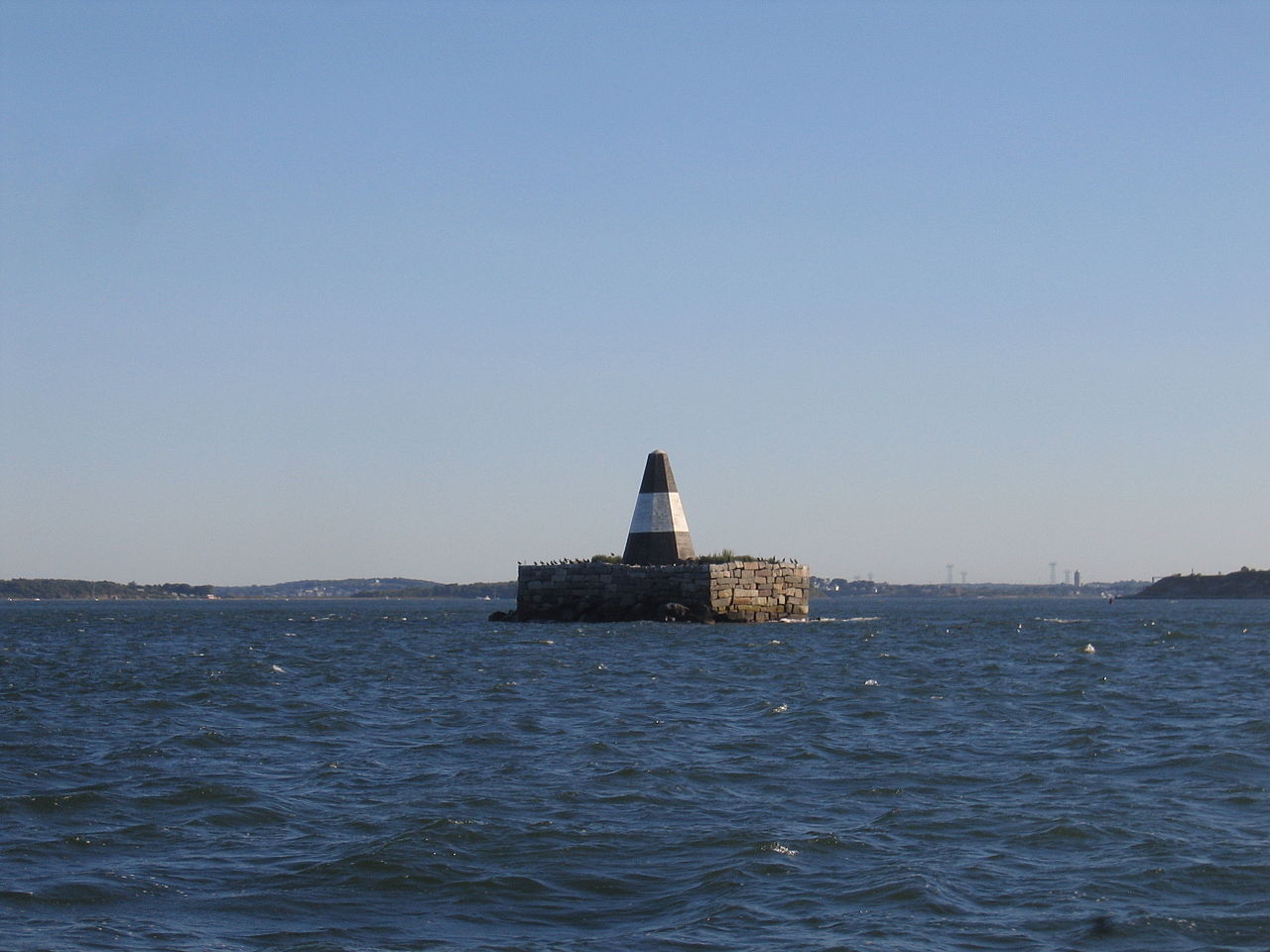
This is an image of a place or building that is listed on the National Register of Historic Places in the United States of America. Its reference number is 04000189. |
Summary edit
| Description |
Deutsch: Pyramiden-Bake auf Nixes Mate Island im Bostoner Hafen eine Stunde nach der Flut. Blickrichtung Südwest
English: Pyramid beacon on Nixes Mate Island in Boston Harbor an hour after high tide looking South-West |
| Date | |
| Source | Own work |
| Author | AndyWorth |
| Camera location | | View this and other nearby images on: OpenStreetMap |
|---|
Licensing edit
| I, the copyright holder of this work, release this work into the public domain. This applies worldwide. In some countries this may not be legally possible; if so: I grant anyone the right to use this work for any purpose, without any conditions, unless such conditions are required by law. |
File history
Click on a date/time to view the file as it appeared at that time.
| Date/Time | Thumbnail | Dimensions | User | Comment | |
|---|---|---|---|---|---|
| current | 04:02, 4 September 2007 | | 2,592 × 1,944 (1.88 MB) | AndyWorth~commonswiki (talk | contribs) | {{Information |Description=Pyramid beacon on Nixes Mate Island in Boston Harbor an hour after hight tide looking South-West |Source=self-made |Date=September 2, 2007 |Author= AndyWorth }} {{Location dec|42.33160|-70.94408}} |
You cannot overwrite this file.
File usage on Commons
The following page uses this file:
File usage on other wikis
The following other wikis use this file:
- Usage on ceb.wikipedia.org
- Usage on de.wikipedia.org
- Usage on en.wikipedia.org
- Usage on fr.wikipedia.org
- Usage on www.wikidata.org