File:North Dorset Trailway near Corfe Mullen - geograph.org.uk - 982339.jpg
No higher resolution available.
North_Dorset_Trailway_near_Corfe_Mullen_-_geograph.org.uk_-_982339.jpg (640 × 480 pixels, file size: 158 KB, MIME type: image/jpeg)
Captions
Captions
Add a one-line explanation of what this file represents
Summary edit
| Description |
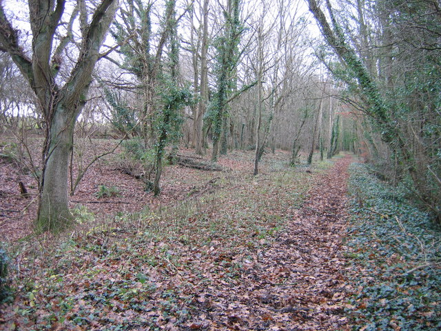
English: North Dorset Trailway near Corfe Mullen If you go down in the woods today, between the A31 Wimborne - Bere Regis road and Brog Street, about 500 metres east of Corfe Mullen parish church, you will find this dead straight leafy path. Between 1860 and 1932 it carried passenger trains between Blandford and Wimborne and rails survived on this stretch to serve a sand quarry until about 1970. Today it is part of the North Dorset Trailway, a walking, cycling and horse-riding route gradually being constructed by the local council along the line of the Somerset & Dorset Railway. In 1893 most trains by this route, which then extended north to Bath, were transferred to a new line, seen as an embankment behind the trees on the left, to avoid a reversal at Wimborne when heading to or from Poole and the then young seaside resort of Bournemouth. |
| Date | |
| Source | From geograph.org.uk |
| Author | A-M-Jervis |
| Attribution (required by the license) | A-M-Jervis / North Dorset Trailway near Corfe Mullen / |
| Camera location | | View this and other nearby images on: OpenStreetMap |
|---|
_heading:225.00&language=en)
| Object location | | View this and other nearby images on: OpenStreetMap |
|---|
_heading:225.00&language=en)
Licensing edit

|
This image was taken from the Geograph project collection. See this photograph's page on the Geograph website for the photographer's contact details. The copyright on this image is owned by A-M-Jervis and is licensed for reuse under the Creative Commons Attribution-ShareAlike 2.0 license.
|
This file is licensed under the Creative Commons Attribution-Share Alike 2.0 Generic license.
Attribution: A-M-Jervis
- You are free:
- to share – to copy, distribute and transmit the work
- to remix – to adapt the work
- Under the following conditions:
- attribution – You must give appropriate credit, provide a link to the license, and indicate if changes were made. You may do so in any reasonable manner, but not in any way that suggests the licensor endorses you or your use.
- share alike – If you remix, transform, or build upon the material, you must distribute your contributions under the same or compatible license as the original.
File history
Click on a date/time to view the file as it appeared at that time.
| Date/Time | Thumbnail | Dimensions | User | Comment | |
|---|---|---|---|---|---|
| current | 00:53, 23 February 2011 | | 640 × 480 (158 KB) | GeographBot (talk | contribs) | == {{int:filedesc}} == {{Information |description={{en|1=North Dorset Trailway near Corfe Mullen If you go down in the woods today, between the A31 Wimborne - Bere Regis road and Brog Street, about 500 metres east of Corfe Mullen parish church, you will f |
You cannot overwrite this file.
File usage on Commons
There are no pages that use this file.