File:North Korea locatormap.PNG
No higher resolution available.
North_Korea_locatormap.PNG (326 × 351 pixels, file size: 6 KB, MIME type: image/png)
Captions
Captions
Add a one-line explanation of what this file represents
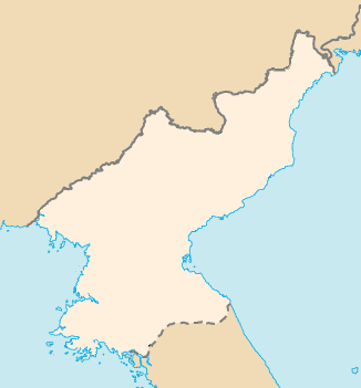
| Description | Map of territory claimed by North Korea without letter |
| Date | |
| Source | CIA WordFact book |
| Author | User:Obersachse |
| Other versions | Image:North Korea map-CIA (zh).png |
.png)
| This image is a work of a Central Intelligence Agency employee, taken or made as part of that person's official duties. As a Work of the United States Government, this image or media is in the public domain in the United States.
|

|
File history
Click on a date/time to view the file as it appeared at that time.
| Date/Time | Thumbnail | Dimensions | User | Comment | |
|---|---|---|---|---|---|
| current | 13:38, 27 March 2008 | | 326 × 351 (6 KB) | Obersachse (talk | contribs) | {{Information |Description=Map of North Korea without letter |Source=CIA WordFact book |Date=2008-03-27 |Author=User:Obersachse |Permission= |other_versions=Image:North Korea map-CIA (zh).png }} {{PD-USGov-CIA}} Category:Maps of North Korea |
You cannot overwrite this file.
File usage on Commons
There are no pages that use this file.