File:North Sandusky Street Historic District, Tiffin.jpg

Size of this preview: 800 × 600 pixels. Other resolutions: 320 × 240 pixels | 640 × 480 pixels | 1,024 × 768 pixels | 1,280 × 960 pixels | 2,560 × 1,920 pixels | 2,816 × 2,112 pixels.
Original file (2,816 × 2,112 pixels, file size: 1.9 MB, MIME type: image/jpeg)
Captions
Captions
Add a one-line explanation of what this file represents
|
This is an image of a place or building that is listed on the National Register of Historic Places in the United States of America. Its reference number is 80003224. |
| Camera location | | View this and other nearby images on: OpenStreetMap |
|---|
| Description |
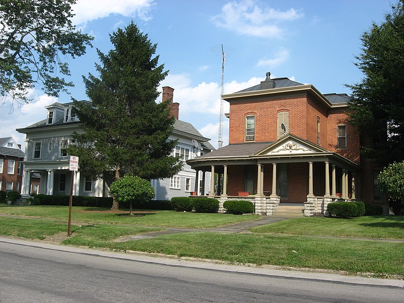
English: Houses on the eastern side of the first block of N. Sandusky Street (State Route 53) in Tiffin, Ohio, United States. These houses are part of the North Sandusky Street Historic District, a historic district that is listed on the National Register of Historic Places. |
||
| Date | Taken on 26 June 2010 | ||
| Source | Own work | ||
| Author | Nyttend | ||
| Permission (Reusing this file) |
|
File history
Click on a date/time to view the file as it appeared at that time.
| Date/Time | Thumbnail | Dimensions | User | Comment | |
|---|---|---|---|---|---|
| current | 13:23, 29 June 2010 | | 2,816 × 2,112 (1.9 MB) | Nyttend (talk | contribs) | {{Location|41|7|19.6|N|83|10|51|W}} {{Information |Description={{en|Houses on the eastern side of the first block of N. Sandusky Street ({{w|Ohio State Route 53|State Route 53}}) in {{w|Tiffin, Ohio|Tiffin}}, {{w|Ohio}}, {{w|United States}}. These house |
You cannot overwrite this file.
File usage on Commons
There are no pages that use this file.
File usage on other wikis
The following other wikis use this file:
- Usage on en.wikipedia.org