File:North pole of Venus.jpg

Size of this preview: 625 × 600 pixels. Other resolutions: 250 × 240 pixels | 500 × 480 pixels | 1,000 × 960 pixels.
Original file (1,000 × 960 pixels, file size: 1.09 MB, MIME type: image/jpeg)
Captions
Captions
Add a one-line explanation of what this file represents
Summary edit
| Description |
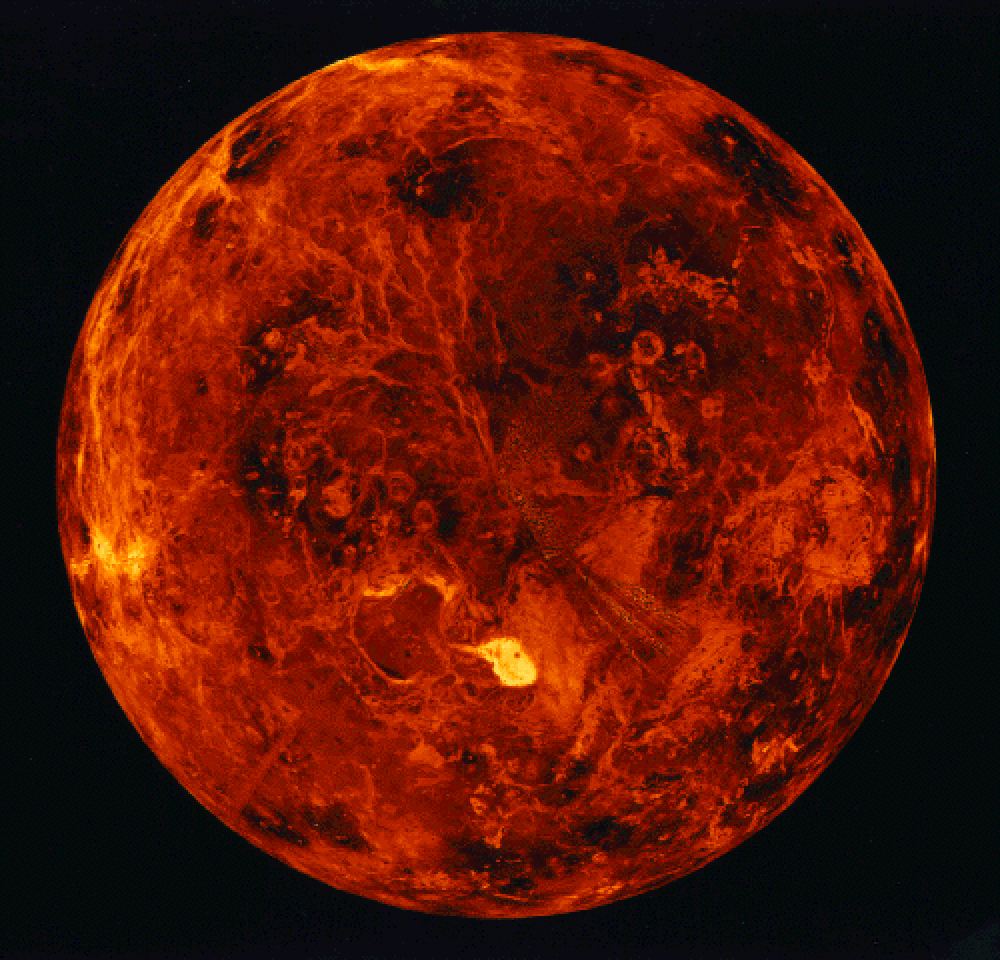
English: The Magellan probe that orbited Venus from 1990 to 1994 was able to peer through the thick Venusian clouds and build up the above image by emitting and re-detecting cloud-penetrating radar. Visible as the bright patch below central North is Venus' highest mountain Maxwell Montes. Other notable features include numerous mountains, coronas, impact craters, tessera, ridges, and lava flows. Although the size and mass of Venus are similar to the Earth, its thick carbon-dioxide atmosphere has trapped heat so efficiently that surface temperature usually exceeds 700 kelvins, hot enough to melt lead. |
| Date | between 1990 and 1994 |
| Source | http://img1.wikia.nocookie.net/__cb20140701041517/solarsystemtour/images/c/ce/North_pole_of_Venus.jpg |
| Author | NASA/JPL, SSV, MIPL (image processed by Jcpag2010) |
Licensing edit
| This file is in the public domain in the United States because it was solely created by NASA. NASA copyright policy states that "NASA material is not protected by copyright unless noted". (See Template:PD-USGov, NASA copyright policy page or JPL Image Use Policy.) | ||
 |
Warnings:
|
File history
Click on a date/time to view the file as it appeared at that time.
| Date/Time | Thumbnail | Dimensions | User | Comment | |
|---|---|---|---|---|---|
| current | 02:20, 3 July 2014 | | 1,000 × 960 (1.09 MB) | Jcpag2012 (talk | contribs) | {{Information |Description ={{en|1=The Magellan probe that orbited Venus from 1990 to 1994 was able to peer through the thick Venusian clouds and build up the above image by emitting and re-detecting cloud-penetrating radar. Visible as the bright pa... |
You cannot overwrite this file.
File usage on Commons
The following 2 pages use this file: