File:Northeast Blackout of 1965.svg

Size of this PNG preview of this SVG file: 498 × 600 pixels. Other resolutions: 199 × 240 pixels | 399 × 480 pixels | 638 × 768 pixels | 850 × 1,024 pixels | 1,701 × 2,048 pixels | 1,789 × 2,154 pixels.
Original file (SVG file, nominally 1,789 × 2,154 pixels, file size: 377 KB)
Captions
Captions
Add a one-line explanation of what this file represents
Summary edit
| Description |
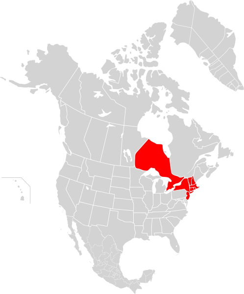
English: Map of states with areas affected by the Northeast Blackout of 1965 |
| Date | |
| Source | Own work |
| Author | 08OceanBeach SD |
This vector image includes elements that have been taken or adapted from this file:
Licensing edit
I, the copyright holder of this work, hereby publish it under the following license:
This file is licensed under the Creative Commons Attribution-Share Alike 3.0 Unported license.
- You are free:
- to share – to copy, distribute and transmit the work
- to remix – to adapt the work
- Under the following conditions:
- attribution – You must give appropriate credit, provide a link to the license, and indicate if changes were made. You may do so in any reasonable manner, but not in any way that suggests the licensor endorses you or your use.
- share alike – If you remix, transform, or build upon the material, you must distribute your contributions under the same or compatible license as the original.
File history
Click on a date/time to view the file as it appeared at that time.
| Date/Time | Thumbnail | Dimensions | User | Comment | |
|---|---|---|---|---|---|
| current | 17:58, 19 October 2012 | | 1,789 × 2,154 (377 KB) | Cwbm (commons) (talk | contribs) | real svg |
| 06:45, 19 September 2011 |  | 744 × 1,052 (774 KB) | 08OceanBeach SD (talk | contribs) |
You cannot overwrite this file.
File usage on Commons
The following page uses this file:
File usage on other wikis
The following other wikis use this file:
- Usage on de.wikipedia.org
- Usage on en.wikipedia.org
- Usage on eu.wikipedia.org
- Usage on fr.wikipedia.org
- Usage on pl.wikipedia.org
- Usage on pt.wikipedia.org
- Usage on www.wikidata.org
- Usage on zh.wikipedia.org