File:Northern Kentucky Downtown Transit Map.png

Size of this preview: 667 × 600 pixels. Other resolutions: 267 × 240 pixels | 534 × 480 pixels | 854 × 768 pixels | 1,138 × 1,024 pixels | 2,277 × 2,048 pixels | 4,000 × 3,598 pixels.
Original file (4,000 × 3,598 pixels, file size: 981 KB, MIME type: image/png)
Captions
Captions
Add a one-line explanation of what this file represents
Summary edit
| Description |
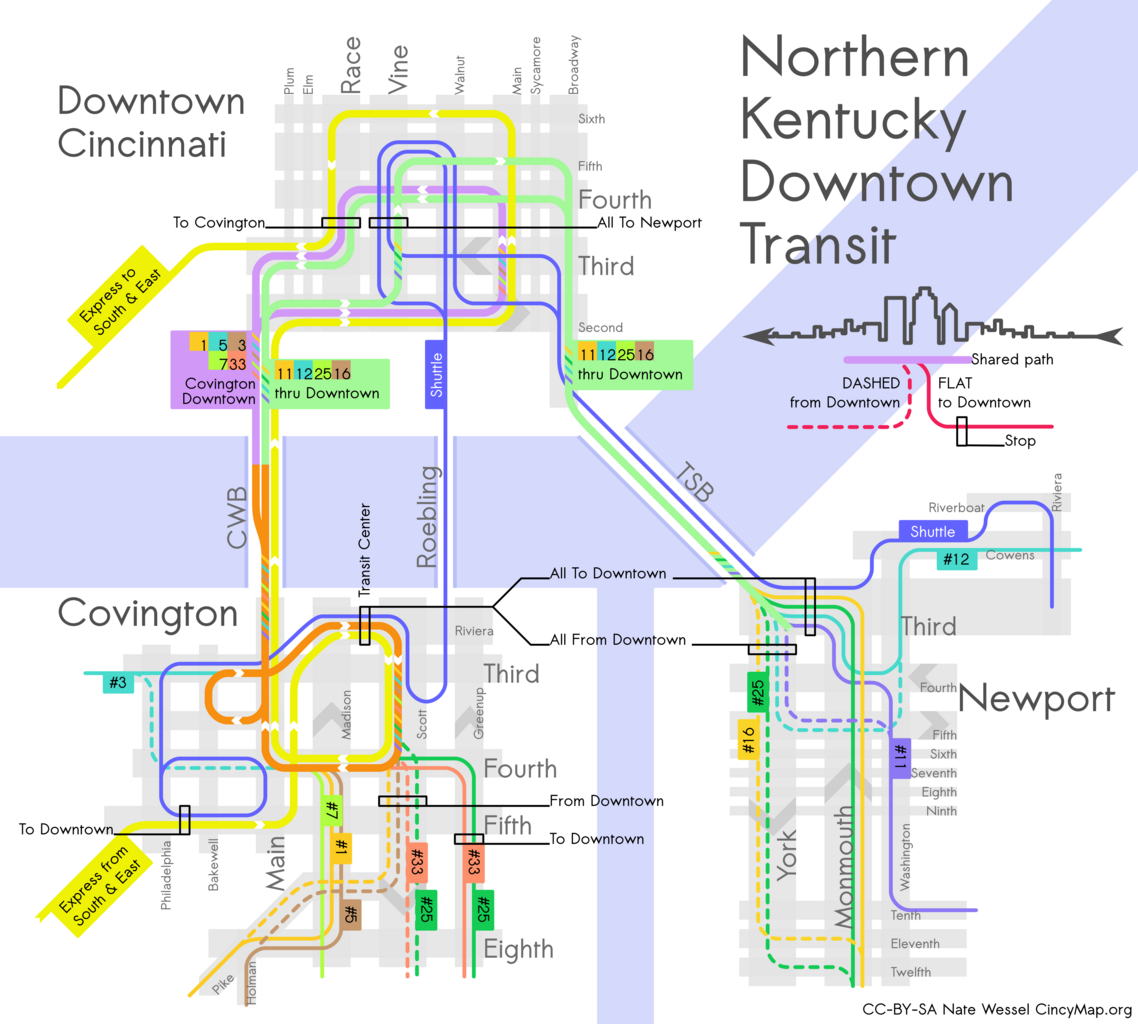
English: A topological map of Downtown Cincinnati, Newport, and Covington Kentucky showing transit routing through downtown and highlighting the most important stops and stations. |
| Date | |
| Source | Own work |
| Author | Nate Wessel |
| Camera location | | View this and other nearby images on: OpenStreetMap |
|---|
Licensing edit
I, the copyright holder of this work, hereby publish it under the following license:
This file is licensed under the Creative Commons Attribution-Share Alike 3.0 Unported license.
- You are free:
- to share – to copy, distribute and transmit the work
- to remix – to adapt the work
- Under the following conditions:
- attribution – You must give appropriate credit, provide a link to the license, and indicate if changes were made. You may do so in any reasonable manner, but not in any way that suggests the licensor endorses you or your use.
- share alike – If you remix, transform, or build upon the material, you must distribute your contributions under the same or compatible license as the original.
File history
Click on a date/time to view the file as it appeared at that time.
| Date/Time | Thumbnail | Dimensions | User | Comment | |
|---|---|---|---|---|---|
| current | 19:36, 10 December 2012 | | 4,000 × 3,598 (981 KB) | Nate Wessel (talk | contribs) | added attribution info |
| 20:14, 1 December 2012 |  | 4,000 × 3,598 (955 KB) | Nate Wessel (talk | contribs) | User created page with UploadWizard |
You cannot overwrite this file.
File usage on Commons
There are no pages that use this file.