File:Northwest Green Bay on April 10, 2022, L3 T16TDR 20220410T163839, Sentinel-2B MSI.png

Original file (10,980 × 10,980 pixels, file size: 136.3 MB, MIME type: image/png)
Captions
Captions
| Warning | The original file is very high-resolution. It might not load properly or could cause your browser to freeze when opened at full size. |
|---|
| Description |
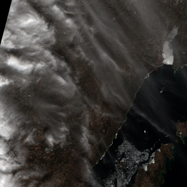
True color image taken April 10, 2022 with the Sentinel-2B satellite by the Copernicus Programme. The image includes the northwestern bay of Green Bay, Door County, and the w:Upper Peninsula of Michigan. The true color picture includes the following colors, which were combined from the following three files:
|
|||
| Date | ||||
| Source | from item L1C_T16TDR_A026607_20220410T164815, available from the EarthExplorer website as a .zip file; the IMG_DATA folder contains .jp2 files for various bands including bands 2, 3, and 4 which were combined with MultiSpec© and converted from the merged .tif file to .png with GIMP. For more about the bands, see Sentinel-2 § Spectral bands; some of the black was cropped | |||
| Author | Copernicus Programme | |||
| Permission (Reusing this file) |
|

File history
Click on a date/time to view the file as it appeared at that time.
| Date/Time | Thumbnail | Dimensions | User | Comment | |
|---|---|---|---|---|---|
| current | 10:16, 11 April 2022 | | 10,980 × 10,980 (136.3 MB) | Epiphyllumlover (talk | contribs) | c:User:Rillke/bigChunkedUpload.js: {{Information | Description = True color image taken April 10, 2022 with the Sentinel-2B satellite by the Copernicus Programme. The image includes the northwestern bay of Green Bay, Door County, and the w:Upper Peninsula of Michigan. The true color picture includes the following colors, which were combined from the following three files... |
You cannot overwrite this file.
File usage on Commons
There are no pages that use this file.