File:Norwalk 1847 Map, CT, 06854, USA.jpg

Size of this preview: 383 × 599 pixels. Other resolutions: 153 × 240 pixels | 307 × 480 pixels | 491 × 768 pixels | 654 × 1,024 pixels | 1,309 × 2,048 pixels | 3,016 × 4,718 pixels.
Original file (3,016 × 4,718 pixels, file size: 3.2 MB, MIME type: image/jpeg)
Captions
Captions
Add a one-line explanation of what this file represents
Summary edit
| Description |
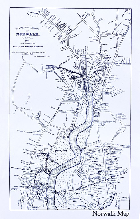
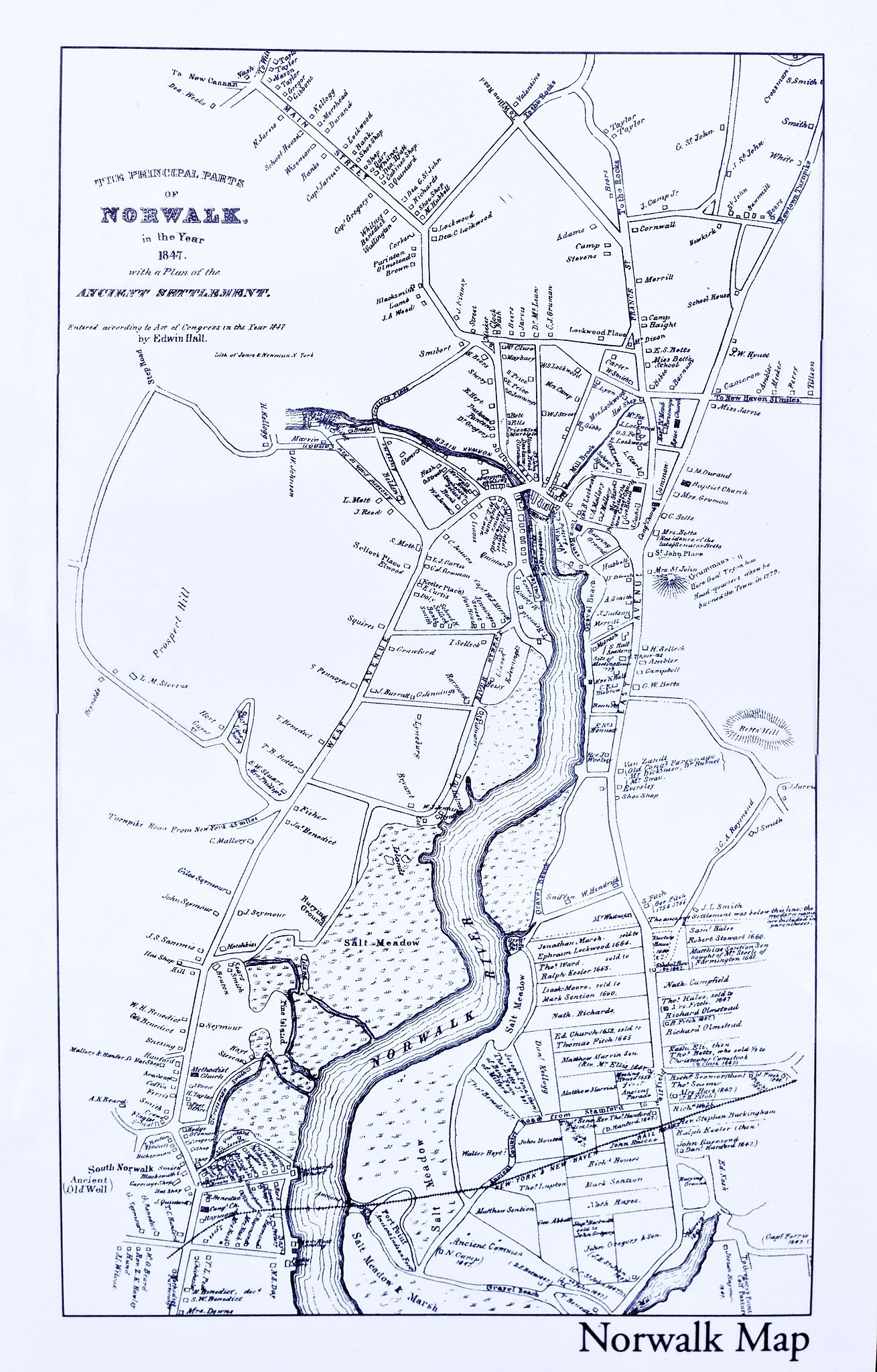
English: Norwalk 1847 Map, CT, 06854, USA.
Title: The Principal Parts of Norwalk, in the Year 1847, with a Plan of the Ancient Settlement. Entered according to Act of Congress in the Year 1847 by Edwin Hall. |
| Date | |
| Source | Norwalk 1847 Map, CT, 06854, USA |
| Author | Edwin Hall |
| Object location | | View this and other nearby images on: OpenStreetMap |
|---|
Licensing edit
This media file is in the public domain in the United States. This applies to U.S. works where the copyright has expired, often because its first publication occurred prior to January 1, 1929, and if not then due to lack of notice or renewal. See this page for further explanation.
|
 | |
 |
This image might not be in the public domain outside of the United States; this especially applies in the countries and areas that do not apply the rule of the shorter term for US works, such as Canada, Mainland China (not Hong Kong or Macao), Germany, Mexico, and Switzerland. The creator and year of publication are essential information and must be provided. See Wikipedia:Public domain and Wikipedia:Copyrights for more details.
|
File history
Click on a date/time to view the file as it appeared at that time.
| Date/Time | Thumbnail | Dimensions | User | Comment | |
|---|---|---|---|---|---|
| current | 15:10, 1 March 2013 | | 3,016 × 4,718 (3.2 MB) | WestportWiki (talk | contribs) | User created page with UploadWizard |
You cannot overwrite this file.
File usage on Commons
There are no pages that use this file.
File usage on other wikis
The following other wikis use this file:
- Usage on en.wikipedia.org
- Usage on ja.wikipedia.org