File:OSM-Sopot.png
Size of this preview: 682 × 599 pixels. Other resolutions: 273 × 240 pixels | 546 × 480 pixels | 874 × 768 pixels | 1,165 × 1,024 pixels | 2,104 × 1,849 pixels.
Original file (2,104 × 1,849 pixels, file size: 1.55 MB, MIME type: image/png)
Captions
Captions
Add a one-line explanation of what this file represents
| Description |
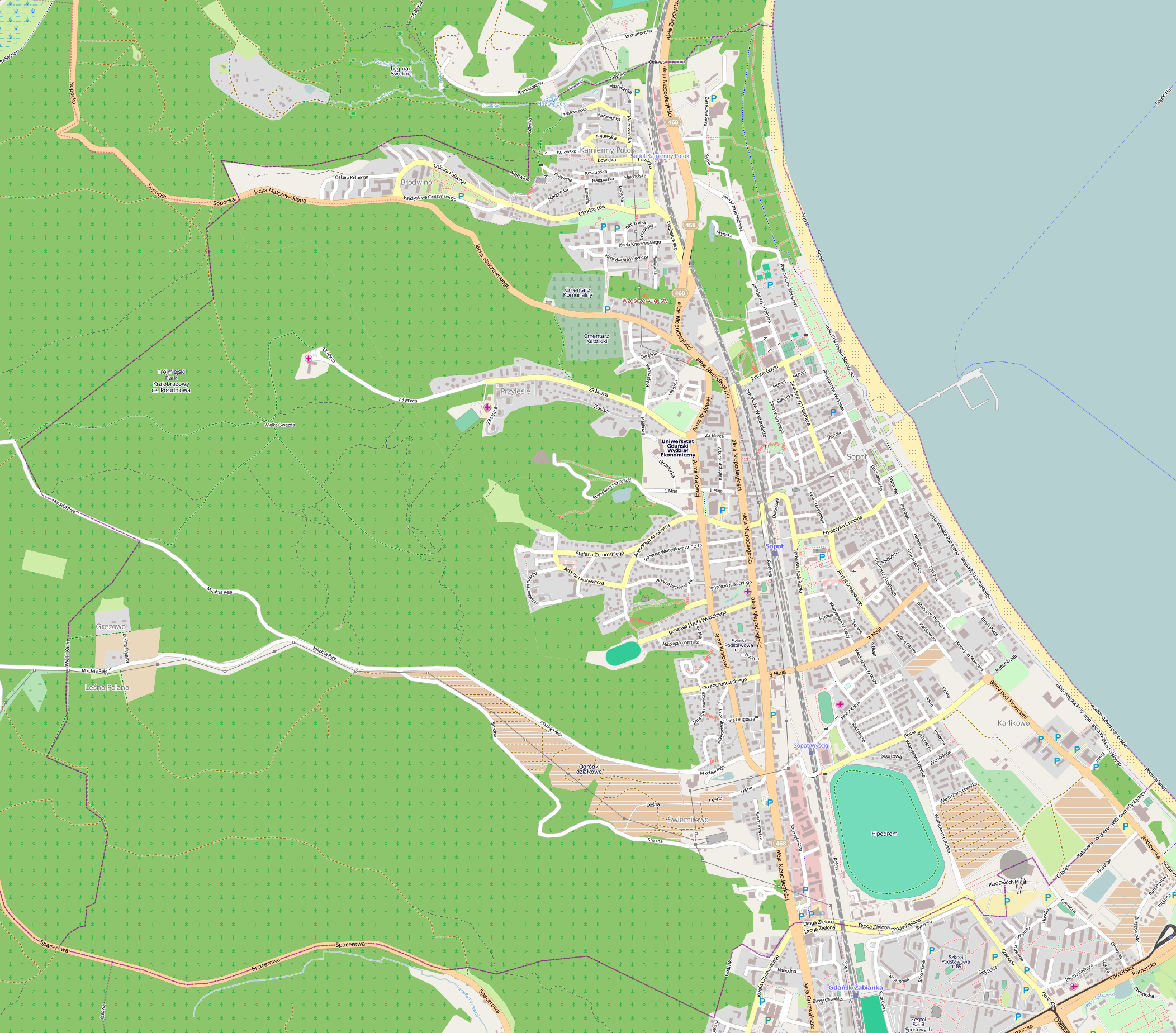
Polski: Mapa Sopotu, Polska
English: Map of Sopot, Poland |
|||||||||
| Date | ||||||||||
| Source | You may find a page on the OpenStreetMap wiki page for Sopot | |||||||||
| Creator |
OpenStreetMap contributors OpenStreetMap contributors |
|||||||||
| Permission (Reusing this file) |
OpenStreetMap data is available under the Open Database License (details). Map tiles are licensed under the Creative Commons Attribution-ShareAlike 2.0 license (CC-BY-SA 2.0).
This file is licensed under the Creative Commons Attribution-Share Alike 2.0 Generic license.
|
|||||||||
| Geotemporal data | ||||||||||
| Bounding box |
|
|||||||||
| Georeferencing | If inappropriate please set warp_status = skip to hide. | |||||||||
File history
Click on a date/time to view the file as it appeared at that time.
| Date/Time | Thumbnail | Dimensions | User | Comment | |
|---|---|---|---|---|---|
| current | 02:02, 9 January 2013 | | 2,104 × 1,849 (1.55 MB) | Nux (talk | contribs) | {{OpenStreetMap | name = Sopot | location = Sopot | description = {{pl|Mapa Sopoty, Polska}} {{en|Map of Sopot, Poland}} | top = 54.4652 | left = 18.5032 | right = 18.5928 | bottom = 54.419 | d... |
You cannot overwrite this file.
File usage on Commons
There are no pages that use this file.