File:OSM data in OpenJUMP.png
Original file (1,280 × 998 pixels, file size: 1.28 MB, MIME type: image/png)
Captions
Captions
| Description |
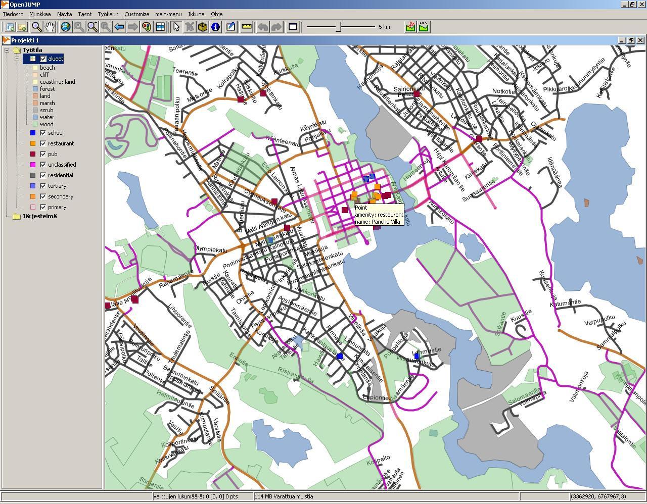
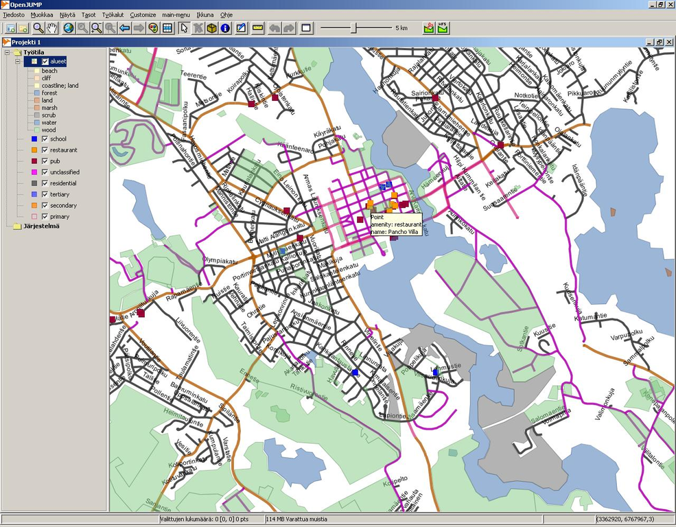
English: OpenStreetMap data stored in PostGIS database and split into layers by SQL queries in the OpenJUMP GIS .
Español: Datos del proyecto OpenStreetMap almacenados en una base de datos PostGIS y mostrados en capas mediante consultas SQL en el SIG OpenJUMP. |
||
| Date | |||
| Source | OpenStreetMap | ||
| Author | JRA | ||
| Permission (Reusing this file) |
This file is licensed under the Creative Commons Attribution-Share Alike 2.0 Generic license.
This screenshot either does not contain copyright-eligible parts or visuals of copyrighted software, or the author has released it under a free license (which should be indicated beneath this notice), and as such follows the licensing guidelines for screenshots of Wikimedia Commons. You may use it freely according to its particular license. Free software license:
Note: if the screenshot shows any work that is not a direct result of the program code itself, such as a text or graphics that are not part of the program, the license for that work must be indicated separately. |

File history
Click on a date/time to view the file as it appeared at that time.
| Date/Time | Thumbnail | Dimensions | User | Comment | |
|---|---|---|---|---|---|
| current | 16:55, 29 July 2008 | | 1,280 × 998 (1.28 MB) | Tony Rotondas (talk | contribs) | {{Information |Description= {{en|OpenStreetMap data stored in PostGIS database and split into layers by SQL queries.}} {{es|Datos del proyecto OpenStreetMap almacenados en una base de datos PostGIS y mostrados en capas mediante consultas SQL.}} |Source=[h |
| 16:50, 29 July 2008 |  | 1,280 × 998 (1.28 MB) | Tony Rotondas (talk | contribs) | {{Information |Description= {{en|OpenStreetMap data stored in PostGIS database and split into layers by SQL queries.}} {{es|Datos del proyecto OpenStreetMap almacenados en una base de datos PostGIS y mostrados en capas mediante consultas SQL.}} |Source=[h |
You cannot overwrite this file.
File usage on Commons
There are no pages that use this file.
File usage on other wikis
The following other wikis use this file:
- Usage on es.wikipedia.org
- Usage on fr.wikiversity.org
- Usage on ko.wikipedia.org