File:Obcine Slovenija 2006 Semic.svg

Size of this PNG preview of this SVG file: 800 × 522 pixels. Other resolutions: 320 × 209 pixels | 640 × 418 pixels | 1,024 × 668 pixels | 1,280 × 835 pixels | 2,560 × 1,670 pixels | 2,613 × 1,705 pixels.
Original file (SVG file, nominally 2,613 × 1,705 pixels, file size: 2.36 MB)
Captions
Captions
Add a one-line explanation of what this file represents
Summary edit
| Description |
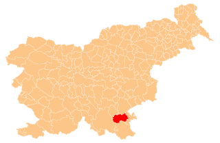
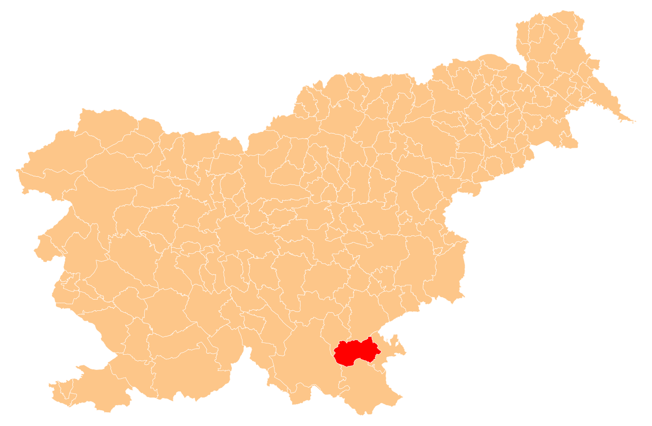
English: Občina Semič (marked red) on map of the municipalities (občine) of the Republic of Slovenia, as since May 2006 (210 units). |
| Date | |
| Source | Manipulated Image:Obcine Slovenija 2006.svg in text editor. |
| Author | Source of the public data is GURS (Geodetska uprava Republike Slovenije or Surveying and Mapping Authority of the Republic of Slovenia). Converted from Shapefile to SVG with shp2svg and prepared for Wikipedia by romanm (talk). |
| Permission (Reusing this file) |
Public domain. See Image:Obcine Slovenija 2006.svg for an explanation. |
Licensing edit
| I, the copyright holder of this work, release this work into the public domain. This applies worldwide. In some countries this may not be legally possible; if so: I grant anyone the right to use this work for any purpose, without any conditions, unless such conditions are required by law. |
File history
Click on a date/time to view the file as it appeared at that time.
| Date/Time | Thumbnail | Dimensions | User | Comment | |
|---|---|---|---|---|---|
| current | 20:08, 7 July 2009 | | 2,613 × 1,705 (2.36 MB) | Romanm (talk | contribs) | {{Information |Description={{en|1=''Občina Semič'' (marked red) on map of the municipalities (''občine'') of the Republic of Slovenia, as since May 2006 (210 units).}} |Source=Manipulated Image:Obcine Slovenija 2006.svg in text editor. |Author=Sou |
You cannot overwrite this file.
File usage on Commons
The following 2 pages use this file:
File usage on other wikis
The following other wikis use this file:
- Usage on ceb.wikipedia.org
- Usage on de.wikipedia.org
- Usage on en.wikipedia.org
- Semič
- Template:Semič
- John Stariha
- Blatnik pri Črmošnjicah
- Štrekljevec
- Brezje pri Rožnem Dolu
- Brezje pri Vinjem Vrhu
- Brezova Reber
- Brezovica pri Črmošnjicah
- Brstovec
- Cerovec pri Črešnjevcu
- Črešnjevec pri Semiču
- Črmošnjice, Semič
- Gornje Laze
- Gradnik
- Hrib pri Cerovcu
- Hrib pri Rožnem Dolu
- Kal, Semič
- Komarna Vas
- Krupa, Semič
- Krvavčji Vrh
- Lipovec, Semič
- Maline pri Štrekljevcu
- Moverna Vas
- Nestoplja Vas
- Omota
- Oskoršnica
- Osojnik, Semič
- Planina, Semič
- Podreber, Semič
- Potoki, Semič
- Praproče, Semič
- Praprot
- Preloge, Semič
- Pribišje
- Pugled, Semič
- Rožni Dol
- Sela pri Vrčicah
- Sodji Vrh
- Sredgora
- Srednja Vas, Semič
- Starihov Vrh
- Stranska Vas pri Semiču
- Trebnji Vrh
- Vinji Vrh pri Semiču
- Vrčice
View more global usage of this file.